
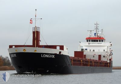
LONGVIK
General Cargo
Current Trip
| Time Travelled | 4 days |
|---|---|
| Remaining Time | --- |
| Distance Travelled | 1089.99 nm |
| Remaining Distance | --- |
| AVG Speed | 8.1 Knots |
| MAX Speed | 12.4 Knots |
| AVG Wind | 14 knots |
| MAX Wind | 34 knots |
| MIN Temp | 7°C / 44.6°F |
| MAX Temp | 22.2°C / 71.96°F |
| Draught | 6.1 m |
| Position Received | 14 h, 48 m ago |
Current Position
| Longitude | -4.04413° |
|---|---|
| Latitude | 58.70950° |
| Status | Under way using engine |
| Speed | 9.3 Knots |
| Course | 265° |
| Area | North Atlantic Ocean |
| Station | T-AIS |
| Position Received | 14 h, 48 m ago |
Info
Information
The current position of LONGVIK is in North Atlantic Ocean with coordinates 58.70950° / -4.04413° as reported on 2024-06-04 12:07 by AIS to our vessel tracker app. The vessel's current speed is 9.3 Knots and is heading at the port of GREENORE. The estimated time of arrival as calculated by vessel tracking app is 2024-06-05 20:00 LT
The vessel LONGVIK (IMO: 9548299, MMSI: 246669000) is a General Cargo that was built in 2011 ( 13 years old ). It's sailing under the flag of [NL] Netherlands.
In this page you can find informations about the vessels current position, last detected port calls, and current voyage information. If the vessels is not in coverage by AIS you will find the latest position.
The current position of LONGVIK is detected by our AIS receivers and we are not responsible for the reliability of the data. The last position was recorded while the vessel was in Coverage by the Ais receivers of our vessel tracking app.
The current draught of LONGVIK as reported by AIS is 6.1 meters
Weather
| Temperature | 9°C / 48.2°F |
|---|---|
| Wind Speed | 27 knots |
| Direction | 287° WNW |
| Pressure | 1004.8 hPa |
| Humidity | 71.1 % |
| Cloud Coverage | 95 % |
Featured Company
Last Port Calls
| Port | Arrival | Departure | Time In Port |
|---|---|---|---|
| 2024-05-29 06:34 | 2024-05-31 03:10 | 1 d | |
| 2024-05-26 10:12 | 2024-05-27 14:16 | 1 d | |
| 2024-05-24 05:22 | 2024-05-25 13:11 | 1 d | |
| 2024-05-19 10:26 | 2024-05-23 04:09 | 3 d | |
| 2024-05-16 20:40 | 2024-05-17 13:07 | 16 h | |
| 2024-05-12 20:54 | 2024-05-14 12:07 | 1 d | |
| 2024-05-09 12:28 | 2024-05-11 00:36 | 1 d | |
| 2024-05-07 11:33 | 2024-05-08 07:33 | 19 h | |
| 2024-05-04 16:41 | 2024-05-05 11:03 | 18 h | |
| 2024-05-01 19:30 | 2024-05-02 17:48 | 22 h |
Last Trips
| Origin | Departure | Destination | Arrival | Distance | |
|---|---|---|---|---|---|
| 2024-05-27 16:16 | 2024-05-29 09:34 | 407.37 nm | |||
| 2024-05-25 15:11 | 2024-05-26 12:12 | 173.14 nm | |||
| 2024-05-23 06:09 | 2024-05-24 07:22 | 255.61 nm | |||
| 2024-05-17 16:07 | 2024-05-19 12:26 | 467.04 nm | |||
| 2024-05-14 14:07 | 2024-05-16 23:40 | 609.06 nm | |||
| 2024-05-11 03:36 | 2024-05-12 22:54 | 455.33 nm | |||
| 2024-05-08 09:33 | 2024-05-09 15:28 | 317.50 nm | |||
| 2024-05-05 14:03 | 2024-05-07 13:33 | 467.18 nm | |||
| 2024-05-02 19:48 | 2024-05-04 19:41 | 469.10 nm | |||
| 2024-04-27 09:56 | 2024-05-01 21:30 | 918.91 nm |
Events
| Time | Event | Details | Position / Dest | Info |
|---|---|---|---|---|
| 2024-06-04 12:09 | Status Changed | Default Under way using engine |
58.70913 / -4.05257
GREENORE
|
Speed: 9.3 kn Course: 265° |
| 2024-06-04 12:07 | OUT of Coverage |
58.70950 / -4.04413
North Atlantic Ocean
GREENORE
|
Speed: 9.3 kn Course: 265° |
|
| 2024-06-04 09:52 | Change Sea Area | United Kingdom part of the North Atlantic Ocean United Kingdom part of the North Sea |
58.70932 / -3.41855
North Atlantic Ocean
GREENORE
|
Speed: 8 kn Course: 267° |
| 2024-06-04 04:50 | Detected in Sea | United Kingdom part of the North Sea |
58.61452 / -2.49830
North Sea
GREENORE
|
Speed: 8.4 kn Course: 270° |
| 2024-06-04 04:49 | Status Changed | Under way using engine Default |
58.61450 / -2.49530
GREENORE
|
Speed: 8.4 kn Course: 271° |
| 2024-06-04 04:42 | IN Coverage |
58.61452 / -2.49830
North Sea
GREENORE
|
Speed: 8.4 kn Course: 270° |
|
| 2024-06-03 08:01 | OUT of Coverage |
58.16973 / 3.38663
North Sea
GREENORE
|
Speed: 8.8 kn Course: 283° |
|
| 2024-06-03 00:39 | Status Changed | Under way using engine Default |
57.93182 / 5.48852
GREENORE
|
Speed: 9.8 kn Course: 279° |
| 2024-06-03 00:35 | Status Changed | Default Under way using engine |
57.92900 / 5.51705
GREENORE
|
Speed: 9.6 kn Course: 279° |
| 2024-06-02 16:49 | Detected in Sea | Norwegian part of the North Sea |
57.77812 / 7.39352
North Sea
GREENORE
|
Speed: 6.9 kn Course: 272° |