
LOVANSING
Other Type
Current Trip
Unknown
| Time Travelled | 3 days |
|---|---|
| Remaining Time | --- |
| Distance Travelled | 32.87 nm |
| Remaining Distance | --- |
| AVG Speed | 3.3 Knots |
| MAX Speed | 3.5 Knots |
| AVG Wind | 11.9 knots |
| MAX Wind | 16 knots |
| MIN Temp | 32.7°C / 90.86°F |
| MAX Temp | 35°C / 95°F |
| Draught | 0 m |
| Position Received | 19 m ago |
Current Position
| Longitude | 50.31820° |
|---|---|
| Latitude | 26.62805° |
| Status | Default |
| Speed | |
| Course | --- |
| Area | Persian Gulf |
| Station | T-AIS |
| Position Received | 19 m ago |
Info
Information
The current position of LOVANSING is in Persian Gulf with coordinates 26.62805° / 50.31820° as reported on 2024-06-29 05:20 by AIS to our vessel tracker app. The vessel's current speed is 0 Knots
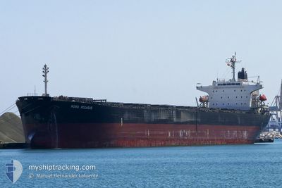
The vessel LOVANSING (IMO: 9733935, MMSI: 372780000) is a Other Type It's sailing under the flag of [PA] Panama.
In this page you can find informations about the vessels current position, last detected port calls, and current voyage information. If the vessels is not in coverage by AIS you will find the latest position.
The current position of LOVANSING is detected by our AIS receivers and we are not responsible for the reliability of the data. The last position was recorded while the vessel was in Coverage by the Ais receivers of our vessel tracking app.
Weather
| Temperature | 33.3°C / 91.94°F |
|---|---|
| Wind Speed | 6 knots |
| Direction | 289° WNW |
| Pressure | 995.8 hPa |
| Humidity | 47.7 % |
| Cloud Coverage | 4 % |
Featured Company
Most Visited Ports (Last year)
| Port | Arrivals |
|---|
Last Trips
| Origin | Departure | Destination | Arrival | Distance |
|---|
Events
| Time | Event | Details | Position / Dest | Info |
|---|---|---|---|---|
| 2024-06-28 17:24 | IN Coverage |
26.62746 / 50.31724
Persian Gulf
|
Speed: Course: 284.8° |
|
| 2024-06-28 16:22 | OUT of Coverage |
26.62762 / 50.31778
Persian Gulf
|
Speed: 0.1 kn Course: 242.4° |
|
| 2024-06-28 06:58 | IN Coverage |
26.62585 / 50.32003
Persian Gulf
|
Speed: 0.4 kn Course: 177.8° |
|
| 2024-06-28 05:54 | OUT of Coverage |
26.62491 / 50.33338
Persian Gulf
|
Speed: 0.5 kn Course: 283.2° |
|
| 2024-06-28 05:27 | STOP Moving | 11.61 nm, North East of DAMMAM |
26.62342 / 50.32885
|
Speed: 0.3 kn Course: 511° |
| 2024-06-28 05:00 | IN Coverage |
26.62516 / 50.32259
Persian Gulf
|
Speed: 2 kn Course: 110.9° |
|
| 2024-06-28 03:56 | OUT of Coverage |
26.62765 / 50.32180
Persian Gulf
|
Speed: 0.7 kn Course: 185.6° |
|
| 2024-06-28 01:57 | START Moving | 8.16 nm, East of RAS TANURA |
26.62658 / 50.22513
|
Speed: 3.1 kn Course: 102.1° |
| 2024-06-27 23:05 | IN Coverage |
26.62188 / 50.21399
Persian Gulf
|
Speed: Course: 261.3° |
|
| 2024-06-27 21:45 | OUT of Coverage |
26.62185 / 50.21404
Persian Gulf
|
Speed: Course: 43.7° |