
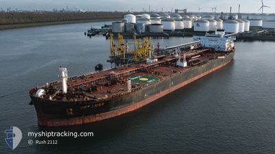
LR2 OLIVIA
Tanker
Current Trip
| Time Travelled | 49 days |
|---|---|
| Remaining Time | --- |
| Distance Travelled | 14147.63 nm |
| Remaining Distance | --- |
| AVG Speed | 11.7 Knots |
| MAX Speed | 16.4 Knots |
| AVG Wind | 14 knots |
| MAX Wind | 32.7 knots |
| MIN Temp | 14.4°C / 57.92°F |
| MAX Temp | 30.6°C / 87.08°F |
| Draught | 14.1 m |
| Position Received | 53 m ago |
Current Position
| Longitude | 5.51046° |
|---|---|
| Latitude | 37.91368° |
| Status | Under way using engine |
| Speed | 13 Knots |
| Course | 78.1° |
| Area | Mediterranean Sea - Western Basin |
| Station | T-AIS |
| Position Received | 53 m ago |
Info
Information
The current position of LR2 OLIVIA is in Mediterranean Sea - Western Basin with coordinates 37.91368° / 5.51046° as reported on 2024-06-30 02:06 by AIS to our vessel tracker app. The vessel's current speed is 13 Knots and is heading at the port of FIUMICINO. The estimated time of arrival as calculated by vessel tracking app is 2024-07-01 10:00 LT
The vessel LR2 OLIVIA (IMO: 9740469, MMSI: 477118700) is a Tanker It's sailing under the flag of [HK] Hong Kong.
In this page you can find informations about the vessels current position, last detected port calls, and current voyage information. If the vessels is not in coverage by AIS you will find the latest position.
The current position of LR2 OLIVIA is detected by our AIS receivers and we are not responsible for the reliability of the data. The last position was recorded while the vessel was in Coverage by the Ais receivers of our vessel tracking app.
The current draught of LR2 OLIVIA as reported by AIS is 14.1 meters
Weather
| Temperature | 22.9°C / 73.22°F |
|---|---|
| Wind Speed | 8 knots |
| Direction | 243° WSW |
| Pressure | 1015.4 hPa |
| Humidity | 78.7 % |
| Cloud Coverage | 1 % |
Featured Company
Most Visited Ports (Last year)
| Port | Arrivals | |
|---|---|---|
| 4 | ||
| 3 | ||
| 2 | ||
| 2 | ||
| 1 | ||
| 1 |
Last Trips
| Origin | Departure | Destination | Arrival | Distance | |
|---|---|---|---|---|---|
| 2024-05-08 03:53 | 2024-05-09 14:26 | 84.95 nm | |||
| 2024-05-05 23:23 | 2024-05-07 16:46 | 128.32 nm | |||
| 2024-04-15 09:27 | 2024-05-05 01:34 | 3504.65 nm | |||
| 2024-04-05 03:03 | 2024-04-12 05:13 | 1707.07 nm | |||
| 2024-02-07 22:24 | 2024-04-02 08:01 | 8614.13 nm |
Events
| Time | Event | Details | Position / Dest | Info |
|---|---|---|---|---|
| 2024-06-30 02:09 | Status Changed | Default Under way using engine |
37.91611 / 5.52454
IT FCO
|
Speed: 13 kn Course: 78.1° |
| 2024-06-30 01:57 | Status Changed | Under way using engine Default |
37.90646 / 5.46991
IT FCO
|
Speed: 12.9 kn Course: 78° |
| 2024-06-30 01:54 | Status Changed | Default Under way using engine |
37.90382 / 5.45505
IT FCO
|
Speed: 12.7 kn Course: 78.3° |
| 2024-06-30 01:18 | Status Changed | Under way using engine Default |
37.88108 / 5.30222
IT FCO
|
Speed: 12.2 kn Course: 79° |
| 2024-06-30 01:13 | Status Changed | Default Under way using engine |
37.87817 / 5.28165
IT FCO
|
Speed: 12.1 kn Course: 79.3° |
| 2024-06-30 00:43 | Status Changed | Under way using engine Default |
37.85838 / 5.15459
IT FCO
|
Speed: 12 kn Course: 78° |
| 2024-06-30 00:43 | IN Coverage |
37.85838 / 5.15459
Mediterranean Sea - Western Basin
IT FCO
|
Speed: 12.1 kn Course: 77.8° |
|
| 2024-06-29 18:53 | Status Changed | Default Under way using engine |
37.59655 / 3.68794
IT FCO
|
Speed: 12 kn Course: 77.8° |
| 2024-06-29 18:36 | Status Changed | Under way using engine Default |
37.58510 / 3.61681
IT FCO
|
Speed: 12 kn Course: 76° |
| 2024-06-29 18:36 | OUT of Coverage |
37.58510 / 3.61681
Mediterranean Sea - Western Basin
IT FCO
|
Speed: 12 kn Course: 77.8° |