
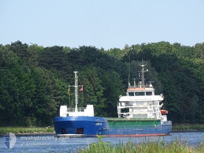
LUCIA B
Container Ship
Current Trip
| Time Travelled | 18 h, 13 mins |
|---|---|
| Remaining Time | 22 h, 37 mins |
| Distance Travelled | 304.92 nm |
| Remaining Distance | 400.44 nm |
| AVG Speed | 16.6 Knots |
| MAX Speed | 18 Knots |
| AVG Wind | 7 knots |
| MAX Wind | 12 knots |
| MIN Temp | 11.7°C / 53.06°F |
| MAX Temp | 16°C / 60.8°F |
| Draught | 6.2 m |
| Position Received | 59 m ago |
Current Position
| Longitude | -6.00548° |
|---|---|
| Latitude | 49.93527° |
| Status | Under way using engine |
| Speed | 16.9 Knots |
| Course | 184.3° |
| Area | Celtic Sea |
| Station | T-AIS |
| Position Received | 59 m ago |
Info
Information
The current position of LUCIA B is in Celtic Sea with coordinates 49.93527° / -6.00548° as reported on 2024-05-17 02:39 by AIS to our vessel tracker app. The vessel's current speed is 16.9 Knots and is heading at the port of SANTANDER. The estimated time of arrival as calculated by vessel tracking app is 2024-05-18 02:15 LT
The vessel LUCIA B (IMO: 9404077, MMSI: 255806171) is a Container Ship that was built in 2007 ( 17 years old ). It's sailing under the flag of [PT] Portugal.
In this page you can find informations about the vessels current position, last detected port calls, and current voyage information. If the vessels is not in coverage by AIS you will find the latest position.
The current position of LUCIA B is detected by our AIS receivers and we are not responsible for the reliability of the data. The last position was recorded while the vessel was in Coverage by the Ais receivers of our vessel tracking app.
The current draught of LUCIA B as reported by AIS is 6.2 meters
Weather
| Temperature | 13.6°C / 56.48°F |
|---|---|
| Wind Speed | 4 knots |
| Direction | 37° NE |
| Pressure | 1006.1 hPa |
| Humidity | 84.3 % |
| Cloud Coverage | 26 % |
Featured Company
Last Port Calls
| Port | Arrival | Departure | Time In Port |
|---|---|---|---|
| 2024-05-15 13:20 | 2024-05-16 09:25 | 20 h | |
| 2024-05-14 02:21 | 2024-05-14 21:23 | 19 h | |
| 2024-05-11 16:07 | 2024-05-12 13:40 | 21 h | |
| 2024-05-09 09:12 | 2024-05-10 00:30 | 15 h | |
| 2024-05-07 21:00 | 2024-05-08 20:24 | 23 h | |
| 2024-05-05 03:41 | 2024-05-05 23:38 | 19 h | |
| 2024-05-02 01:27 | 2024-05-03 09:14 | 1 d | |
| 2024-04-30 20:29 | 2024-05-01 14:39 | 18 h | |
| 2024-04-28 09:57 | 2024-04-29 07:38 | 21 h | |
| 2024-04-25 19:49 | 2024-04-26 15:20 | 19 h |
Last Trips
| Origin | Departure | Destination | Arrival | Distance | |
|---|---|---|---|---|---|
| 2024-05-14 22:23 | 2024-05-15 14:20 | 120.69 nm | |||
| 2024-05-12 15:40 | 2024-05-14 03:21 | 619.84 nm | |||
| 2024-05-10 01:30 | 2024-05-11 18:07 | 698.52 nm | |||
| 2024-05-08 21:24 | 2024-05-09 10:12 | 119.11 nm | |||
| 2024-05-06 01:38 | 2024-05-07 22:00 | 627.61 nm | |||
| 2024-05-03 10:14 | 2024-05-05 05:41 | 701.71 nm | |||
| 2024-05-01 15:39 | 2024-05-02 02:27 | 119.09 nm | |||
| 2024-04-29 09:38 | 2024-04-30 21:29 | 618.66 nm | |||
| 2024-04-26 16:20 | 2024-04-28 11:57 | 699.77 nm | |||
| 2024-04-25 03:07 | 2024-04-25 20:49 | 125.67 nm |
Events
| Time | Event | Details | Position / Dest | Info |
|---|---|---|---|---|
| 2024-05-17 02:46 | Status Changed | Default Under way using engine |
49.89966 / -6.01501
ESSDR
|
Speed: 16.9 kn Course: 184.3° |
| 2024-05-17 01:55 | Status Changed | Under way using engine Default |
50.14407 / -6.00358
ESSDR
|
Speed: 17 kn Course: 180° |
| 2024-05-17 01:50 | Status Changed | Default Under way using engine |
50.16544 / -6.00367
ESSDR
|
Speed: 17 kn Course: 179.9° |
| 2024-05-17 00:36 | Status Changed | Under way using engine Default |
50.51452 / -5.99331
ESSDR
|
Speed: 17 kn Course: 183° |
| 2024-05-17 00:35 | Status Changed | Default Under way using engine |
50.52358 / -5.99267
ESSDR
|
Speed: 16.8 kn Course: 182.1° |
| 2024-05-16 21:43 | Change Sea Area | United Kingdom part of the Celtic Sea United Kingdom part of the Irish Sea and St. George's Channel |
51.33571 / -6.01009
Celtic Sea
ESSDR
|
Speed: 17.7 kn Course: 178.2° |
| 2024-05-16 21:43 | Status Changed | Under way using engine Default |
51.33571 / -6.01009
ESSDR
|
Speed: 17.7 kn Course: 177° |
| 2024-05-16 21:34 | IN Coverage |
51.33571 / -6.01009
Celtic Sea
ESSDR
|
Speed: 17.7 kn Course: 178.2° |
|
| 2024-05-16 18:31 | Status Changed | Default Under way using engine |
52.24078 / -5.66202
ESSDR
|
Speed: 17.2 kn Course: 200.3° |
| 2024-05-16 18:26 | OUT of Coverage |
52.26045 / -5.65030
Irish Sea and St. George's Channel
ESSDR
|
Speed: 17.2 kn Course: 200.3° |