
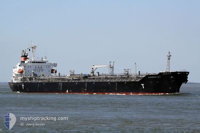
LYDERHORN
Oil/Chemical Tanker
Current Trip
IT AUG
| Time Travelled | 24 days |
|---|---|
| Remaining Time | --- |
| Distance Travelled | 2294.63 nm |
| Remaining Distance | --- |
| AVG Speed | 8.6 Knots |
| MAX Speed | 13.8 Knots |
| AVG Wind | 9 knots |
| MAX Wind | 27 knots |
| MIN Temp | 14.7°C / 58.46°F |
| MAX Temp | 22.2°C / 71.96°F |
| Draught | 10 m |
| Position Received | Now |
Current Position
| Longitude | 15.60914° |
|---|---|
| Latitude | 37.26676° |
| Status | Restricted manoeuverability |
| Speed | 0.8 Knots |
| Course | 17° |
| Area | Ionian Sea |
| Station | T-AIS |
| Position Received | Now |
Info
Information
The current position of LYDERHORN is in Ionian Sea with coordinates 37.26676° / 15.60914° as reported on 2024-05-19 22:22 by AIS to our vessel tracker app. The vessel's current speed is 0.8 Knots
The vessel LYDERHORN (IMO: 9325855, MMSI: 257710000) is a Oil/Chemical Tanker that was built in 2006 ( 18 years old ). It's sailing under the flag of [NO] Norway.
In this page you can find informations about the vessels current position, last detected port calls, and current voyage information. If the vessels is not in coverage by AIS you will find the latest position.
The current position of LYDERHORN is detected by our AIS receivers and we are not responsible for the reliability of the data. The last position was recorded while the vessel was in Coverage by the Ais receivers of our vessel tracking app.
The current draught of LYDERHORN as reported by AIS is 10 meters
Weather
| Temperature | 20.2°C / 68.36°F |
|---|---|
| Wind Speed | 5 knots |
| Direction | 13° NNE |
| Pressure | 1010.7 hPa |
| Humidity | 84.7 % |
| Cloud Coverage | 77 % |
Featured Company
Last Port Calls
| Port | Arrival | Departure | Time In Port |
|---|---|---|---|
| 2024-04-23 23:38 | 2024-04-25 00:07 | 1 d | |
| 2024-03-27 09:48 | 2024-03-28 13:40 | 1 d | |
| 2024-03-08 12:09 | 2024-03-09 18:25 | 1 d | |
| 2024-03-07 18:41 | 2024-03-08 10:45 | 16 h |
Most Visited Ports (Last year)
| Port | Arrivals | |
|---|---|---|
| 3 | ||
| 3 | ||
| 3 | ||
| 3 | ||
| 2 | ||
| 2 |
Last Trips
| Origin | Departure | Destination | Arrival | Distance | |
|---|---|---|---|---|---|
| 2024-03-28 16:40 | 2024-04-24 00:38 | 7147.87 nm | |||
| 2024-03-10 02:25 | 2024-03-27 12:48 | 4359.08 nm | |||
| 2024-03-08 18:45 | 2024-03-08 20:09 | 9.72 nm | |||
| 2024-02-13 15:20 | 2024-03-08 02:41 | 3276.33 nm |
Events
| Time | Event | Details | Position / Dest | Info |
|---|---|---|---|---|
| 2024-05-19 21:59 | Status Changed | Restricted manoeuverability Default |
37.27133 / 15.61208
IT AUG
|
Speed: 0.8 kn Course: 2° |
| 2024-05-19 21:56 | Status Changed | Default Restricted manoeuverability |
37.27189 / 15.61238
IT AUG
|
Speed: 0.8 kn Course: 7° |
| 2024-05-19 21:41 | Status Changed | Restricted manoeuverability Default |
37.27478 / 15.61419
IT AUG
|
Speed: 0.8 kn Course: 8° |
| 2024-05-19 21:36 | Status Changed | Default Restricted manoeuverability |
37.27569 / 15.61475
IT AUG
|
Speed: 0.7 kn Course: 10° |
| 2024-05-19 18:55 | Status Changed | Restricted manoeuverability Default |
37.28100 / 15.63094
IT AUG
|
Speed: 0.4 kn Course: 71° |
| 2024-05-19 18:24 | Status Changed | Default Restricted manoeuverability |
37.27999 / 15.63470
IT AUG
|
Speed: 0.4 kn Course: 50° |
| 2024-05-19 18:16 | Status Changed | Restricted manoeuverability Default |
37.27929 / 15.63570
IT AUG
|
Speed: 0.3 kn Course: 53° |
| 2024-05-19 18:06 | STOP Moving | 20.33 nm, North East of SANTA PANAGIA |
37.27876 / 15.63654
IT AUG
|
Speed: 0.3 kn Course: 53° |
| 2024-05-19 18:00 | Status Changed | Default Restricted manoeuverability |
37.27822 / 15.63679
IT AUG
|
Speed: 0.7 kn Course: 57° |
| 2024-05-19 17:50 | Status Changed | Restricted manoeuverability Default |
37.27667 / 15.63665
IT AUG
|
Speed: 0.8 kn Course: 50° |