
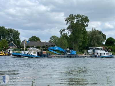
MA-JA
Dredging or underwater ops
Current Trip
| Time Travelled | 4 days |
|---|---|
| Remaining Time | --- |
| Distance Travelled | 11.97 nm |
| Remaining Distance | --- |
| AVG Speed | 3.6 Knots |
| MAX Speed | 4.5 Knots |
| AVG Wind | 5.3 knots |
| MAX Wind | 13 knots |
| MIN Temp | 11.5°C / 52.7°F |
| MAX Temp | 25.6°C / 78.08°F |
| Draught | 0.1 m |
| Position Received | 1 m ago |
Current Position
| Longitude | 4.73766° |
|---|---|
| Latitude | 52.20970° |
| Status | Under way sailing |
| Speed | |
| Course | --- |
| Area | North Sea |
| Station | T-AIS |
| Position Received | 1 m ago |
Info
Information
The current position of MA-JA is in North Sea with coordinates 52.20970° / 4.73766° as reported on 2024-05-18 20:18 by AIS to our vessel tracker app. The vessel's current speed is 0 Knots
The vessel MA-JA (MMSI: 244620979) is a Dredging or underwater ops It's sailing under the flag of [NL] Netherlands.
In this page you can find informations about the vessels current position, last detected port calls, and current voyage information. If the vessels is not in coverage by AIS you will find the latest position.
The current position of MA-JA is detected by our AIS receivers and we are not responsible for the reliability of the data. The last position was recorded while the vessel was in Coverage by the Ais receivers of our vessel tracking app.
The current draught of MA-JA as reported by AIS is 0.1 meters
Weather
| Temperature | 14.4°C / 57.92°F |
|---|---|
| Wind Speed | 3 knots |
| Direction | 7° N |
| Pressure | 1011 hPa |
| Humidity | 88.4 % |
| Cloud Coverage | 6 % |
Featured Company
Last Port Calls
| Port | Arrival | Departure | Time In Port |
|---|---|---|---|
| 2024-05-13 16:31 | 2024-05-14 11:43 | 19 h | |
| 2024-05-13 11:08 | 2024-05-13 14:33 | 3 h | |
| 2024-05-07 13:02 | 2024-05-13 09:08 | 5 d | |
| 2024-05-02 11:23 | 2024-05-07 03:36 | 4 d | |
| 2024-04-30 05:16 | 2024-04-30 06:54 | 1 h | |
| 2024-04-12 10:37 | 2024-04-24 05:06 | 11 d | |
| 2024-04-11 07:32 | 2024-04-11 14:41 | 7 h | |
| 2024-04-10 12:55 | 2024-04-11 05:51 | 16 h | |
| 2024-04-04 06:00 | 2024-04-04 06:15 | 15 m | |
| 2024-04-03 13:05 | 2024-04-03 17:41 | 4 h |
Most Visited Ports (Last year)
| Port | Arrivals | |
|---|---|---|
| 14 | ||
| 11 | ||
| 11 | ||
| 10 | ||
| 7 | ||
| 6 |
Last Trips
| Origin | Departure | Destination | Arrival | Distance | |
|---|---|---|---|---|---|
| 2024-05-13 16:33 | 2024-05-13 18:31 | 7.07 nm | |||
| 2024-05-13 11:08 | 2024-05-13 13:08 | 6.58 nm | |||
| 2024-05-07 05:36 | 2024-05-07 15:02 | 7.76 nm | |||
| 2024-04-30 08:54 | 2024-05-02 13:23 | 8.11 nm | |||
| 2024-04-24 07:06 | 2024-04-30 07:16 | 10.52 nm | |||
| 2024-04-11 16:41 | 2024-04-12 12:37 | 7.25 nm | |||
| 2024-04-11 07:51 | 2024-04-11 09:32 | 6.29 nm | |||
| 2024-04-04 08:15 | 2024-04-10 14:55 | 10.52 nm | |||
| 2024-04-03 19:41 | 2024-04-04 08:00 | 7.68 nm | |||
| 2024-04-03 12:17 | 2024-04-03 15:05 | 23.13 nm |
Events
| Time | Event | Details | Position / Dest | Info |
|---|---|---|---|---|
| 2024-05-17 06:09 | STOP Moving | 1.56 nm, South of KUDELSTAART |
52.20958 / 4.73760
AMSTERDAM
|
Speed: Course: 511° |
| 2024-05-17 05:56 | START Moving | 1.18 nm, South of KUDELSTAART |
52.21693 / 4.75236
AMSTERDAM
|
Speed: 3.6 kn Course: 213.6° |
| 2024-05-16 16:35 | STOP Moving | 1.29 nm, South East of KUDELSTAART |
52.21754 / 4.76042
AMSTERDAM
|
Speed: Course: 511° |
| 2024-05-16 14:28 | START Moving | 0.49 nm, North of NES AAN DE AMSTEL |
52.28205 / 4.88191
AMSTERDAM
|
Speed: 4.3 kn Course: 222.2° |
| 2024-05-16 13:58 | STOP Moving | 0.68 nm, North of NES AAN DE AMSTEL |
52.28491 / 4.88468
AMSTERDAM
|
Speed: 0.2 kn Course: 511° |
| 2024-05-16 13:56 | IN Coverage |
52.28491 / 4.88468
North Sea
|
Speed: 0.2 kn Course: 255.9° |
|
| 2024-05-16 12:35 | OUT of Coverage |
52.28697 / 4.88598
North Sea
|
Speed: 0.9 kn Course: 208.8° |
|
| 2024-05-16 12:25 | START Moving | 1.25 nm, North of NES AAN DE AMSTEL |
52.29381 / 4.89101
AMSTERDAM
|
Speed: 3.3 kn Course: 191.1° |
| 2024-05-16 11:34 | STOP Moving | 1.42 nm, North East of NES AAN DE AMSTEL |
52.29546 / 4.89638
AMSTERDAM
|
Speed: 0.1 kn Course: 511° |
| 2024-05-16 11:32 | START Moving | 1.47 nm, North East of NES AAN DE AMSTEL |
52.29572 / 4.89874
AMSTERDAM
|
Speed: 4.1 kn Course: 257° |