
MA
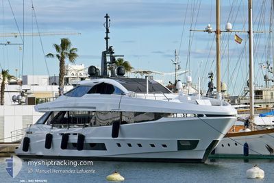
Pleasure Craft
Current Trip
| Time Travelled | 7 h, 15 mins |
|---|---|
| Remaining Time | --- |
| Distance Travelled | 0.12 nm |
| Remaining Distance | --- |
| AVG Speed | 3.4 Knots |
| MAX Speed | 3.4 Knots |
| AVG Wind | 5.3 knots |
| MAX Wind | 5.8 knots |
| MIN Temp | 10.6°C / 51.08°F |
| MAX Temp | 13.5°C / 56.3°F |
| Draught | 2.2 m |
| Position Received | 2 h, 10 m ago |
Current Position
| Longitude | 5.99495° |
|---|---|
| Latitude | 59.98592° |
| Status | Moored |
| Speed | 0.1 Knots |
| Course | 93° |
| Area | North Sea |
| Station | T-AIS |
| Position Received | 2 h, 10 m ago |
Info
Information
The current position of MA is in North Sea with coordinates 59.98592° / 5.99495° as reported on 2024-06-15 22:23 by AIS to our vessel tracker app. The vessel's current speed is 0.1 Knots
The vessel MA (IMO: 9890290, MMSI: 215443000) is a Pleasure Craft It's sailing under the flag of [MT] Malta.
In this page you can find informations about the vessels current position, last detected port calls, and current voyage information. If the vessels is not in coverage by AIS you will find the latest position.
The current position of MA is detected by our AIS receivers and we are not responsible for the reliability of the data. The last position was recorded while the vessel was in Coverage by the Ais receivers of our vessel tracking app.
The current draught of MA as reported by AIS is 2.2 meters
Weather
| Temperature | 10.6°C / 51.08°F |
|---|---|
| Wind Speed | 5 knots |
| Direction | 81° E |
| Pressure | 998.4 hPa |
| Humidity | 80.2 % |
| Cloud Coverage | 100 % |
Featured Company
Last Port Calls
| Port | Arrival | Departure | Time In Port |
|---|---|---|---|
| 2024-06-15 16:46 | 2024-06-15 17:19 | 33 m | |
| 2024-06-13 20:57 | 2024-06-14 16:44 | 19 h | |
| 2024-06-08 11:34 | 2024-06-12 20:46 | 4 d | |
| 2024-05-30 15:29 | 2024-06-04 06:57 | 4 d | |
| 2024-05-28 11:21 | 2024-05-30 03:21 | 1 d | |
| 2024-05-21 09:17 | 2024-05-25 17:59 | 4 d | |
| 2024-05-18 10:24 | 2024-05-18 12:09 | 1 h | |
| 2024-05-17 15:04 | 2024-05-18 08:16 | 17 h | |
| 2024-05-16 15:05 | 2024-05-17 14:30 | 23 h | |
| 2024-05-15 17:03 | 2024-05-16 07:46 | 14 h |
Last Trips
| Origin | Departure | Destination | Arrival | Distance | |
|---|---|---|---|---|---|
| 2024-06-14 18:44 | 2024-06-15 18:46 | 91.41 nm | |||
| 2024-06-12 21:46 | 2024-06-13 22:57 | 344.97 nm | |||
| 2024-06-04 07:57 | 2024-06-08 12:34 | 1505.17 nm | |||
| 2024-05-30 05:21 | 2024-05-30 16:29 | 176.19 nm | |||
| 2024-05-25 19:59 | 2024-05-28 13:21 | 787.20 nm | |||
| 2024-05-18 14:09 | 2024-05-21 11:17 | 88.83 nm | |||
| 2024-05-18 10:16 | 2024-05-18 12:24 | 23.32 nm | |||
| 2024-05-17 16:30 | 2024-05-17 17:04 | 2.47 nm | |||
| 2024-05-16 09:46 | 2024-05-16 17:05 | 110.93 nm | |||
| 2024-05-15 13:11 | 2024-05-15 19:03 | 36.96 nm |
Events
| Time | Event | Details | Position / Dest | Info |
|---|---|---|---|---|
| 2024-06-15 22:23 | OUT of Coverage |
59.98592 / 5.99495
North Sea
|
Speed: 0.1 kn Course: 15.3° |
|
| 2024-06-15 22:23 | IN Coverage |
59.98592 / 5.99495
North Sea
|
Speed: 0.1 kn Course: 15.3° |
|
| 2024-06-15 21:20 | OUT of Coverage |
59.98595 / 5.99562
North Sea
|
Speed: 0.6 kn Course: 146.7° |
|
| 2024-06-15 21:20 | IN Coverage |
59.98595 / 5.99562
North Sea
|
Speed: 0.6 kn Course: 146.7° |
|
| 2024-06-15 17:40 | OUT of Coverage |
59.98606 / 5.99377
North Sea
|
Speed: 3.4 kn Course: 135.8° |
|
| 2024-06-15 17:19 | STOP Moving | 0.27 nm, West of ROSENDAL |
59.98581 / 5.99508
STAVANGER
|
Speed: 0.1 kn Course: 185° |
| 2024-06-15 17:19 | PORT DEPARTURE |
|
59.98581 / 5.99508
STAVANGER
|
Speed: 5.3 kn Course: 327° |
| 2024-06-15 16:46 | PORT ARRIVAL |
|
59.98412 / 6.00219
[NO] ROSENDAL
|
Speed: 3 kn Course: 107° |
| 2024-06-15 12:45 | START Moving | 1.08 nm, North West of VORMEDAL |
59.36206 / 5.28649
STAVANGER
|
Speed: 3.3 kn Course: 73° |
| 2024-06-15 09:58 | STOP Moving | 1.09 nm, North West of VORMEDAL |
59.36033 / 5.28440
STAVANGER
|
Speed: 0.3 kn Course: 63° |