
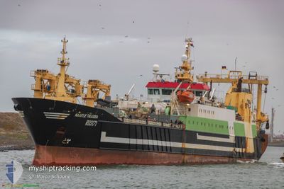
MAARTJE THEADORA
Trawler
Current Trip
FISHINGGROUNDS
| Time Travelled | 3 days |
|---|---|
| Remaining Time | --- |
| Distance Travelled | 519.13 nm |
| Remaining Distance | --- |
| AVG Speed | 10.8 Knots |
| MAX Speed | 14.3 Knots |
| AVG Wind | 15.5 knots |
| MAX Wind | 19.1 knots |
| MIN Temp | 10.8°C / 51.44°F |
| MAX Temp | 13.7°C / 56.66°F |
| Draught | 7.2 m |
| Position Received | 2 d ago |
Current Position
| Longitude | -4.27214° |
|---|---|
| Latitude | 59.36604° |
| Status | Under way using engine |
| Speed | 13.8 Knots |
| Course | 325.3° |
| Area | North Atlantic Ocean |
| Station | T-AIS |
| Position Received | 2 d ago |
Info
Information
The current position of MAARTJE THEADORA is in North Atlantic Ocean with coordinates 59.36604° / -4.27214° as reported on 2024-05-27 02:41 by AIS to our vessel tracker app. The vessel's current speed is 13.8 Knots
The vessel MAARTJE THEADORA (IMO: 9182801, MMSI: 218066000) is a Trawler that was built in 2000 ( 24 years old ). It's sailing under the flag of [DE] Germany.
In this page you can find informations about the vessels current position, last detected port calls, and current voyage information. If the vessels is not in coverage by AIS you will find the latest position.
The current position of MAARTJE THEADORA is detected by our AIS receivers and we are not responsible for the reliability of the data. The last position was recorded while the vessel was in Coverage by the Ais receivers of our vessel tracking app.
The current draught of MAARTJE THEADORA as reported by AIS is 7.2 meters
Weather
| Temperature | 10.9°C / 51.62°F |
|---|---|
| Wind Speed | 18 knots |
| Direction | 114° ESE |
| Pressure | 1007.9 hPa |
| Humidity | 94.7 % |
| Cloud Coverage | 17 % |
Featured Company
Events
| Time | Event | Details | Position / Dest | Info |
|---|---|---|---|---|
| 2024-05-27 02:41 | OUT of Coverage |
59.36604 / -4.27214
North Atlantic Ocean
|
Speed: 13.8 kn Course: 325.3° |
|
| 2024-05-26 23:14 | Change Sea Area | United Kingdom part of the North Atlantic Ocean United Kingdom part of the North Sea |
58.73329 / -3.42544
North Atlantic Ocean
|
Speed: 11.5 kn Course: 295.2° |
| 2024-05-26 20:33 | IN Coverage |
58.54103 / -2.78289
North Sea
|
Speed: 12.7 kn Course: 323.4° |
|
| 2024-05-26 18:47 | OUT of Coverage |
58.25590 / -2.24495
North Sea
|
Speed: 14 kn Course: 315° |
|
| 2024-05-26 18:26 | IN Coverage |
58.19405 / -2.13817
North Sea
|
Speed: 13.9 kn Course: 318.5° |
|
| 2024-05-26 17:23 | OUT of Coverage |
58.01497 / -1.83118
North Sea
|
Speed: 13.5 kn Course: 315.9° |
|
| 2024-05-26 13:55 | IN Coverage |
57.42428 / -1.02465
North Sea
|
Speed: 12.3 kn Course: 322.2° |
|
| 2024-05-26 00:15 | OUT of Coverage |
54.66971 / 1.56523
North Sea
|
Speed: 14.3 kn Course: 329.7° |
|
| 2024-05-26 00:15 | IN Coverage |
54.66971 / 1.56523
North Sea
|
Speed: 14.3 kn Course: 329.7° |
|
| 2024-05-25 22:34 | OUT of Coverage |
54.33745 / 1.94089
North Sea
|
Speed: 13.5 kn Course: 328.3° |