
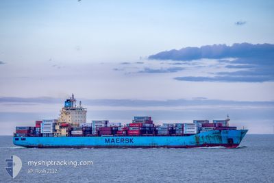
MAERSK BRANI
Container Ship
Current Trip
| Trip Time | 19 h, 34 mins |
|---|---|
| Trip Distance | 121.88 nm |
| AVG Speed | 12.4 Knots |
| MAX Speed | 18.1 Knots |
| Draught | 11.9 m |
| AVG Wind | 8.3 knots |
| MAX Wind | 13.1 knots |
| MIN Temp | 13.1°C / 55.58°F |
| MAX Temp | 17.5°C / 63.5°F |
| Position Received | 2 m ago |
Current Position
| Longitude | 4.05007° |
|---|---|
| Latitude | 51.95846° |
| Status | Moored |
| Speed | |
| Course | 82° |
| Area | North Sea |
| Station | T-AIS |
| Position Received | 2 m ago |
Info
Information
The current position of MAERSK BRANI is in North Sea with coordinates 51.95846° / 4.05007° as reported on 2024-05-20 04:47 by AIS to our vessel tracker app. The vessel's current speed is 0 Knots and is currently inside the port of MAASVLAKTE - ROTTERDAM.
The vessel MAERSK BRANI (IMO: 9409352, MMSI: 564399000) is a Container Ship that was built in 2010 ( 14 years old ). It's sailing under the flag of [SG] Singapore.
In this page you can find informations about the vessels current position, last detected port calls, and current voyage information. If the vessels is not in coverage by AIS you will find the latest position.
The current position of MAERSK BRANI is detected by our AIS receivers and we are not responsible for the reliability of the data. The last position was recorded while the vessel was in Coverage by the Ais receivers of our vessel tracking app.
The current draught of MAERSK BRANI as reported by AIS is 8.7 meters
Weather
| Temperature | 12.7°C / 54.86°F |
|---|---|
| Wind Speed | 13 knots |
| Direction | 9° N |
| Pressure | 1012 hPa |
| Humidity | 92.3 % |
| Cloud Coverage | 30 % |
Featured Company
Last Port Calls
| Port | Arrival | Departure | Time In Port |
|---|---|---|---|
| 2024-05-19 12:14 | |||
| 2024-05-18 06:57 | 2024-05-18 16:40 | 9 h | |
| 2024-05-05 01:50 | 2024-05-06 12:06 | 1 d | |
| 2024-05-02 13:53 | 2024-05-03 15:34 | 1 d | |
| 2024-04-24 10:13 | 2024-04-25 18:08 | 1 d | |
| 2024-04-20 16:45 | 2024-04-21 06:16 | 13 h | |
| 2024-04-15 12:55 | 2024-04-16 12:28 | 23 h | |
| 2024-04-13 03:28 | 2024-04-13 22:41 | 19 h | |
| 2024-04-11 17:06 | 2024-04-12 10:10 | 17 h | |
| 2024-03-29 17:52 | 2024-03-30 08:37 | 14 h |
Most Visited Ports (Last year)
| Port | Arrivals | |
|---|---|---|
| 13 | ||
| 13 | ||
| 8 | ||
| 8 | ||
| 7 | ||
| 7 |
Last Trips
| Origin | Departure | Destination | Arrival | Distance | |
|---|---|---|---|---|---|
| 2024-05-18 18:40 | 2024-05-19 14:14 | 121.88 nm | |||
| 2024-05-06 07:06 | 2024-05-18 08:57 | 4834.39 nm | |||
| 2024-05-03 10:34 | 2024-05-04 20:50 | 66.33 nm | |||
| 2024-04-25 14:08 | 2024-05-02 08:53 | 2701.25 nm | |||
| 2024-04-21 01:16 | 2024-04-24 06:13 | 1305.32 nm | |||
| 2024-04-16 07:28 | 2024-04-20 11:45 | 1372.43 nm | |||
| 2024-04-13 17:41 | 2024-04-15 07:55 | 71.27 nm | |||
| 2024-04-12 05:10 | 2024-04-12 22:28 | 281.87 nm | |||
| 2024-03-30 09:37 | 2024-04-11 12:06 | 4833.92 nm | |||
| 2024-03-28 13:23 | 2024-03-29 18:52 | 336.50 nm |
Events
| Time | Event | Details | Position / Dest | Info |
|---|---|---|---|---|
| 2024-05-20 02:33 | Draught Changed | 8.7 11.9 |
51.95842 / 4.05011
[NL] MAASVLAKTE - ROTTERDAM
|
Speed: Course: 82° |
| 2024-05-20 02:27 | Status Changed | Moored Under way using engine |
51.95842 / 4.05014
[NL] MAASVLAKTE - ROTTERDAM
|
Speed: Course: 82° |
| 2024-05-19 12:48 | STOP Moving |
51.95869 / 4.05004
[NL] MAASVLAKTE - ROTTERDAM
|
Speed: 0.3 kn Course: 79° |
|
| 2024-05-19 12:14 | PORT ARRIVAL |
|
51.96235 / 4.07952
[NL] MAASVLAKTE - ROTTERDAM
|
Speed: 3.9 kn Course: 263° |
| 2024-05-19 09:31 | START Moving | 16.08 nm, North West of BROUWERSDAM |
51.90838 / 3.48241
BEANT>NLROT
|
Speed: 3.6 kn Course: 355° |
| 2024-05-19 09:20 | Status Changed | Under way using engine At anchor |
51.90614 / 3.48183
BEANT>NLROT
|
Speed: 0.1 kn Course: 280° |
| 2024-05-19 09:03 | Status Changed | At anchor Default |
51.90562 / 3.48095
BEANT>NLROT
|
Speed: 0.1 kn Course: 324° |
| 2024-05-19 08:54 | Status Changed | Default At anchor |
51.90522 / 3.48040
BEANT>NLROT
|
Speed: 0.1 kn Course: 321° |
| 2024-05-19 08:30 | Status Changed | At anchor Default |
51.90475 / 3.47939
BEANT>NLROT
|
Speed: Course: 339° |
| 2024-05-19 08:27 | Status Changed | Default At anchor |
51.90477 / 3.47928
BEANT>NLROT
|
Speed: Course: 338° |