
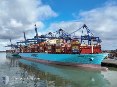
MAERSK CINCINNATI
Cargo D
Current Trip
| Time Travelled | 20 days |
|---|---|
| Remaining Time | 3 days |
| Distance Travelled | 9293.00 nm |
| Remaining Distance | 1578.95 nm |
| AVG Speed | 18.3 Knots |
| MAX Speed | 21.4 Knots |
| AVG Wind | 13.7 knots |
| MAX Wind | 34 knots |
| MIN Temp | 14.5°C / 58.1°F |
| MAX Temp | 30.4°C / 86.72°F |
| Draught | 17.4 m |
| Position Received | 7 d ago |
Current Position
| Longitude | 17.75603° |
|---|---|
| Latitude | -34.36538° |
| Status | Under way using engine |
| Speed | 19.8 Knots |
| Course | 301.4° |
| Area | South Atlantic Ocean |
| Station | T-AIS |
| Position Received | 7 d ago |
Info
Information
The current position of MAERSK CINCINNATI is in South Atlantic Ocean with coordinates -34.36538° / 17.75603° as reported on 2024-06-04 08:27 by AIS to our vessel tracker app. The vessel's current speed is 19.8 Knots and is heading at the port of TANGER MED. The estimated time of arrival as calculated by vessel tracking app is 2024-06-15 03:51 LT
The vessel MAERSK CINCINNATI (IMO: 9936410, MMSI: 477867500) is a Cargo D It's sailing under the flag of [HK] Hong Kong.
In this page you can find informations about the vessels current position, last detected port calls, and current voyage information. If the vessels is not in coverage by AIS you will find the latest position.
The current position of MAERSK CINCINNATI is detected by our AIS receivers and we are not responsible for the reliability of the data. The last position was recorded while the vessel was in Coverage by the Ais receivers of our vessel tracking app.
The current draught of MAERSK CINCINNATI as reported by AIS is 17.4 meters
Weather
| Temperature | 24.4°C / 75.92°F |
|---|---|
| Wind Speed | 8 knots |
| Direction | 319° NW |
| Pressure | 1013.3 hPa |
| Humidity | 83.7 % |
| Cloud Coverage | 8 % |
Featured Company
Last Port Calls
| Port | Arrival | Departure | Time In Port |
|---|---|---|---|
| 2024-05-19 22:43 | 2024-05-22 00:51 | 2 d | |
| 2024-05-15 17:12 | 2024-05-16 14:08 | 20 h | |
| 2024-05-13 06:47 | 2024-05-15 00:49 | 1 d | |
| 2024-04-29 09:39 | 2024-05-01 21:22 | 2 d | |
| 2024-04-25 22:25 | 2024-04-27 14:43 | 1 d | |
| 2024-04-02 02:39 | 2024-04-02 18:10 | 15 h | |
| 2024-04-01 08:43 | 2024-04-01 17:06 | 8 h |
Most Visited Ports (Last year)
| Port | Arrivals | |
|---|---|---|
| 2 | ||
| 2 | ||
| 1 | ||
| 1 | ||
| 1 | ||
| 1 |
Last Trips
| Origin | Departure | Destination | Arrival | Distance | |
|---|---|---|---|---|---|
| 2024-05-16 22:08 | 2024-05-20 06:43 | 1500.49 nm | |||
| 2024-05-15 08:49 | 2024-05-16 01:12 | 113.75 nm | |||
| 2024-05-02 01:22 | 2024-05-13 14:47 | 4987.37 nm | |||
| 2024-04-27 18:43 | 2024-04-29 13:39 | 48.50 nm | |||
| 2024-04-02 18:10 | 2024-04-26 02:25 | 10093.85 nm | |||
| 2024-04-01 19:06 | 2024-04-02 02:39 | 63.71 nm | |||
| 2024-03-27 22:44 | 2024-04-01 10:43 | 1301.52 nm |
Events
| Time | Event | Details | Position / Dest | Info |
|---|---|---|---|---|
| 2024-06-04 08:33 | Status Changed | Default Under way using engine |
-34.34333 / 17.72333
MYTPP>>MAPTM
|
Speed: 19.8 kn Course: 301.4° |
| 2024-06-04 08:27 | Status Changed | Under way using engine Default |
-34.36538 / 17.75603
MYTPP>>MAPTM
|
Speed: 19 kn Course: 301° |
| 2024-06-04 08:27 | OUT of Coverage |
-34.36538 / 17.75603
South Atlantic Ocean
MYTPP>>MAPTM
|
Speed: 19.8 kn Course: 301.4° |
|
| 2024-06-04 08:21 | Status Changed | Default Under way using engine |
-34.38221 / 17.78964
MYTPP>>MAPTM
|
Speed: 19.5 kn Course: 300.2° |
| 2024-06-04 05:57 | Status Changed | Under way using engine Default |
-34.79777 / 18.59777
MYTPP>>MAPTM
|
Speed: 19.3 kn Course: 294° |
| 2024-06-04 05:52 | Status Changed | Default Under way using engine |
-34.80925 / 18.62666
MYTPP>>MAPTM
|
Speed: 19.3 kn Course: 295.4° |
| 2024-06-04 05:40 | Status Changed | Under way using engine Default |
-34.83780 / 18.70159
MYTPP>>MAPTM
|
Speed: 19.5 kn Course: 295° |
| 2024-06-04 05:37 | Status Changed | Default Under way using engine |
-34.84390 / 18.71701
MYTPP>>MAPTM
|
Speed: 19.4 kn Course: 293.2° |
| 2024-06-04 05:26 | Destination Changed | MYTPP>>MAPTM MYTPP-->MAPTM |
-34.86791 / 18.78484
MYTPP>>MAPTM
|
Speed: 19.4 kn Course: 292.2° |
| 2024-06-04 05:26 | ETA Changed | 2024/06/14 19:30 2024/06/14 04:30 |
-34.86791 / 18.78484
MYTPP>>MAPTM
|
Speed: 19.4 kn Course: 292.2° |