
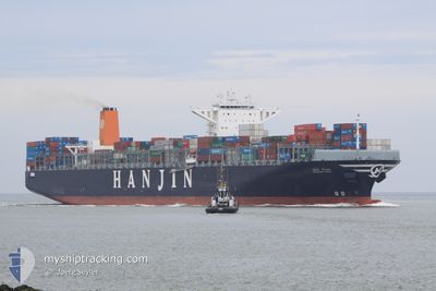
MAERSK EDIRNE
Container Ship
Current Trip
| Time Travelled | 15 days |
|---|---|
| Remaining Time | --- |
| Distance Travelled | 6013.53 nm |
| Remaining Distance | --- |
| AVG Speed | 17.4 Knots |
| MAX Speed | 21.3 Knots |
| AVG Wind | 16.1 knots |
| MAX Wind | 32.2 knots |
| MIN Temp | 15.8°C / 60.44°F |
| MAX Temp | 29.1°C / 84.38°F |
| Draught | 14.5 m |
| Position Received | 9 d ago |
Current Position
| Longitude | 18.53694° |
|---|---|
| Latitude | -34.80946° |
| Status | Under way using engine |
| Speed | 16 Knots |
| Course | 108.8° |
| Area | South Atlantic Ocean |
| Station | T-AIS |
| Position Received | 9 d ago |
Info
Information
The current position of MAERSK EDIRNE is in South Atlantic Ocean with coordinates -34.80946° / 18.53694° as reported on 2024-05-13 12:57 by AIS to our vessel tracker app. The vessel's current speed is 16 Knots and is heading at the port of COLOMBO. The estimated time of arrival as calculated by vessel tracking app is 2024-05-24 06:30 LT
The vessel MAERSK EDIRNE (IMO: 9502867, MMSI: 563090500) is a Container Ship that was built in 2012 ( 12 years old ). It's sailing under the flag of [SG] Singapore.
In this page you can find informations about the vessels current position, last detected port calls, and current voyage information. If the vessels is not in coverage by AIS you will find the latest position.
The current position of MAERSK EDIRNE is detected by our AIS receivers and we are not responsible for the reliability of the data. The last position was recorded while the vessel was in Coverage by the Ais receivers of our vessel tracking app.
The current draught of MAERSK EDIRNE as reported by AIS is 14.5 meters
Weather
| Temperature | 29°C / 84.2°F |
|---|---|
| Wind Speed | 21 knots |
| Direction | 257° WSW |
| Pressure | 1004.6 hPa |
| Humidity | 84.4 % |
| Cloud Coverage | 23 % |
Featured Company
Last Port Calls
| Port | Arrival | Departure | Time In Port |
|---|---|---|---|
| 2024-05-05 16:43 | 2024-05-08 06:23 | 2 d | |
| 2024-04-26 14:54 | 2024-04-29 06:46 | 2 d | |
| 2024-03-27 20:28 | 2024-03-28 22:24 | 1 d | |
| 2024-03-26 04:41 | 2024-03-27 17:37 | 1 d | |
| 2024-03-17 05:42 | 2024-03-18 09:11 | 1 d | |
| 2024-03-12 14:14 | 2024-03-13 03:55 | 13 h | |
| 2024-03-10 05:35 | 2024-03-11 01:08 | 19 h | |
| 2024-03-07 14:51 |
Last Trips
| Origin | Departure | Destination | Arrival | Distance | |
|---|---|---|---|---|---|
| 2024-04-29 06:46 | 2024-05-05 17:43 | 1232.74 nm | |||
| 2024-03-29 06:24 | 2024-04-26 14:54 | 9142.31 nm | |||
| 2024-03-28 01:37 | 2024-03-28 04:28 | 21.42 nm | |||
| 2024-03-18 17:11 | 2024-03-26 12:41 | 1516.87 nm | |||
| 2024-03-13 11:55 | 2024-03-17 13:42 | 1040.48 nm | |||
| 2024-03-11 10:08 | 2024-03-12 22:14 | 454.23 nm | |||
| 2024-03-07 22:51 | 2024-03-10 14:35 | 578.82 nm |
Events
| Time | Event | Details | Position / Dest | Info |
|---|---|---|---|---|
| 2024-05-13 13:03 | Status Changed | Default Under way using engine |
-34.81833 / 18.56833
CGPNR>>LKCMB
|
Speed: 16 kn Course: 108.8° |
| 2024-05-13 12:57 | OUT of Coverage |
-34.80946 / 18.53694
South Atlantic Ocean
CGPNR>>LKCMB
|
Speed: 16 kn Course: 108.8° |
|
| 2024-05-13 12:07 | ETA Changed | 2024/05/24 06:30 2024/05/22 14:30 |
-34.70975 / 18.29981
CGPNR>>LKCMB
|
Speed: 15.7 kn Course: 115° |
| 2024-05-13 11:26 | Draught Changed | 14.5 16.1 |
-34.61033 / 18.12654
CGPNR>>LKCMB
|
Speed: 14.9 kn Course: 138.1° |
| 2024-05-13 11:26 | Destination Changed | CGPNR>>LKCMB SGSIN>>GHTEM |
-34.61033 / 18.12654
CGPNR>>LKCMB
|
Speed: 14.9 kn Course: 138.1° |
| 2024-05-13 11:26 | ETA Changed | 2024/05/22 14:30 2024/04/16 15:00 |
-34.61033 / 18.12654
CGPNR>>LKCMB
|
Speed: 14.9 kn Course: 138.1° |
| 2024-05-13 10:31 | Status Changed | Under way using engine Default |
-34.45520 / 17.91506
SGSIN>>GHTEM
|
Speed: 15.2 kn Course: 136° |
| 2024-05-13 10:22 | Status Changed | Default Under way using engine |
-34.43046 / 17.88594
SGSIN>>GHTEM
|
Speed: 15.3 kn Course: 136.2° |
| 2024-05-13 09:11 | Status Changed | Under way using engine Default |
-34.19893 / 17.63383
SGSIN>>GHTEM
|
Speed: 15.8 kn Course: 137° |
| 2024-05-13 09:07 | IN Coverage |
-34.20019 / 17.63520
South Atlantic Ocean
|
Speed: 15.9 kn Course: 137.5° |