
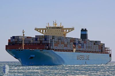
MAERSK ESSEN
Container Ship
Current Trip
| Time Travelled | 11 days |
|---|---|
| Remaining Time | 3 h, 38 mins |
| Distance Travelled | 4778.75 nm |
| Remaining Distance | 74.28 nm |
| AVG Speed | 17.2 Knots |
| MAX Speed | 19.8 Knots |
| AVG Wind | 15.6 knots |
| MAX Wind | 40 knots |
| MIN Temp | 6°C / 42.8°F |
| MAX Temp | 23.6°C / 74.48°F |
| Draught | 11.2 m |
| Position Received | 1 h, 51 m ago |
Current Position
| Longitude | 140.70026° |
|---|---|
| Latitude | 35.04229° |
| Status | Under way using engine |
| Speed | 12.4 Knots |
| Course | 239.2° |
| Area | North Pacific Ocean |
| Station | T-AIS |
| Position Received | 1 h, 51 m ago |
Info
Information
The current position of MAERSK ESSEN is in North Pacific Ocean with coordinates 35.04229° / 140.70026° as reported on 2024-05-29 01:02 by AIS to our vessel tracker app. The vessel's current speed is 12.4 Knots and is heading at the port of YOKOHAMA. The estimated time of arrival as calculated by vessel tracking app is 2024-05-29 06:31 LT
The vessel MAERSK ESSEN (IMO: 9456783, MMSI: 219210000) is a Container Ship that was built in 2010 ( 14 years old ). It's sailing under the flag of [DK] Denmark.
In this page you can find informations about the vessels current position, last detected port calls, and current voyage information. If the vessels is not in coverage by AIS you will find the latest position.
The current position of MAERSK ESSEN is detected by our AIS receivers and we are not responsible for the reliability of the data. The last position was recorded while the vessel was in Coverage by the Ais receivers of our vessel tracking app.
The current draught of MAERSK ESSEN as reported by AIS is 11.2 meters
Weather
| Temperature | 20.3°C / 68.54°F |
|---|---|
| Wind Speed | 9 knots |
| Direction | 50° NE |
| Pressure | 1006.1 hPa |
| Humidity | 82.4 % |
| Cloud Coverage | 100 % |
Featured Company
Last Port Calls
| Port | Arrival | Departure | Time In Port |
|---|---|---|---|
| 2024-05-10 10:02 | 2024-05-17 15:15 | 7 d | |
| 2024-04-17 06:59 | 2024-04-18 11:53 | 1 d | |
| 2024-04-15 14:17 | 2024-04-16 00:29 | 10 h | |
| 2024-04-07 18:44 | 2024-04-08 17:05 | 22 h | |
| 2024-03-14 09:23 | 2024-03-15 09:05 | 23 h | |
| 2024-03-11 19:34 | 2024-03-13 08:58 | 1 d | |
| 2024-03-08 16:31 | 2024-03-09 18:22 | 1 d | |
| 2024-03-02 13:56 |
Most Visited Ports (Last year)
| Port | Arrivals | |
|---|---|---|
| 5 | ||
| 5 | ||
| 3 | ||
| 3 | ||
| 2 | ||
| 2 |
Last Trips
| Origin | Departure | Destination | Arrival | Distance | |
|---|---|---|---|---|---|
| 2024-04-18 19:53 | 2024-05-10 03:02 | 6635.03 nm | |||
| 2024-04-16 08:29 | 2024-04-17 14:59 | 108.34 nm | |||
| 2024-04-09 01:05 | 2024-04-15 22:17 | 2077.58 nm | |||
| 2024-03-15 06:05 | 2024-04-08 02:44 | 10497.40 nm | |||
| 2024-03-13 05:58 | 2024-03-14 06:23 | 233.83 nm | |||
| 2024-03-09 15:22 | 2024-03-11 16:34 | 670.33 nm | |||
| 2024-03-02 08:56 | 2024-03-08 13:31 | 2139.55 nm |
Events
| Time | Event | Details | Position / Dest | Info |
|---|---|---|---|---|
| 2024-05-29 01:09 | Status Changed | Default Under way using engine |
35.02833 / 140.67500
JPYOK
|
Speed: 12.4 kn Course: 239.2° |
| 2024-05-29 01:02 | OUT of Coverage |
35.04229 / 140.70026
North Pacific Ocean
JPYOK
|
Speed: 12.4 kn Course: 239.2° |
|
| 2024-05-28 21:23 | Draught Changed | 11.2 11.5 |
35.48728 / 141.59424
JPYOK
|
Speed: 13.9 kn Course: 235.3° |
| 2024-05-28 21:23 | ETA Changed | 2024/05/29 07:30 2024/05/29 02:00 |
35.48728 / 141.59424
JPYOK
|
Speed: 13.9 kn Course: 235.3° |
| 2024-05-28 21:12 | Status Changed | Under way using engine Default |
35.51137 / 141.63785
JPYOK
|
Speed: 14.1 kn Course: 238° |
| 2024-05-28 21:04 | Status Changed | Default Under way using engine |
35.52709 / 141.66716
JPYOK
|
Speed: 14.7 kn Course: 239.2° |
| 2024-05-28 20:59 | Change Sea Area | Japanese part of the North Pacific Ocean United States part of the North Pacific Ocean |
35.53941 / 141.69020
North Pacific Ocean
JPYOK
|
Speed: 14.2 kn Course: 237° |
| 2024-05-28 20:58 | Status Changed | Under way using engine Default |
35.54027 / 141.69183
JPYOK
|
Speed: 14.7 kn Course: 237° |
| 2024-05-28 20:50 | IN Coverage |
35.53941 / 141.69020
North Pacific Ocean
JPYOK
|
Speed: 14.2 kn Course: 237° |