
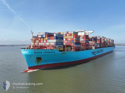
MAERSK HORSBURGH
Cargo A
Current Trip
| Time Travelled | 6 days |
|---|---|
| Remaining Time | --- |
| Distance Travelled | 2243.62 nm |
| Remaining Distance | --- |
| AVG Speed | 18.9 Knots |
| MAX Speed | 22.9 Knots |
| AVG Wind | 11.9 knots |
| MAX Wind | 27 knots |
| MIN Temp | 26.2°C / 79.16°F |
| MAX Temp | 34.1°C / 93.38°F |
| Draught | 11.5 m |
| Position Received | 2 d ago |
Current Position
| Longitude | 77.23487° |
|---|---|
| Latitude | 7.35305° |
| Status | Under way using engine |
| Speed | 20.8 Knots |
| Course | 128° |
| Area | Laccadive Sea |
| Station | T-AIS |
| Position Received | 2 d ago |
Info
Information
The current position of MAERSK HORSBURGH is in Laccadive Sea with coordinates 7.35305° / 77.23487° as reported on 2024-06-27 11:26 by AIS to our vessel tracker app. The vessel's current speed is 20.8 Knots and is heading at the port of NAN AO. The estimated time of arrival as calculated by vessel tracking app is 2024-07-04 16:00 LT
The vessel MAERSK HORSBURGH (IMO: 9784269, MMSI: 563026700) is a Cargo A It's sailing under the flag of [SG] Singapore.
In this page you can find informations about the vessels current position, last detected port calls, and current voyage information. If the vessels is not in coverage by AIS you will find the latest position.
The current position of MAERSK HORSBURGH is detected by our AIS receivers and we are not responsible for the reliability of the data. The last position was recorded while the vessel was in Coverage by the Ais receivers of our vessel tracking app.
The current draught of MAERSK HORSBURGH as reported by AIS is 11.5 meters
Weather
| Temperature | 27.3°C / 81.14°F |
|---|---|
| Wind Speed | 7 knots |
| Direction | 168° SSE |
| Pressure | 1010.3 hPa |
| Humidity | 81.2 % |
| Cloud Coverage | 100 % |
Featured Company
Last Port Calls
| Port | Arrival | Departure | Time In Port |
|---|---|---|---|
| 2024-06-19 06:47 | 2024-06-23 15:23 | 4 d | |
| 2024-06-11 08:09 | 2024-06-13 10:25 | 2 d | |
| 2024-05-18 05:29 | 2024-05-18 23:11 | 17 h | |
| 2024-05-13 15:44 | 2024-05-15 05:16 | 1 d | |
| 2024-05-11 11:51 | 2024-05-12 17:29 | 1 d | |
| 2024-05-08 16:16 | 2024-05-10 05:54 | 1 d | |
| 2024-05-04 11:54 | 2024-05-07 07:26 | 2 d | |
| 2024-04-29 17:42 | 2024-05-01 11:49 | 1 d | |
| 2024-04-03 14:21 | 2024-04-04 18:13 | 1 d |
Most Visited Ports (Last year)
| Port | Arrivals | |
|---|---|---|
| 6 | ||
| 6 | ||
| 5 | ||
| 3 | ||
| 2 | ||
| 2 |
Last Trips
| Origin | Departure | Destination | Arrival | Distance | |
|---|---|---|---|---|---|
| 2024-06-13 14:25 | 2024-06-19 10:47 | 54.38 nm | |||
| 2024-05-19 00:11 | 2024-06-11 12:09 | 10248.81 nm | |||
| 2024-05-15 07:16 | 2024-05-18 06:29 | 1243.68 nm | |||
| 2024-05-12 18:29 | 2024-05-13 17:44 | 276.63 nm | |||
| 2024-05-10 07:54 | 2024-05-11 12:51 | 239.47 nm | |||
| 2024-05-07 09:26 | 2024-05-08 18:16 | 425.73 nm | |||
| 2024-05-01 12:49 | 2024-05-04 13:54 | 408.15 nm | |||
| 2024-04-04 23:43 | 2024-04-29 18:42 | 10986.39 nm | |||
| 2024-03-31 15:37 | 2024-04-03 19:51 | 1610.84 nm |
Events
| Time | Event | Details | Position / Dest | Info |
|---|---|---|---|---|
| 2024-06-27 11:37 | Status Changed | Default Under way using engine |
7.31373 / 77.28442
AEJAL>CNNAN
|
Speed: 20.8 kn Course: 128° |
| 2024-06-27 11:26 | OUT of Coverage |
7.35305 / 77.23487
Laccadive Sea
AEJAL>CNNAN
|
Speed: 20.8 kn Course: 128° |
|
| 2024-06-27 11:21 | Status Changed | Under way using engine Default |
7.37023 / 77.21307
AEJAL>CNNAN
|
Speed: 20.7 kn Course: 127° |
| 2024-06-27 10:38 | Status Changed | Default Under way using engine |
7.51550 / 77.01502
AEJAL>CNNAN
|
Speed: 20.7 kn Course: 123.8° |
| 2024-06-27 09:29 | ETA Changed | 2024/07/04 16:00 2024/07/04 22:00 |
7.74970 / 76.68713
AEJAL>CNNAN
|
Speed: 20.8 kn Course: 127.4° |
| 2024-06-27 08:47 | Detected in Sea | Indian part of the Laccadive Sea |
7.89668 / 76.49610
Laccadive Sea
AEJAL>CNNAN
|
Speed: 20.7 kn Course: 127.1° |
| 2024-06-27 08:47 | Status Changed | Under way using engine Default |
7.89668 / 76.49610
AEJAL>CNNAN
|
Speed: 20.4 kn Course: 137° |
| 2024-06-27 08:47 | IN Coverage |
7.89668 / 76.49610
Laccadive Sea
AEJAL>CNNAN
|
Speed: 20.7 kn Course: 127.1° |
|
| 2024-06-24 05:30 | Status Changed | Default Under way using engine |
24.90318 / 57.33003
AEJAL>CNNAN
|
Speed: 19.8 kn Course: 120.3° |
| 2024-06-24 05:24 | OUT of Coverage |
24.91883 / 57.30085
Gulf of Oman
AEJAL>CNNAN
|
Speed: 19.8 kn Course: 120.3° |