
MAERSK IDAHO
Container Ship
Current Trip
| Time Travelled | 4 days |
|---|---|
| Remaining Time | 3 h, 51 mins |
| Distance Travelled | 1406.33 nm |
| Remaining Distance | 53.43 nm |
| AVG Speed | 12.2 Knots |
| MAX Speed | 18.4 Knots |
| AVG Wind | 9.5 knots |
| MAX Wind | 18.2 knots |
| MIN Temp | 23.3°C / 73.94°F |
| MAX Temp | 29.1°C / 84.38°F |
| Draught | 10.8 m |
| Position Received | 6 h, 44 m ago |
Current Position
| Longitude | -92.99222° |
|---|---|
| Latitude | 28.30131° |
| Status | Under way using engine |
| Speed | 12.7 Knots |
| Course | 298.3° |
| Area | Gulf of Mexico |
| Station | T-AIS |
| Position Received | 6 h, 44 m ago |
Info
Information
The current position of MAERSK IDAHO is in Gulf of Mexico with coordinates 28.30131° / -92.99222° as reported on 2024-05-22 10:00 by AIS to our vessel tracker app. The vessel's current speed is 12.7 Knots and is heading at the port of HOUSTON. The estimated time of arrival as calculated by vessel tracking app is 2024-05-22 20:35 LT
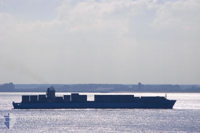
The vessel MAERSK IDAHO (IMO: 9193264, MMSI: 563146500) is a Container Ship that was built in 2000 ( 24 years old ). It's sailing under the flag of [SG] Singapore.
In this page you can find informations about the vessels current position, last detected port calls, and current voyage information. If the vessels is not in coverage by AIS you will find the latest position.
The current position of MAERSK IDAHO is detected by our AIS receivers and we are not responsible for the reliability of the data. The last position was recorded while the vessel was in Coverage by the Ais receivers of our vessel tracking app.
The current draught of MAERSK IDAHO as reported by AIS is 10.8 meters
Weather
| Temperature | 26.3°C / 79.34°F |
|---|---|
| Wind Speed | 13 knots |
| Direction | 147° SSE |
| Pressure | 1012.9 hPa |
| Humidity | 91.4 % |
| Cloud Coverage | 83 % |
Featured Company
Last Port Calls
| Port | Arrival | Departure | Time In Port |
|---|---|---|---|
| 2024-05-17 07:59 | 2024-05-17 21:56 | 13 h | |
| 2024-05-15 10:33 | 2024-05-16 04:01 | 17 h | |
| 2024-05-04 22:55 | 2024-05-05 19:09 | 20 h | |
| 2024-05-02 12:16 | 2024-05-03 09:25 | 21 h | |
| 2024-05-01 02:19 | 2024-05-01 20:45 | 18 h | |
| 2024-04-20 07:27 | 2024-04-21 06:29 | 23 h | |
| 2024-04-13 00:14 | 2024-04-14 20:01 | 1 d | |
| 2024-04-08 08:14 | 2024-04-08 23:21 | 15 h | |
| 2024-03-26 14:49 | 2024-03-27 20:56 | 1 d | |
| 2024-03-24 17:49 | 2024-03-25 10:13 | 16 h |
Most Visited Ports (Last year)
| Port | Arrivals | |
|---|---|---|
| 16 | ||
| 9 | ||
| 9 | ||
| 9 | ||
| 9 | ||
| 8 |
Last Trips
| Origin | Departure | Destination | Arrival | Distance | |
|---|---|---|---|---|---|
| 2024-05-16 00:01 | 2024-05-17 03:59 | 425.68 nm | |||
| 2024-05-05 21:09 | 2024-05-15 06:33 | 3836.11 nm | |||
| 2024-05-03 11:25 | 2024-05-05 00:55 | 277.55 nm | |||
| 2024-05-01 22:45 | 2024-05-02 14:16 | 124.42 nm | |||
| 2024-04-21 02:29 | 2024-05-01 04:19 | 3561.16 nm | |||
| 2024-04-14 15:01 | 2024-04-20 03:27 | 1780.52 nm | |||
| 2024-04-08 19:21 | 2024-04-12 19:14 | 1463.07 nm | |||
| 2024-03-27 21:56 | 2024-04-08 04:14 | 4079.30 nm | |||
| 2024-03-25 11:13 | 2024-03-26 15:49 | 276.21 nm | |||
| 2024-03-23 13:29 | 2024-03-24 18:49 | 128.48 nm |
Events
| Time | Event | Details | Position / Dest | Info |
|---|---|---|---|---|
| 2024-05-22 10:03 | Status Changed | Default Under way using engine |
28.30760 / -93.00500
USNCA>>>USHOU
|
Speed: 12.7 kn Course: 298.3° |
| 2024-05-22 10:00 | Status Changed | Under way using engine Default |
28.30131 / -92.99222
USNCA>>>USHOU
|
Speed: 13 kn Course: 298° |
| 2024-05-22 10:00 | OUT of Coverage |
28.30131 / -92.99222
Gulf of Mexico
USNCA>>>USHOU
|
Speed: 12.7 kn Course: 298.3° |
|
| 2024-05-22 09:51 | Status Changed | Default Under way using engine |
28.28833 / -92.96333
USNCA>>>USHOU
|
Speed: 12.6 kn Course: 297.2° |
| 2024-05-22 09:34 | Change Sea Area | United States part of the Gulf of Mexico Bahamas part of the North Atlantic Ocean |
28.25633 / -92.90400
Gulf of Mexico
USNCA>>>USHOU
|
Speed: 12.9 kn Course: 316.6° |
| 2024-05-22 09:33 | Status Changed | Under way using engine Default |
28.25494 / -92.90251
USNCA>>>USHOU
|
Speed: 13.1 kn Course: 322° |
| 2024-05-22 09:33 | IN Coverage |
28.25633 / -92.90400
Gulf of Mexico
USNCA>>>USHOU
|
Speed: 12.9 kn Course: 316.6° |
|
| 2024-05-19 08:46 | Status Changed | Default Under way using engine |
25.88167 / -79.43166
USNCA>>>USHOU
|
Speed: 11.3 kn Course: 185.4° |
| 2024-05-19 08:37 | OUT of Coverage |
25.90871 / -79.42868
North Atlantic Ocean
USNCA>>>USHOU
|
Speed: 11.3 kn Course: 185.4° |
|
| 2024-05-19 08:16 | Status Changed | Under way using engine Default |
25.97450 / -79.41129
USNCA>>>USHOU
|
Speed: 12 kn Course: 194° |