
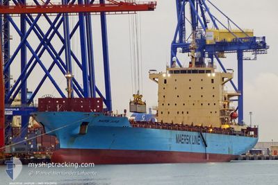
MAERSK JAIPUR
Container Ship
Current Trip
| Time Travelled | 19 h, 47 mins |
|---|---|
| Remaining Time | 1 day |
| Distance Travelled | 365.01 nm |
| Remaining Distance | 813.12 nm |
| AVG Speed | 19.2 Knots |
| MAX Speed | 21.8 Knots |
| AVG Wind | 6.6 knots |
| MAX Wind | 20 knots |
| MIN Temp | 19.3°C / 66.74°F |
| MAX Temp | 23.9°C / 75.02°F |
| Draught | 7.6 m |
| Position Received | 1 h, 46 m ago |
Current Position
| Longitude | 19.00061° |
|---|---|
| Latitude | 36.53279° |
| Status | Under way using engine |
| Speed | 19.6 Knots |
| Course | 112.1° |
| Area | Ionian Sea |
| Station | T-AIS |
| Position Received | 1 h, 46 m ago |
Info
Information
The current position of MAERSK JAIPUR is in Ionian Sea with coordinates 36.53279° / 19.00061° as reported on 2024-06-07 00:51 by AIS to our vessel tracker app. The vessel's current speed is 19.6 Knots and is heading at the port of HAIFA. The estimated time of arrival as calculated by vessel tracking app is 2024-06-08 18:31 LT
The vessel MAERSK JAIPUR (IMO: 9343974, MMSI: 248207000) is a Container Ship that was built in 2008 ( 16 years old ). It's sailing under the flag of [MT] Malta.
In this page you can find informations about the vessels current position, last detected port calls, and current voyage information. If the vessels is not in coverage by AIS you will find the latest position.
The current position of MAERSK JAIPUR is detected by our AIS receivers and we are not responsible for the reliability of the data. The last position was recorded while the vessel was in Coverage by the Ais receivers of our vessel tracking app.
The current draught of MAERSK JAIPUR as reported by AIS is 7.6 meters
Weather
| Temperature | 22.5°C / 72.5°F |
|---|---|
| Wind Speed | 18 knots |
| Direction | 316° NW |
| Pressure | 1013.7 hPa |
| Humidity | 82.8 % |
| Cloud Coverage | --- |
Featured Company
Last Port Calls
| Port | Arrival | Departure | Time In Port |
|---|---|---|---|
| 2024-06-05 05:46 | 2024-06-06 06:51 | 1 d | |
| 2024-06-01 05:40 | 2024-06-01 19:10 | 13 h | |
| 2024-05-27 18:37 | 2024-05-28 13:12 | 18 h | |
| 2024-05-20 05:07 | 2024-05-21 04:51 | 23 h | |
| 2024-05-17 19:19 | 2024-05-18 10:52 | 15 h | |
| 2024-05-13 05:18 | 2024-05-13 12:07 | 6 h | |
| 2024-05-10 11:15 | 2024-05-11 03:12 | 15 h | |
| 2024-04-30 02:25 | 2024-04-30 14:08 | 11 h | |
| 2024-04-29 05:31 | 2024-04-29 18:46 | 13 h | |
| 2024-04-25 05:18 | 2024-04-25 21:31 | 16 h |
Most Visited Ports (Last year)
| Port | Arrivals | |
|---|---|---|
| 12 | ||
| 6 | ||
| 5 | ||
| 5 | ||
| 5 | ||
| 4 |
Last Trips
| Origin | Departure | Destination | Arrival | Distance | |
|---|---|---|---|---|---|
| 2024-06-01 21:10 | 2024-06-05 07:46 | 153.65 nm | |||
| 2024-05-28 15:12 | 2024-06-01 07:40 | 266.08 nm | |||
| 2024-05-21 06:51 | 2024-05-27 20:37 | 257.61 nm | |||
| 2024-05-18 12:52 | 2024-05-20 07:07 | 166.20 nm | |||
| 2024-05-13 14:07 | 2024-05-17 21:19 | 1073.49 nm | |||
| 2024-05-11 05:12 | 2024-05-13 07:18 | 418.93 nm | |||
| 2024-04-30 15:08 | 2024-05-10 13:15 | 1000.63 nm | |||
| 2024-04-29 20:46 | 2024-04-30 03:25 | 55.12 nm | |||
| 2024-04-25 23:31 | 2024-04-29 07:31 | 991.21 nm | |||
| 2024-04-24 06:25 | 2024-04-25 07:18 | 60.85 nm |
Events
| Time | Event | Details | Position / Dest | Info |
|---|---|---|---|---|
| 2024-06-07 01:06 | Status Changed | Default Under way using engine |
36.49725 / 19.09848
ILHFA
|
Speed: 19.6 kn Course: 112.1° |
| 2024-06-07 00:51 | OUT of Coverage |
36.53279 / 19.00061
Ionian Sea
ILHFA
|
Speed: 19.6 kn Course: 112.1° |
|
| 2024-06-06 23:13 | Detected in Sea | Greek part of the Ionian Sea |
36.76082 / 18.39528
Ionian Sea
ILHFA
|
Speed: 20 kn Course: 115.7° |
| 2024-06-06 23:12 | IN Coverage |
36.76082 / 18.39528
Ionian Sea
ILHFA
|
Speed: 20 kn Course: 115.7° |
|
| 2024-06-06 22:07 | OUT of Coverage |
36.92296 / 17.97264
Ionian Sea
ILHFA
|
Speed: 21.5 kn Course: 115° |
|
| 2024-06-06 19:01 | IN Coverage |
37.39653 / 16.74677
Ionian Sea
ILHFA
|
Speed: 20.9 kn Course: 112.2° |
|
| 2024-06-06 17:46 | OUT of Coverage |
37.58601 / 16.25161
Ionian Sea
ILHFA
|
Speed: 21 kn Course: 115.2° |
|
| 2024-06-06 14:46 | Change Sea Area | Italian part of the Ionian Sea Italian part of the Tyrrhenian Sea |
38.25196 / 15.64217
Ionian Sea
ILHFA
|
Speed: 15.3 kn Course: 237.6° |
| 2024-06-06 11:58 | Status Changed | Under way using engine Default |
39.09282 / 15.32613
ILHFA
|
Speed: 20.9 kn Course: 174° |
| 2024-06-06 11:58 | IN Coverage |
39.09282 / 15.32613
Tyrrhenian Sea
ILHFA
|
Speed: 20.9 kn Course: 158.6° |