
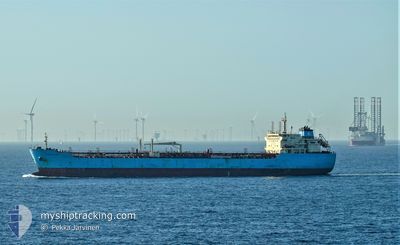
MAERSK KARA
Oil/Chemical Tanker
Current Trip
| Time Travelled | 9 days |
|---|---|
| Remaining Time | --- |
| Distance Travelled | 393.22 nm |
| Remaining Distance | --- |
| AVG Speed | 9 Knots |
| MAX Speed | 14.8 Knots |
| AVG Wind | 15.7 knots |
| MAX Wind | 27.7 knots |
| MIN Temp | 12.2°C / 53.96°F |
| MAX Temp | 17.4°C / 63.32°F |
| Draught | 7.4 m |
| Position Received | 3 m ago |
Current Position
| Longitude | 3.33561° |
|---|---|
| Latitude | 51.81068° |
| Status | At anchor |
| Speed | 0.1 Knots |
| Course | 9° |
| Area | North Sea |
| Station | T-AIS |
| Position Received | 3 m ago |
Info
Information
The current position of MAERSK KARA is in North Sea with coordinates 51.81068° / 3.33561° as reported on 2024-06-01 18:52 by AIS to our vessel tracker app. The vessel's current speed is 0.1 Knots
The vessel MAERSK KARA (IMO: 9374428, MMSI: 565186000) is a Oil/Chemical Tanker that was built in 2008 ( 16 years old ). It's sailing under the flag of [SG] Singapore.
In this page you can find informations about the vessels current position, last detected port calls, and current voyage information. If the vessels is not in coverage by AIS you will find the latest position.
The current position of MAERSK KARA is detected by our AIS receivers and we are not responsible for the reliability of the data. The last position was recorded while the vessel was in Coverage by the Ais receivers of our vessel tracking app.
The current draught of MAERSK KARA as reported by AIS is 7.4 meters
Weather
| Temperature | 13.6°C / 56.48°F |
|---|---|
| Wind Speed | 23 knots |
| Direction | 359° N |
| Pressure | 1022.6 hPa |
| Humidity | 85 % |
| Cloud Coverage | 98 % |
Featured Company
Last Port Calls
| Port | Arrival | Departure | Time In Port |
|---|---|---|---|
| 2024-05-20 12:37 | 2024-05-23 07:02 | 2 d | |
| 2024-05-16 18:38 | 2024-05-18 05:27 | 1 d | |
| 2024-05-08 13:56 | 2024-05-09 00:26 | 10 h | |
| 2024-04-26 08:36 | 2024-04-28 10:31 | 2 d | |
| 2024-04-21 11:45 | 2024-04-23 11:34 | 1 d | |
| 2024-04-18 08:11 | 2024-04-20 08:04 | 1 d |
Most Visited Ports (Last year)
| Port | Arrivals | |
|---|---|---|
| 4 | ||
| 3 | ||
| 3 | ||
| 2 | ||
| 2 | ||
| 1 |
Last Trips
| Origin | Departure | Destination | Arrival | Distance | |
|---|---|---|---|---|---|
| 2024-05-18 07:27 | 2024-05-20 14:37 | 366.57 nm | |||
| 2024-05-09 01:26 | 2024-05-16 20:38 | 1773.34 nm | |||
| 2024-04-28 11:31 | 2024-05-08 14:56 | 2897.89 nm | |||
| 2024-04-23 12:34 | 2024-04-26 09:36 | 8.92 nm | |||
| 2024-04-20 09:04 | 2024-04-21 12:45 | 8.20 nm | |||
| 2024-01-28 12:45 | 2024-04-18 09:11 | 703.53 nm |
Events
| Time | Event | Details | Position / Dest | Info |
|---|---|---|---|---|
| 2024-06-01 03:19 | Status Changed | At anchor Default |
51.81072 / 3.33555
BEANR
|
Speed: 0.2 kn Course: 2° |
| 2024-06-01 03:10 | Status Changed | Default At anchor |
51.81070 / 3.33562
BEANR
|
Speed: 0.1 kn Course: 9° |
| 2024-06-01 00:04 | Status Changed | At anchor Default |
51.81084 / 3.33706
BEANR
|
Speed: Course: 350° |
| 2024-06-01 00:02 | ETA Changed | 2025/05/26 13:00 2024/05/26 13:00 |
51.81078 / 3.33714
BEANR
|
Speed: Course: 350° |
| 2024-06-01 00:01 | Status Changed | Default At anchor |
51.81083 / 3.33710
BEANR
|
Speed: Course: 350° |
| 2024-05-30 12:52 | Status Changed | At anchor Default |
51.81210 / 3.33489
BEANR
|
Speed: 0.2 kn Course: 7° |
| 2024-05-30 12:49 | Status Changed | Default At anchor |
51.81206 / 3.33505
BEANR
|
Speed: 0.2 kn Course: 3° |
| 2024-05-27 21:25 | Status Changed | At anchor Default |
51.81447 / 3.33932
BEANR
|
Speed: 0.2 kn Course: 242° |
| 2024-05-27 21:19 | Status Changed | Default At anchor |
51.81464 / 3.33934
BEANR
|
Speed: 0.1 kn Course: 216° |
| 2024-05-26 13:24 | Status Changed | At anchor Under way using engine |
51.81329 / 3.33967
BEANR
|
Speed: 0.9 kn Course: 282° |