
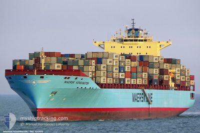
MAERSK KENSINGTON
Container Ship
Current Trip
| Time Travelled | 6 days |
|---|---|
| Remaining Time | 2 days |
| Distance Travelled | 2306.63 nm |
| Remaining Distance | 1083.56 nm |
| AVG Speed | 15.9 Knots |
| MAX Speed | 20 Knots |
| AVG Wind | 16.7 knots |
| MAX Wind | 27.8 knots |
| MIN Temp | 16.9°C / 62.42°F |
| MAX Temp | 20.8°C / 69.44°F |
| Draught | 13.2 m |
| Position Received | 3 h, 48 m ago |
Current Position
| Longitude | -27.43555° |
|---|---|
| Latitude | 39.64899° |
| Status | Under way using engine |
| Speed | 15.2 Knots |
| Course | 94.6° |
| Area | North Atlantic Ocean |
| Station | T-AIS |
| Position Received | 3 h, 48 m ago |
Info
Information
The current position of MAERSK KENSINGTON is in North Atlantic Ocean with coordinates 39.64899° / -27.43555° as reported on 2024-06-07 03:38 by AIS to our vessel tracker app. The vessel's current speed is 15.2 Knots and is heading at the port of ALGECIRAS. The estimated time of arrival as calculated by vessel tracking app is 2024-06-10 01:49 LT
The vessel MAERSK KENSINGTON (IMO: 9333010, MMSI: 303657000) is a Container Ship that was built in 2007 ( 17 years old ). It's sailing under the flag of [US] USA.
In this page you can find informations about the vessels current position, last detected port calls, and current voyage information. If the vessels is not in coverage by AIS you will find the latest position.
The current position of MAERSK KENSINGTON is detected by our AIS receivers and we are not responsible for the reliability of the data. The last position was recorded while the vessel was in Coverage by the Ais receivers of our vessel tracking app.
The current draught of MAERSK KENSINGTON as reported by AIS is 13.2 meters
Weather
| Temperature | 18.2°C / 64.76°F |
|---|---|
| Wind Speed | 11 knots |
| Direction | 71° ENE |
| Pressure | 1021.6 hPa |
| Humidity | 75 % |
| Cloud Coverage | 100 % |
Featured Company
Last Port Calls
| Port | Arrival | Departure | Time In Port |
|---|---|---|---|
| 2024-05-31 07:36 | 2024-06-01 04:52 | 21 h | |
| 2024-05-29 20:01 | 2024-05-30 11:35 | 15 h | |
| 2024-05-23 09:46 | 2024-05-24 23:15 | 1 d | |
| 2024-05-18 14:30 | 2024-05-19 12:52 | 22 h | |
| 2024-05-17 06:52 | 2024-05-18 00:20 | 17 h | |
| 2024-05-14 07:13 | 2024-05-15 04:43 | 21 h | |
| 2024-05-05 11:41 | 2024-05-06 08:36 | 20 h | |
| 2024-04-10 04:52 | 2024-04-11 03:47 | 22 h | |
| 2024-04-06 04:05 | 2024-04-06 19:23 | 15 h | |
| 2024-04-04 23:23 | 2024-04-05 07:44 | 8 h |
Last Trips
| Origin | Departure | Destination | Arrival | Distance | |
|---|---|---|---|---|---|
| 2024-05-30 07:35 | 2024-05-31 03:36 | 293.48 nm | |||
| 2024-05-24 18:15 | 2024-05-29 16:01 | 1776.29 nm | |||
| 2024-05-19 08:52 | 2024-05-23 04:46 | 1340.06 nm | |||
| 2024-05-17 20:20 | 2024-05-18 10:30 | 118.08 nm | |||
| 2024-05-15 00:43 | 2024-05-17 02:52 | 627.35 nm | |||
| 2024-05-06 10:36 | 2024-05-14 03:13 | 3269.94 nm | |||
| 2024-04-11 07:47 | 2024-05-05 13:41 | 9936.18 nm | |||
| 2024-04-07 00:53 | 2024-04-10 08:52 | 1094.24 nm | |||
| 2024-04-05 13:14 | 2024-04-06 09:35 | 256.96 nm | |||
| 2024-04-03 14:16 | 2024-04-05 04:53 | 476.57 nm |
Events
| Time | Event | Details | Position / Dest | Info |
|---|---|---|---|---|
| 2024-06-07 03:41 | Status Changed | Default Under way using engine |
39.64834 / -27.42167
US NWK>ES ALG
|
Speed: 15.2 kn Course: 94.6° |
| 2024-06-07 03:38 | OUT of Coverage |
39.64899 / -27.43555
North Atlantic Ocean
US NWK>ES ALG
|
Speed: 15.2 kn Course: 94.6° |
|
| 2024-06-07 03:20 | Status Changed | Under way using engine Default |
39.65796 / -27.53409
US NWK>ES ALG
|
Speed: 16 kn Course: 97° |
| 2024-06-07 03:11 | Status Changed | Default Under way using engine |
39.66273 / -27.58366
US NWK>ES ALG
|
Speed: 15.5 kn Course: 97.6° |
| 2024-06-07 02:36 | Status Changed | Under way using engine Default |
39.67901 / -27.77841
US NWK>ES ALG
|
Speed: 15 kn Course: 97° |
| 2024-06-07 02:32 | Status Changed | Default Under way using engine |
39.68167 / -27.80333
US NWK>ES ALG
|
Speed: 15.3 kn Course: 96.9° |
| 2024-06-06 19:43 | Change Sea Area | Portuguese (Azores) part of the North Atlantic Ocean United States part of the North Atlantic Ocean |
39.85825 / -30.04520
North Atlantic Ocean
US NWK>ES ALG
|
Speed: 15.7 kn Course: 96° |
| 2024-06-06 19:42 | IN Coverage |
39.85825 / -30.04520
North Atlantic Ocean
US NWK>ES ALG
|
Speed: 15.7 kn Course: 96° |
|
| 2024-06-01 14:49 | Status Changed | Default Under way using engine |
39.46233 / -72.91061
US NWK>ES ALG
|
Speed: 15.9 kn Course: 180.8° |
| 2024-06-01 14:49 | OUT of Coverage |
39.46470 / -72.91055
North Atlantic Ocean
US NWK>ES ALG
|
Speed: 15.9 kn Course: 180.8° |