
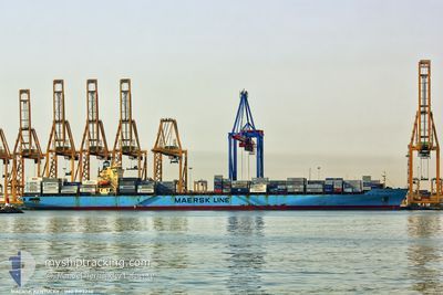
MAERSK KENTUCKY
Container Ship
Current Trip
| Time Travelled | 5 days |
|---|---|
| Remaining Time | --- |
| Distance Travelled | 2382.48 nm |
| Remaining Distance | --- |
| AVG Speed | 17.4 Knots |
| MAX Speed | 19.3 Knots |
| AVG Wind | 10.6 knots |
| MAX Wind | 18 knots |
| MIN Temp | 18.8°C / 65.84°F |
| MAX Temp | 28.5°C / 83.3°F |
| Draught | 13.4 m |
| Position Received | 3 d ago |
Current Position
| Longitude | -13.79662° |
|---|---|
| Latitude | 27.46044° |
| Status | Under way using engine |
| Speed | 18.4 Knots |
| Course | 214.2° |
| Area | North Atlantic Ocean |
| Station | T-AIS |
| Position Received | 3 d ago |
Info
Information
The current position of MAERSK KENTUCKY is in North Atlantic Ocean with coordinates 27.46044° / -13.79662° as reported on 2024-06-08 05:03 by AIS to our vessel tracker app. The vessel's current speed is 18.4 Knots and is heading at the port of SALALAH. The estimated time of arrival as calculated by vessel tracking app is 2024-06-28 21:30 LT
The vessel MAERSK KENTUCKY (IMO: 9193240, MMSI: 563073800) is a Container Ship that was built in 1999 ( 25 years old ). It's sailing under the flag of [SG] Singapore.
In this page you can find informations about the vessels current position, last detected port calls, and current voyage information. If the vessels is not in coverage by AIS you will find the latest position.
The current position of MAERSK KENTUCKY is detected by our AIS receivers and we are not responsible for the reliability of the data. The last position was recorded while the vessel was in Coverage by the Ais receivers of our vessel tracking app.
The current draught of MAERSK KENTUCKY as reported by AIS is 13.4 meters
Weather
| Temperature | 26.3°C / 79.34°F |
|---|---|
| Wind Speed | 13 knots |
| Direction | 143° SE |
| Pressure | 1013.5 hPa |
| Humidity | 73.7 % |
| Cloud Coverage | 40 % |
Featured Company
Last Port Calls
| Port | Arrival | Departure | Time In Port |
|---|---|---|---|
| 2024-06-05 23:45 | 2024-06-06 14:43 | 14 h | |
| 2024-06-03 07:39 | 2024-06-04 00:35 | 16 h | |
| 2024-05-24 17:12 | |||
| 2024-04-24 04:56 | 2024-04-25 00:20 | 19 h | |
| 2024-04-21 23:42 | 2024-04-22 05:43 | 6 h | |
| 2024-04-19 11:46 | 2024-04-20 02:26 | 14 h | |
| 2024-04-17 20:12 | 2024-04-18 17:51 | 21 h | |
| 2024-04-14 11:26 | 2024-04-15 02:37 | 15 h | |
| 2024-04-12 18:02 | 2024-04-13 23:43 | 1 d | |
| 2024-04-08 16:20 | 2024-04-09 08:40 | 16 h |
Most Visited Ports (Last year)
| Port | Arrivals | |
|---|---|---|
| 20 | ||
| 20 | ||
| 11 | ||
| 11 | ||
| 11 | ||
| 11 |
Last Trips
| Origin | Departure | Destination | Arrival | Distance | |
|---|---|---|---|---|---|
| 2024-06-04 02:35 | 2024-06-06 01:45 | 573.09 nm | |||
| 2024-04-25 04:20 | 2024-06-03 09:39 | 10773.70 nm | |||
| 2024-04-25 04:20 | 2024-05-24 19:12 | 11379.77 nm | |||
| 2024-04-22 09:43 | 2024-04-24 08:56 | 354.76 nm | |||
| 2024-04-20 06:26 | 2024-04-22 03:42 | 701.59 nm | |||
| 2024-04-18 21:51 | 2024-04-19 15:46 | 65.24 nm | |||
| 2024-04-15 05:37 | 2024-04-18 00:12 | 356.82 nm | |||
| 2024-04-14 02:43 | 2024-04-14 14:26 | 129.54 nm | |||
| 2024-04-09 12:40 | 2024-04-12 21:02 | 399.96 nm | |||
| 2024-04-06 02:01 | 2024-04-08 20:20 | 995.53 nm |
Events
| Time | Event | Details | Position / Dest | Info |
|---|---|---|---|---|
| 2024-06-08 05:09 | Status Changed | Default Under way using engine |
27.43548 / -13.81572
ESALG>OMSLL
|
Speed: 18.4 kn Course: 214.2° |
| 2024-06-08 05:03 | OUT of Coverage |
27.46044 / -13.79662
North Atlantic Ocean
ESALG>OMSLL
|
Speed: 18.4 kn Course: 214.2° |
|
| 2024-06-08 04:57 | Status Changed | Under way using engine Default |
27.48674 / -13.77644
ESALG>OMSLL
|
Speed: 18.4 kn Course: 215° |
| 2024-06-08 04:25 | Status Changed | Default Under way using engine |
27.62121 / -13.67098
ESALG>OMSLL
|
Speed: 18.8 kn Course: 214.7° |
| 2024-06-08 04:21 | Detected in Sea | Western Saharan part of the North Atlantic Ocean |
27.63812 / -13.65755
North Atlantic Ocean
ESALG>OMSLL
|
Speed: 18.8 kn Course: 214.7° |
| 2024-06-08 04:21 | Status Changed | Under way using engine Default |
27.63812 / -13.65755
ESALG>OMSLL
|
Speed: 18.8 kn Course: 215° |
| 2024-06-08 04:14 | Status Changed | Default Under way using engine |
27.67160 / -13.63077
ESALG>OMSLL
|
Speed: 18.8 kn Course: 215.7° |
| 2024-06-08 02:50 | Status Changed | Under way using engine Default |
28.02696 / -13.34679
ESALG>OMSLL
|
Speed: 18.5 kn Course: 216° |
| 2024-06-08 02:19 | Status Changed | Default Under way using engine |
28.15399 / -13.23901
ESALG>OMSLL
|
Speed: 18.6 kn Course: 218.3° |
| 2024-06-08 02:06 | Status Changed | Under way using engine Default |
28.20805 / -13.19154
ESALG>OMSLL
|
Speed: 18.6 kn Course: 218° |