
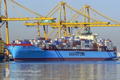
MAERSK KINLOSS
Container Ship
Current Trip
| Time Travelled | 2 days |
|---|---|
| Remaining Time | --- |
| Distance Travelled | 1098.46 nm |
| Remaining Distance | --- |
| AVG Speed | 19 Knots |
| MAX Speed | 21 Knots |
| AVG Wind | 9.9 knots |
| MAX Wind | 19 knots |
| MIN Temp | 17°C / 62.6°F |
| MAX Temp | 20.5°C / 68.9°F |
| Draught | 14.5 m |
| Position Received | 21 h, 11 m ago |
Current Position
| Longitude | -13.90236° |
|---|---|
| Latitude | 27.73262° |
| Status | Under way using engine |
| Speed | 20 Knots |
| Course | 215.5° |
| Area | North Atlantic Ocean |
| Station | T-AIS |
| Position Received | 21 h, 11 m ago |
Info
Information
The current position of MAERSK KINLOSS is in North Atlantic Ocean with coordinates 27.73262° / -13.90236° as reported on 2024-05-29 08:01 by AIS to our vessel tracker app. The vessel's current speed is 20 Knots and is heading at the port of SALALAH. The estimated time of arrival as calculated by vessel tracking app is 2024-06-18 12:00 LT
The vessel MAERSK KINLOSS (IMO: 9333022, MMSI: 338241000) is a Container Ship that was built in 2008 ( 16 years old ). It's sailing under the flag of [US] USA.
In this page you can find informations about the vessels current position, last detected port calls, and current voyage information. If the vessels is not in coverage by AIS you will find the latest position.
The current position of MAERSK KINLOSS is detected by our AIS receivers and we are not responsible for the reliability of the data. The last position was recorded while the vessel was in Coverage by the Ais receivers of our vessel tracking app.
The current draught of MAERSK KINLOSS as reported by AIS is 14.5 meters
Weather
| Temperature | 19.9°C / 67.82°F |
|---|---|
| Wind Speed | 15 knots |
| Direction | 356° N |
| Pressure | 1016.1 hPa |
| Humidity | 82.8 % |
| Cloud Coverage | 19 % |
Featured Company
Last Port Calls
| Port | Arrival | Departure | Time In Port |
|---|---|---|---|
| 2024-05-27 00:39 | 2024-05-27 21:46 | 21 h | |
| 2024-05-17 11:48 | 2024-05-18 11:49 | 1 d | |
| 2024-05-15 08:43 | 2024-05-16 00:55 | 16 h | |
| 2024-05-08 18:57 | 2024-05-11 00:09 | 2 d | |
| 2024-05-04 15:16 | 2024-05-05 13:41 | 22 h | |
| 2024-05-03 03:59 | 2024-05-04 01:30 | 21 h | |
| 2024-04-30 12:30 | 2024-05-01 09:34 | 21 h | |
| 2024-04-21 17:02 | 2024-04-22 14:35 | 21 h | |
| 2024-03-27 15:46 | 2024-03-28 14:03 | 22 h | |
| 2024-03-23 23:41 | 2024-03-24 20:04 | 20 h |
Most Visited Ports (Last year)
| Port | Arrivals | |
|---|---|---|
| 10 | ||
| 9 | ||
| 8 | ||
| 6 | ||
| 5 | ||
| 5 |
Last Trips
| Origin | Departure | Destination | Arrival | Distance | |
|---|---|---|---|---|---|
| 2024-05-18 07:49 | 2024-05-27 02:39 | 3250.35 nm | |||
| 2024-05-15 20:55 | 2024-05-17 07:48 | 306.67 nm | |||
| 2024-05-10 19:09 | 2024-05-15 04:43 | 1718.57 nm | |||
| 2024-05-05 09:41 | 2024-05-08 13:57 | 1345.34 nm | |||
| 2024-05-03 21:30 | 2024-05-04 11:16 | 136.10 nm | |||
| 2024-05-01 05:34 | 2024-05-02 23:59 | 653.01 nm | |||
| 2024-04-22 16:35 | 2024-04-30 08:30 | 3239.33 nm | |||
| 2024-03-28 18:03 | 2024-04-21 19:02 | 9870.61 nm | |||
| 2024-03-25 01:34 | 2024-03-27 19:46 | 1105.39 nm | |||
| 2024-03-23 10:49 | 2024-03-24 05:11 | 252.96 nm |
Events
| Time | Event | Details | Position / Dest | Info |
|---|---|---|---|---|
| 2024-05-29 08:06 | Status Changed | Default Under way using engine |
27.70833 / -13.92167
OM SLL
|
Speed: 20 kn Course: 215.5° |
| 2024-05-29 08:01 | OUT of Coverage |
27.73262 / -13.90236
North Atlantic Ocean
OM SLL
|
Speed: 20 kn Course: 215.5° |
|
| 2024-05-29 08:00 | Status Changed | Under way using engine Default |
27.73810 / -13.89799
OM SLL
|
Speed: 20 kn Course: 215° |
| 2024-05-29 07:42 | Status Changed | Default Under way using engine |
27.81833 / -13.83500
OM SLL
|
Speed: 20.1 kn Course: 214° |
| 2024-05-29 07:29 | Status Changed | Under way using engine Default |
27.88098 / -13.78764
OM SLL
|
Speed: 20 kn Course: 214° |
| 2024-05-29 07:24 | Status Changed | Default Under way using engine |
27.90167 / -13.77167
OM SLL
|
Speed: 20.2 kn Course: 214.5° |
| 2024-05-29 07:21 | Status Changed | Under way using engine Default |
27.91803 / -13.75905
OM SLL
|
Speed: 20.2 kn Course: 214° |
| 2024-05-29 06:54 | Status Changed | Default Under way using engine |
28.04333 / -13.66333
OM SLL
|
Speed: 20.2 kn Course: 214.3° |
| 2024-05-29 04:23 | Status Changed | Under way using engine Default |
28.73202 / -13.11640
OM SLL
|
Speed: 20.1 kn Course: 215° |
| 2024-05-29 04:11 | Status Changed | Default Under way using engine |
28.78699 / -13.07259
OM SLL
|
Speed: 20.3 kn Course: 215.2° |