
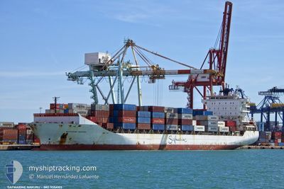
MAERSK NAKURU
Container Ship
Current Trip
Current Position
| Longitude | 25.66673° |
|---|---|
| Latitude | 38.36473° |
| Status | Under way using engine |
| Speed | 18.8 Knots |
| Course | 358.9° |
| Area | Aegean Sea |
| Station | T-AIS |
| Position Received | 5 m ago |
Info
Information
The current position of MAERSK NAKURU is in Aegean Sea with coordinates 38.36473° / 25.66673° as reported on 2024-05-17 04:05 by AIS to our vessel tracker app. The vessel's current speed is 18.8 Knots and is heading at the port of IZMIR. The estimated time of arrival as calculated by vessel tracking app is 2024-05-17 08:23 LT
The vessel MAERSK NAKURU (IMO: 9356103, MMSI: 477552900) is a Container Ship that was built in 2008 ( 16 years old ). It's sailing under the flag of [HK] Hong Kong.
In this page you can find informations about the vessels current position, last detected port calls, and current voyage information. If the vessels is not in coverage by AIS you will find the latest position.
The current position of MAERSK NAKURU is detected by our AIS receivers and we are not responsible for the reliability of the data. The last position was recorded while the vessel was in Coverage by the Ais receivers of our vessel tracking app.
The current draught of MAERSK NAKURU as reported by AIS is 9.3 meters
Weather
| Temperature | 19°C / 66.2°F |
|---|---|
| Wind Speed | 10 knots |
| Direction | 121° ESE |
| Pressure | 1015.3 hPa |
| Humidity | 74 % |
| Cloud Coverage | 100 % |
Featured Company
Last Port Calls
| Port | Arrival | Departure | Time In Port |
|---|---|---|---|
| 2024-05-14 23:42 | |||
| 2024-05-13 03:26 | 2024-05-14 01:23 | 21 h | |
| 2024-05-09 19:05 | 2024-05-11 02:36 | 1 d | |
| 2024-05-06 16:00 | 2024-05-07 05:15 | 13 h | |
| 2024-05-02 19:41 | 2024-05-04 02:41 | 1 d | |
| 2024-04-29 02:52 | 2024-04-29 22:00 | 19 h | |
| 2024-04-25 08:40 | 2024-04-27 03:06 | 1 d | |
| 2024-04-22 08:35 | 2024-04-23 00:21 | 15 h | |
| 2024-04-18 19:52 | 2024-04-20 10:02 | 1 d | |
| 2024-04-16 08:23 | 2024-04-17 03:34 | 19 h |
Last Trips
| Origin | Departure | Destination | Arrival | Distance | |
|---|---|---|---|---|---|
| 2024-05-11 05:36 | 2024-05-15 02:42 | 954.75 nm | |||
| 2024-05-11 05:36 | 2024-05-13 05:26 | 635.94 nm | |||
| 2024-05-04 05:41 | 2024-05-09 22:05 | 1288.76 nm | |||
| 2024-05-04 05:41 | 2024-05-06 18:00 | 644.97 nm | |||
| 2024-04-27 06:06 | 2024-05-02 22:41 | 1306.42 nm | |||
| 2024-04-27 06:06 | 2024-04-29 04:52 | 638.27 nm | |||
| 2024-04-20 13:02 | 2024-04-25 11:40 | 1277.46 nm | |||
| 2024-04-20 13:02 | 2024-04-22 10:35 | 639.90 nm | |||
| 2024-04-14 04:46 | 2024-04-18 22:52 | 1265.95 nm | |||
| 2024-04-14 04:46 | 2024-04-16 10:23 | 636.86 nm |
Events
| Time | Event | Details | Position / Dest | Info |
|---|---|---|---|---|
| 2024-05-17 03:44 | Status Changed | Under way using engine Default |
38.25453 / 25.66980
ILHFA - TRIZM
|
Speed: 19.2 kn Course: 357° |
| 2024-05-17 03:17 | Status Changed | Default Under way using engine |
38.11495 / 25.67730
ILHFA - TRIZM
|
Speed: 19.1 kn Course: 356.4° |
| 2024-05-16 23:09 | Status Changed | Under way using engine Default |
36.97957 / 26.15530
ILHFA - TRIZM
|
Speed: 18.9 kn Course: 318° |
| 2024-05-16 23:00 | Status Changed | Default Under way using engine |
36.94510 / 26.19985
ILHFA - TRIZM
|
Speed: 19 kn Course: 318.6° |
| 2024-05-16 17:53 | Change Sea Area | Greek part of the Aegean Sea Greek part of the Mediterranean Sea - Eastern Basin |
35.80375 / 27.59095
Aegean Sea
ILHFA - TRIZM
|
Speed: 18.7 kn Course: 299.2° |
| 2024-05-16 10:16 | Change Sea Area | Greek part of the Mediterranean Sea - Eastern Basin Turkish part of the Mediterranean Sea - Eastern Basin |
34.68719 / 30.18313
Mediterranean Sea - Eastern Basin
ILHFA - TRIZM
|
Speed: 19.2 kn Course: 297.7° |
| 2024-05-16 09:40 | Change Sea Area | Turkish part of the Mediterranean Sea - Eastern Basin Cypriote part of the Mediterranean Sea - Eastern Basin |
34.59653 / 30.39222
Mediterranean Sea - Eastern Basin
ILHFA - TRIZM
|
Speed: 19.6 kn Course: 297.5° |
| 2024-05-16 07:48 | Status Changed | Under way using engine Default |
34.30680 / 31.04605
ILHFA - TRIZM
|
Speed: 19.6 kn Course: 298° |
| 2024-05-16 07:48 | IN Coverage |
34.30680 / 31.04605
Mediterranean Sea - Eastern Basin
ILHFA - TRIZM
|
Speed: 19.5 kn Course: 297.8° |
|
| 2024-05-16 06:27 | OUT of Coverage |
34.10400 / 31.51942
Mediterranean Sea - Eastern Basin
ILHFA - TRIZM
|
Speed: 19.7 kn Course: 293.6° |