
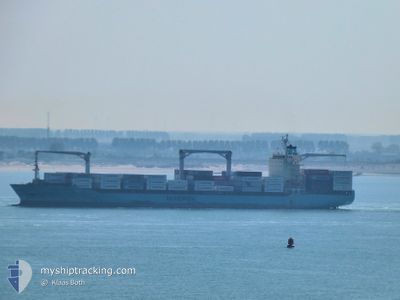
MAERSK NESTON
Container Ship
Current Trip
| Time Travelled | 12 days |
|---|---|
| Remaining Time | --- |
| Distance Travelled | 5343.92 nm |
| Remaining Distance | --- |
| AVG Speed | 17.7 Knots |
| MAX Speed | 20.5 Knots |
| AVG Wind | 10.3 knots |
| MAX Wind | 27 knots |
| MIN Temp | 3.7°C / 38.66°F |
| MAX Temp | 29.5°C / 85.1°F |
| Draught | 10.5 m |
| Position Received | 10 h, 7 m ago |
Current Position
| Longitude | -94.16510° |
|---|---|
| Latitude | 20.01904° |
| Status | Under way using engine |
| Speed | 14.9 Knots |
| Course | 248.7° |
| Area | Gulf of Mexico |
| Station | T-AIS |
| Position Received | 10 h, 7 m ago |
Info
Information
The current position of MAERSK NESTON is in Gulf of Mexico with coordinates 20.01904° / -94.16510° as reported on 2024-05-30 03:09 by AIS to our vessel tracker app. The vessel's current speed is 14.9 Knots
The vessel MAERSK NESTON (IMO: 9215907, MMSI: 563458000) is a Container Ship that was built in 2001 ( 23 years old ). It's sailing under the flag of [SG] Singapore.
In this page you can find informations about the vessels current position, last detected port calls, and current voyage information. If the vessels is not in coverage by AIS you will find the latest position.
The current position of MAERSK NESTON is detected by our AIS receivers and we are not responsible for the reliability of the data. The last position was recorded while the vessel was in Coverage by the Ais receivers of our vessel tracking app.
The current draught of MAERSK NESTON as reported by AIS is 10.5 meters
Weather
| Temperature | 28.8°C / 83.84°F |
|---|---|
| Wind Speed | 10 knots |
| Direction | 135° SE |
| Pressure | 1012 hPa |
| Humidity | 86.4 % |
| Cloud Coverage | 6 % |
Featured Company
Last Port Calls
| Port | Arrival | Departure | Time In Port |
|---|---|---|---|
| 2024-05-16 15:36 | 2024-05-17 23:46 | 1 d | |
| 2024-05-13 18:30 | 2024-05-14 11:30 | 16 h | |
| 2024-05-11 03:28 | 2024-05-12 15:37 | 1 d | |
| 2024-05-09 12:25 | 2024-05-10 05:14 | 16 h | |
| 2024-04-27 23:28 | 2024-04-28 15:03 | 15 h | |
| 2024-04-23 12:43 | 2024-04-26 12:51 | 3 d | |
| 2024-04-20 15:16 | 2024-04-21 23:54 | 1 d | |
| 2024-04-14 13:00 | 2024-04-15 12:47 | 23 h | |
| 2024-03-26 17:54 | 2024-03-27 13:18 | 19 h | |
| 2024-03-25 12:45 | 2024-03-26 09:07 | 20 h |
Most Visited Ports (Last year)
| Port | Arrivals | |
|---|---|---|
| 9 | ||
| 8 | ||
| 8 | ||
| 8 | ||
| 7 | ||
| 7 |
Last Trips
| Origin | Departure | Destination | Arrival | Distance | |
|---|---|---|---|---|---|
| 2024-05-14 13:30 | 2024-05-16 17:36 | 119.15 nm | |||
| 2024-05-12 17:37 | 2024-05-13 20:30 | 418.86 nm | |||
| 2024-05-10 06:14 | 2024-05-11 05:28 | 278.65 nm | |||
| 2024-04-28 10:03 | 2024-05-09 13:25 | 4329.06 nm | |||
| 2024-04-26 07:51 | 2024-04-27 18:28 | 304.37 nm | |||
| 2024-04-21 18:54 | 2024-04-23 07:43 | 259.30 nm | |||
| 2024-04-15 07:47 | 2024-04-20 10:16 | 1297.77 nm | |||
| 2024-03-27 14:18 | 2024-04-14 08:00 | 6406.59 nm | |||
| 2024-03-26 10:07 | 2024-03-26 18:54 | 114.44 nm | |||
| 2024-03-24 11:48 | 2024-03-25 13:45 | 420.86 nm |
Events
| Time | Event | Details | Position / Dest | Info |
|---|---|---|---|---|
| 2024-05-30 03:20 | Status Changed | Default Under way using engine |
20.00334 / -94.20825
MXVER
|
Speed: 14.9 kn Course: 248.7° |
| 2024-05-30 03:09 | OUT of Coverage |
20.01904 / -94.16510
Gulf of Mexico
MXVER
|
Speed: 14.9 kn Course: 248.7° |
|
| 2024-05-30 02:59 | Change Sea Area | Mexican part of the Gulf of Mexico Bahamas part of the North Atlantic Ocean |
20.03484 / -94.12167
Gulf of Mexico
MXVER
|
Speed: 14.8 kn Course: 249.5° |
| 2024-05-30 02:56 | Status Changed | Under way using engine Default |
20.03863 / -94.11107
MXVER
|
Speed: 14.8 kn Course: 248° |
| 2024-05-30 02:41 | IN Coverage |
20.03484 / -94.12167
Gulf of Mexico
MXVER
|
Speed: 14.8 kn Course: 249.5° |
|
| 2024-05-28 03:21 | Status Changed | Default Under way using engine |
24.27349 / -80.25882
MXVER
|
Speed: 17.2 kn Course: 240.1° |
| 2024-05-28 03:18 | OUT of Coverage |
24.28032 / -80.24556
North Atlantic Ocean
MXVER
|
Speed: 17.2 kn Course: 240.1° |
|
| 2024-05-28 03:11 | Status Changed | Under way using engine Default |
24.29734 / -80.21224
MXVER
|
Speed: 17.9 kn Course: 240° |
| 2024-05-28 02:56 | Status Changed | Default Under way using engine |
24.33342 / -80.14111
MXVER
|
Speed: 18.5 kn Course: 241.9° |
| 2024-05-28 02:33 | Status Changed | Under way using engine Default |
24.39100 / -80.02756
MXVER
|
Speed: 18.1 kn Course: 240° |