
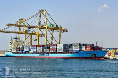
MAERSK NORFOLK
Container Ship
Current Trip
| Time Travelled | 3 days |
|---|---|
| Remaining Time | --- |
| Distance Travelled | 1099.48 nm |
| Remaining Distance | --- |
| AVG Speed | 14.6 Knots |
| MAX Speed | 14.6 Knots |
| AVG Wind | 7.9 knots |
| MAX Wind | 17 knots |
| MIN Temp | 23.3°C / 73.94°F |
| MAX Temp | 31.9°C / 89.42°F |
| Draught | 9.5 m |
| Position Received | 2 h, 10 m ago |
Current Position
| Longitude | 21.68700° |
|---|---|
| Latitude | 35.61540° |
| Status | Under way using engine |
| Speed | 17.9 Knots |
| Course | 296.2° |
| Area | Mediterranean Sea - Eastern Basin |
| Station | T-AIS |
| Position Received | 2 h, 10 m ago |
Info
Information
The current position of MAERSK NORFOLK is in Mediterranean Sea - Eastern Basin with coordinates 35.61540° / 21.68700° as reported on 2024-06-18 09:39 by AIS to our vessel tracker app. The vessel's current speed is 17.9 Knots and is heading at the port of VADO LIGURE. The estimated time of arrival as calculated by vessel tracking app is 2024-06-20 12:00 LT
The vessel MAERSK NORFOLK (IMO: 9356139, MMSI: 219225000) is a Container Ship that was built in 2008 ( 16 years old ). It's sailing under the flag of [DK] Denmark.
In this page you can find informations about the vessels current position, last detected port calls, and current voyage information. If the vessels is not in coverage by AIS you will find the latest position.
The current position of MAERSK NORFOLK is detected by our AIS receivers and we are not responsible for the reliability of the data. The last position was recorded while the vessel was in Coverage by the Ais receivers of our vessel tracking app.
The current draught of MAERSK NORFOLK as reported by AIS is 9.5 meters
Weather
| Temperature | 23.8°C / 74.84°F |
|---|---|
| Wind Speed | 10 knots |
| Direction | 327° NNW |
| Pressure | 1016 hPa |
| Humidity | 83.5 % |
| Cloud Coverage | --- |
Featured Company
Last Port Calls
| Port | Arrival | Departure | Time In Port |
|---|---|---|---|
| 2024-06-14 00:28 | 2024-06-14 16:04 | 15 h | |
| 2024-06-13 09:35 | 2024-06-14 00:23 | 14 h | |
| 2024-06-10 20:53 | 2024-06-11 23:57 | 1 d | |
| 2024-06-03 11:07 | 2024-06-04 14:40 | 1 d | |
| 2024-06-02 09:42 | 2024-06-03 10:55 | 1 d | |
| 2024-05-30 04:24 | 2024-05-31 16:44 | 1 d | |
| 2024-05-25 15:05 | 2024-05-26 11:39 | 20 h | |
| 2024-05-24 10:09 | 2024-05-24 22:26 | 12 h | |
| 2024-05-23 02:29 | 2024-05-23 16:48 | 14 h | |
| 2024-05-22 03:48 | 2024-05-22 11:25 | 7 h |
Last Trips
| Origin | Departure | Destination | Arrival | Distance | |
|---|---|---|---|---|---|
| 2024-06-14 03:23 | 2024-06-14 03:28 | 1.57 nm | |||
| 2024-06-12 01:57 | 2024-06-13 12:35 | 453.38 nm | |||
| 2024-06-04 16:40 | 2024-06-10 22:53 | 1918.43 nm | |||
| 2024-06-03 12:55 | 2024-06-03 13:07 | 1.05 nm | |||
| 2024-05-31 17:44 | 2024-06-02 11:42 | 290.21 nm | |||
| 2024-05-26 13:39 | 2024-05-30 05:24 | 688.93 nm | |||
| 2024-05-25 00:26 | 2024-05-25 17:05 | 162.63 nm | |||
| 2024-05-23 18:48 | 2024-05-24 12:09 | 191.03 nm | |||
| 2024-05-22 13:25 | 2024-05-23 04:29 | 216.56 nm | |||
| 2024-05-14 15:00 | 2024-05-22 05:48 | 2360.78 nm |
Events
| Time | Event | Details | Position / Dest | Info |
|---|---|---|---|---|
| 2024-06-18 09:43 | Status Changed | Default Under way using engine |
35.62472 / 21.66397
ITVDL
|
Speed: 17.9 kn Course: 296.2° |
| 2024-06-18 09:39 | OUT of Coverage |
35.61540 / 21.68700
Mediterranean Sea - Eastern Basin
ITVDL
|
Speed: 17.9 kn Course: 296.2° |
|
| 2024-06-18 09:21 | Status Changed | Under way using engine Default |
35.57618 / 21.78667
ITVDL
|
Speed: 18.1 kn Course: 295° |
| 2024-06-18 09:14 | Status Changed | Default Under way using engine |
35.56083 / 21.82643
ITVDL
|
Speed: 18.1 kn Course: 295.3° |
| 2024-06-18 09:10 | Status Changed | Under way using engine Default |
35.55353 / 21.84542
ITVDL
|
Speed: 18 kn Course: 295° |
| 2024-06-18 09:07 | Status Changed | Default Under way using engine |
35.54621 / 21.86443
ITVDL
|
Speed: 18 kn Course: 294.9° |
| 2024-06-18 08:57 | Status Changed | Under way using engine Default |
35.52458 / 21.92118
ITVDL
|
Speed: 17.9 kn Course: 296° |
| 2024-06-18 08:42 | Status Changed | Default Under way using engine |
35.49060 / 22.00447
ITVDL
|
Speed: 18 kn Course: 295.8° |
| 2024-06-18 07:49 | Status Changed | Under way using engine Default |
35.37517 / 22.29213
ITVDL
|
Speed: 18 kn Course: 295° |
| 2024-06-18 07:44 | Status Changed | Default Under way using engine |
35.36463 / 22.31855
ITVDL
|
Speed: 18 kn Course: 293.8° |