
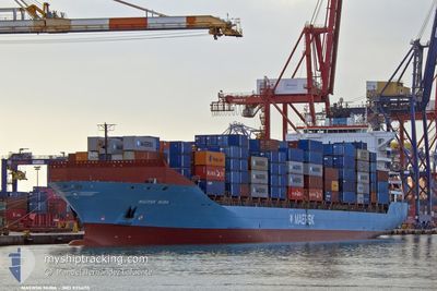
MAERSK NUBA
Container Ship
Current Trip
| Trip Time | 5 days |
|---|---|
| Trip Distance | 1344.79 nm |
| AVG Speed | 12 Knots |
| MAX Speed | 18.9 Knots |
| Draught | 10.6 m |
| AVG Wind | 7.7 knots |
| MAX Wind | 19.9 knots |
| MIN Temp | 13.9°C / 57.02°F |
| MAX Temp | 26.6°C / 79.88°F |
| Position Received | 16 h, 33 m ago |
Current Position
| Longitude | 29.69499° |
|---|---|
| Latitude | 31.34651° |
| Status | Under way using engine |
| Speed | 1 Knots |
| Course | 185° |
| Area | Mediterranean Sea - Eastern Basin |
| Station | T-AIS |
| Position Received | 16 h, 33 m ago |
Info
Information
The current position of MAERSK NUBA is in Mediterranean Sea - Eastern Basin with coordinates 31.34651° / 29.69499° as reported on 2024-06-01 20:54 by AIS to our vessel tracker app. The vessel's current speed is 1 Knots and is currently inside the port of ALEXANDRIA.
The vessel MAERSK NUBA (IMO: 9356115, MMSI: 477552100) is a Container Ship that was built in 2008 ( 16 years old ). It's sailing under the flag of [HK] Hong Kong.
In this page you can find informations about the vessels current position, last detected port calls, and current voyage information. If the vessels is not in coverage by AIS you will find the latest position.
The current position of MAERSK NUBA is detected by our AIS receivers and we are not responsible for the reliability of the data. The last position was recorded while the vessel was in Coverage by the Ais receivers of our vessel tracking app.
The current draught of MAERSK NUBA as reported by AIS is 10.6 meters
Weather
| Temperature | 24.4°C / 75.92°F |
|---|---|
| Wind Speed | 14 knots |
| Direction | 34° NE |
| Pressure | 1012.9 hPa |
| Humidity | 73 % |
| Cloud Coverage | --- |
Featured Company
Last Port Calls
| Port | Arrival | Departure | Time In Port |
|---|---|---|---|
| 2024-06-02 00:33 | |||
| 2024-05-27 04:15 | 2024-05-27 19:08 | 14 h | |
| 2024-05-25 03:28 | 2024-05-25 16:35 | 13 h | |
| 2024-05-22 14:31 | 2024-05-23 23:07 | 1 d | |
| 2024-05-19 05:34 | 2024-05-19 19:03 | 13 h | |
| 2024-05-14 03:41 | 2024-05-15 02:39 | 22 h | |
| 2024-05-10 02:52 | 2024-05-11 22:36 | 1 d | |
| 2024-05-07 05:54 | 2024-05-07 22:51 | 16 h | |
| 2024-05-05 10:46 | 2024-05-06 09:40 | 22 h | |
| 2024-04-30 20:38 | 2024-05-02 11:30 | 1 d |
Last Trips
| Origin | Departure | Destination | Arrival | Distance | |
|---|---|---|---|---|---|
| 2024-05-27 21:08 | 2024-06-02 02:33 | 1344.79 nm | |||
| 2024-05-25 18:35 | 2024-05-27 06:15 | 372.12 nm | |||
| 2024-05-24 01:07 | 2024-05-25 05:28 | 175.27 nm | |||
| 2024-05-19 21:03 | 2024-05-22 16:31 | 551.56 nm | |||
| 2024-05-15 05:39 | 2024-05-19 07:34 | 1669.89 nm | |||
| 2024-05-12 01:36 | 2024-05-14 06:41 | 639.76 nm | |||
| 2024-05-08 01:51 | 2024-05-10 05:52 | 200.17 nm | |||
| 2024-05-06 11:40 | 2024-05-07 08:54 | 347.56 nm | |||
| 2024-05-02 13:30 | 2024-05-05 12:46 | 1331.49 nm | |||
| 2024-04-30 00:07 | 2024-04-30 22:38 | 372.41 nm |
Events
| Time | Event | Details | Position / Dest | Info |
|---|---|---|---|---|
| 2024-06-02 01:15 | STOP Moving |
31.16968 / 29.86028
[EG] ALEXANDRIA
|
Speed: Course: 35° |
|
| 2024-06-02 00:33 | PORT ARRIVAL |
|
31.16715 / 29.85003
[EG] ALEXANDRIA
|
Speed: 5.3 kn Course: 58° |
| 2024-06-01 22:23 | START Moving | 12.76 nm, North West of ALEXANDRIA |
31.34425 / 29.70206
IT GOA>EG ALY
|
Speed: 8.4 kn Course: 162° |
| 2024-06-01 20:55 | Status Changed | Default Under way using engine |
31.34667 / 29.69500
IT GOA>EG ALY
|
Speed: 1 kn Course: 185° |
| 2024-06-01 20:54 | OUT of Coverage |
31.34651 / 29.69499
Mediterranean Sea - Eastern Basin
|
Speed: 1 kn Course: 344.6° |
|
| 2024-06-01 20:38 | Status Changed | Under way using engine Default |
31.34231 / 29.69662
IT GOA>EG ALY
|
Speed: 0.9 kn Course: 178° |
| 2024-06-01 19:53 | Status Changed | Default Under way using engine |
31.33192 / 29.70330
IT GOA>EG ALY
|
Speed: 0.7 kn Course: 172° |
| 2024-06-01 19:47 | Status Changed | Under way using engine Default |
31.33073 / 29.70404
IT GOA>EG ALY
|
Speed: 0.6 kn Course: 151° |
| 2024-06-01 19:36 | IN Coverage |
31.33073 / 29.70404
Mediterranean Sea - Eastern Basin
|
Speed: 0.7 kn Course: 334.8° |
|
| 2024-06-01 19:08 | STOP Moving | 11.79 nm, North West of ALEXANDRIA |
31.32546 / 29.70592
IT GOA>EG ALY
|
Speed: 0.3 kn Course: 138° |