
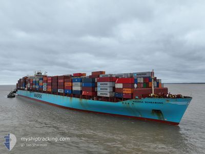
MAERSK SEMBAWANG
Container Ship
Current Trip
| Time Travelled | 18 h, 52 mins |
|---|---|
| Remaining Time | --- |
| Distance Travelled | 360.83 nm |
| Remaining Distance | --- |
| AVG Speed | 20.7 Knots |
| MAX Speed | 21.8 Knots |
| AVG Wind | 5.5 knots |
| MAX Wind | 9.5 knots |
| MIN Temp | 17.5°C / 63.5°F |
| MAX Temp | 26.2°C / 79.16°F |
| Draught | 13.9 m |
| Position Received | 1 h, 24 m ago |
Current Position
| Longitude | 20.75315° |
|---|---|
| Latitude | 36.30598° |
| Status | Under way using engine |
| Speed | 21.2 Knots |
| Course | 270.6° |
| Area | Mediterranean Sea - Eastern Basin |
| Station | T-AIS |
| Position Received | 1 h, 24 m ago |
Info
Information
The current position of MAERSK SEMBAWANG is in Mediterranean Sea - Eastern Basin with coordinates 36.30598° / 20.75315° as reported on 2024-05-18 03:29 by AIS to our vessel tracker app. The vessel's current speed is 21.2 Knots and is heading at the port of FLIXBOROUGH. The estimated time of arrival as calculated by vessel tracking app is 2024-05-23 15:00 LT
The vessel MAERSK SEMBAWANG (IMO: 9315226, MMSI: 565448000) is a Container Ship that was built in 2007 ( 17 years old ). It's sailing under the flag of [SG] Singapore.
In this page you can find informations about the vessels current position, last detected port calls, and current voyage information. If the vessels is not in coverage by AIS you will find the latest position.
The current position of MAERSK SEMBAWANG is detected by our AIS receivers and we are not responsible for the reliability of the data. The last position was recorded while the vessel was in Coverage by the Ais receivers of our vessel tracking app.
The current draught of MAERSK SEMBAWANG as reported by AIS is 13.9 meters
Weather
| Temperature | 20.5°C / 68.9°F |
|---|---|
| Wind Speed | 6 knots |
| Direction | 142° SE |
| Pressure | 1014.5 hPa |
| Humidity | 82.4 % |
| Cloud Coverage | 100 % |
Featured Company
Last Port Calls
| Port | Arrival | Departure | Time In Port |
|---|---|---|---|
| 2024-05-15 14:12 | 2024-05-17 10:01 | 1 d | |
| 2024-05-13 13:34 | 2024-05-14 18:15 | 1 d | |
| 2024-05-12 01:28 | 2024-05-13 08:54 | 1 d | |
| 2024-05-08 21:13 | 2024-05-11 14:35 | 2 d | |
| 2024-05-04 05:54 | 2024-05-07 06:20 | 3 d | |
| 2024-04-25 11:31 | 2024-04-26 13:08 | 1 d | |
| 2024-04-22 15:51 | 2024-04-23 19:24 | 1 d | |
| 2024-04-20 14:31 | 2024-04-21 20:57 | 1 d | |
| 2024-04-17 22:32 | 2024-04-19 12:42 | 1 d | |
| 2024-04-07 20:20 | 2024-04-09 10:04 | 1 d |
Most Visited Ports (Last year)
| Port | Arrivals | |
|---|---|---|
| 9 | ||
| 7 | ||
| 7 | ||
| 6 | ||
| 6 | ||
| 6 |
Last Trips
| Origin | Departure | Destination | Arrival | Distance | |
|---|---|---|---|---|---|
| 2024-05-14 21:15 | 2024-05-15 17:12 | 288.62 nm | |||
| 2024-05-13 11:54 | 2024-05-13 16:34 | 48.69 nm | |||
| 2024-05-11 17:35 | 2024-05-12 04:28 | 55.08 nm | |||
| 2024-05-07 09:20 | 2024-05-09 00:13 | 403.52 nm | |||
| 2024-04-26 15:08 | 2024-05-04 08:54 | 2978.95 nm | |||
| 2024-04-23 21:24 | 2024-04-25 13:31 | 480.97 nm | |||
| 2024-04-21 22:57 | 2024-04-22 17:51 | 183.18 nm | |||
| 2024-04-19 13:42 | 2024-04-20 16:31 | 404.29 nm | |||
| 2024-04-09 13:04 | 2024-04-17 23:32 | 3045.07 nm | |||
| 2024-04-06 15:36 | 2024-04-07 23:20 | 291.79 nm |
Events
| Time | Event | Details | Position / Dest | Info |
|---|---|---|---|---|
| 2024-05-18 03:35 | Status Changed | Default Under way using engine |
36.30623 / 20.71519
TRIZM>GBFLX
|
Speed: 21.2 kn Course: 270.6° |
| 2024-05-18 03:29 | OUT of Coverage |
36.30598 / 20.75315
Mediterranean Sea - Eastern Basin
TRIZM>GBFLX
|
Speed: 21.2 kn Course: 270.6° |
|
| 2024-05-18 03:24 | Status Changed | Under way using engine Default |
36.30563 / 20.79829
TRIZM>GBFLX
|
Speed: 21.2 kn Course: 270° |
| 2024-05-18 03:09 | IN Coverage |
36.30573 / 20.78085
Mediterranean Sea - Eastern Basin
TRIZM>GBFLX
|
Speed: 21.1 kn Course: 270.5° |
|
| 2024-05-17 23:34 | Status Changed | Default Under way using engine |
36.28782 / 22.45947
TRIZM>GBFLX
|
Speed: 21.4 kn Course: 251.6° |
| 2024-05-17 23:25 | OUT of Coverage |
36.29471 / 22.52482
Mediterranean Sea - Eastern Basin
TRIZM>GBFLX
|
Speed: 21.4 kn Course: 251.6° |
|
| 2024-05-17 23:02 | Status Changed | Under way using engine Default |
36.36493 / 22.66884
TRIZM>GBFLX
|
Speed: 20.9 kn Course: 239° |
| 2024-05-17 22:42 | Status Changed | Default Under way using engine |
36.40842 / 22.80080
TRIZM>GBFLX
|
Speed: 21.2 kn Course: 257.6° |
| 2024-05-17 22:39 | Change Sea Area | Greek part of the Mediterranean Sea - Eastern Basin Greek part of the Aegean Sea |
36.41253 / 22.82062
Mediterranean Sea - Eastern Basin
TRIZM>GBFLX
|
Speed: 21.2 kn Course: 257.6° |
| 2024-05-17 22:39 | Status Changed | Under way using engine Default |
36.41253 / 22.82062
TRIZM>GBFLX
|
Speed: 21.2 kn Course: 262° |