
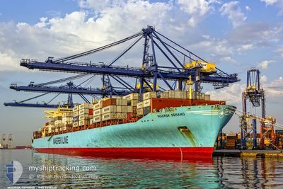
MAERSK SENANG
Container Ship
Current Trip
| Time Travelled | 22 h, 26 mins |
|---|---|
| Remaining Time | 8 h, 39 mins |
| Distance Travelled | 226.07 nm |
| Remaining Distance | 144.92 nm |
| AVG Speed | 11 Knots |
| MAX Speed | 13.5 Knots |
| AVG Wind | 9.8 knots |
| MAX Wind | 17.2 knots |
| MIN Temp | 19.3°C / 66.74°F |
| MAX Temp | 20.4°C / 68.72°F |
| Draught | 12.9 m |
| Position Received | 11 h, 53 m ago |
Current Position
| Longitude | -0.51261° |
|---|---|
| Latitude | 37.62324° |
| Status | Under way using engine |
| Speed | 11.9 Knots |
| Course | 214° |
| Area | Mediterranean Sea - Western Basin |
| Station | T-AIS |
| Position Received | 11 h, 53 m ago |
Info
Information
The current position of MAERSK SENANG is in Mediterranean Sea - Western Basin with coordinates 37.62324° / -0.51261° as reported on 2024-05-28 17:40 by AIS to our vessel tracker app. The vessel's current speed is 11.9 Knots and is heading at the port of ALGECIRAS. The estimated time of arrival as calculated by vessel tracking app is 2024-05-29 14:12 LT
The vessel MAERSK SENANG (IMO: 9315240, MMSI: 565482000) is a Container Ship that was built in 2007 ( 17 years old ). It's sailing under the flag of [SG] Singapore.
In this page you can find informations about the vessels current position, last detected port calls, and current voyage information. If the vessels is not in coverage by AIS you will find the latest position.
The current position of MAERSK SENANG is detected by our AIS receivers and we are not responsible for the reliability of the data. The last position was recorded while the vessel was in Coverage by the Ais receivers of our vessel tracking app.
The current draught of MAERSK SENANG as reported by AIS is 12.9 meters
Weather
| Temperature | 18.9°C / 66.02°F |
|---|---|
| Wind Speed | 8 knots |
| Direction | 99° E |
| Pressure | 1017.3 hPa |
| Humidity | 88.5 % |
| Cloud Coverage | --- |
Featured Company
Last Port Calls
| Port | Arrival | Departure | Time In Port |
|---|---|---|---|
| 2024-05-27 01:32 | 2024-05-28 07:07 | 1 d | |
| 2024-05-24 08:17 | 2024-05-25 07:26 | 23 h | |
| 2024-05-20 20:37 | 2024-05-22 23:03 | 2 d | |
| 2024-05-17 03:56 | 2024-05-18 02:16 | 22 h | |
| 2024-05-14 22:56 | 2024-05-15 12:18 | 13 h | |
| 2024-05-10 05:02 | 2024-05-10 22:31 | 17 h | |
| 2024-04-28 16:47 | 2024-04-29 15:39 | 22 h | |
| 2024-04-25 18:14 | 2024-04-26 20:50 | 1 d | |
| 2024-04-21 17:30 | 2024-04-23 11:54 | 1 d | |
| 2024-04-17 17:35 | 2024-04-18 13:47 | 20 h |
Last Trips
| Origin | Departure | Destination | Arrival | Distance | |
|---|---|---|---|---|---|
| 2024-05-25 09:26 | 2024-05-27 03:32 | 185.96 nm | |||
| 2024-05-23 01:03 | 2024-05-24 10:17 | 399.62 nm | |||
| 2024-05-18 04:16 | 2024-05-20 22:37 | 479.36 nm | |||
| 2024-05-15 14:18 | 2024-05-17 05:56 | 684.54 nm | |||
| 2024-05-11 00:31 | 2024-05-15 00:56 | 575.25 nm | |||
| 2024-04-29 11:39 | 2024-05-10 07:02 | 3876.88 nm | |||
| 2024-04-26 15:50 | 2024-04-28 12:47 | 756.60 nm | |||
| 2024-04-23 06:54 | 2024-04-25 13:14 | 460.32 nm | |||
| 2024-04-18 08:47 | 2024-04-21 12:30 | 499.22 nm | |||
| 2024-04-13 08:37 | 2024-04-17 12:35 | 1305.59 nm |
Events
| Time | Event | Details | Position / Dest | Info |
|---|---|---|---|---|
| 2024-05-28 17:40 | Status Changed | Default Under way using engine |
37.62275 / -.51304
ESVLC>>ESALG
|
Speed: 11.9 kn Course: 214° |
| 2024-05-28 17:40 | Status Changed | Under way using engine Default |
37.62324 / -.51261
ESVLC>>ESALG
|
Speed: 12.9 kn Course: 214° |
| 2024-05-28 17:40 | OUT of Coverage |
37.62324 / -.51261
Mediterranean Sea - Western Basin
ESVLC>>ESALG
|
Speed: 11.9 kn Course: 214° |
|
| 2024-05-28 17:29 | Status Changed | Default Under way using engine |
37.65441 / -.48612
ESVLC>>ESALG
|
Speed: 11.9 kn Course: 214° |
| 2024-05-28 17:13 | Change Sea Area | Spanish part of the Mediterranean Sea - Western Basin Spanish part of the Balearic Sea |
37.70237 / -.44540
Mediterranean Sea - Western Basin
ESVLC>>ESALG
|
Speed: 11.9 kn Course: 214° |
| 2024-05-28 17:13 | Status Changed | Under way using engine Default |
37.70237 / -.44540
ESVLC>>ESALG
|
Speed: 12.9 kn Course: 214° |
| 2024-05-28 17:13 | IN Coverage |
37.70237 / -.44540
Mediterranean Sea - Western Basin
ESVLC>>ESALG
|
Speed: 11.9 kn Course: 214° |
|
| 2024-05-28 09:16 | OUT of Coverage |
39.14445 / .02808
Balearic Sea
ESVLC>>ESALG
|
Speed: 12.7 kn Course: 145° |
|
| 2024-05-28 07:07 | PORT DEPARTURE |
|
39.43050 / -.30260
ESVLC>>ESALG
|
Speed: 5 kn Course: 130° |
| 2024-05-28 06:50 | START Moving |
39.43612 / -.32368
[ES] VALENCIA
|
Speed: 3.1 kn Course: 96° |