
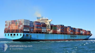
MAERSK SEOUL
Container Ship
Current Trip
| Time Travelled | 15 days |
|---|---|
| Remaining Time | 8 days |
| Distance Travelled | 6921.40 nm |
| Remaining Distance | 4275.85 nm |
| AVG Speed | 19.4 Knots |
| MAX Speed | 22.5 Knots |
| AVG Wind | 14.1 knots |
| MAX Wind | 27.9 knots |
| MIN Temp | 14.6°C / 58.28°F |
| MAX Temp | 30.9°C / 87.62°F |
| Draught | 13.1 m |
| Position Received | 5 d ago |
Current Position
| Longitude | 18.40188° |
|---|---|
| Latitude | -34.73971° |
| Status | Under way using engine |
| Speed | 19.4 Knots |
| Course | 301.7° |
| Area | South Atlantic Ocean |
| Station | T-AIS |
| Position Received | 5 d ago |
Info
Information
The current position of MAERSK SEOUL is in South Atlantic Ocean with coordinates -34.73971° / 18.40188° as reported on 2024-06-01 00:29 by AIS to our vessel tracker app. The vessel's current speed is 19.4 Knots and is heading at the port of NEW YORK. The estimated time of arrival as calculated by vessel tracking app is 2024-06-15 14:12 LT
The vessel MAERSK SEOUL (IMO: 9306550, MMSI: 563032900) is a Container Ship that was built in 2006 ( 18 years old ). It's sailing under the flag of [SG] Singapore.
In this page you can find informations about the vessels current position, last detected port calls, and current voyage information. If the vessels is not in coverage by AIS you will find the latest position.
The current position of MAERSK SEOUL is detected by our AIS receivers and we are not responsible for the reliability of the data. The last position was recorded while the vessel was in Coverage by the Ais receivers of our vessel tracking app.
The current draught of MAERSK SEOUL as reported by AIS is 13.1 meters
Weather
| Temperature | 26.8°C / 80.24°F |
|---|---|
| Wind Speed | 16 knots |
| Direction | 106° ESE |
| Pressure | 1016.3 hPa |
| Humidity | 76.1 % |
| Cloud Coverage | 11 % |
Featured Company
Last Port Calls
| Port | Arrival | Departure | Time In Port |
|---|---|---|---|
| 2024-05-22 03:13 | 2024-05-22 14:16 | 11 h | |
| 2024-05-17 16:08 | 2024-05-18 06:28 | 14 h | |
| 2024-05-13 03:12 | 2024-05-13 22:46 | 19 h | |
| 2024-05-10 10:38 | 2024-05-11 13:28 | 1 d | |
| 2024-05-02 17:49 | 2024-05-05 06:28 | 2 d | |
| 2024-04-28 04:36 | 2024-04-29 01:43 | 21 h |
Most Visited Ports (Last year)
| Port | Arrivals | |
|---|---|---|
| 9 | ||
| 7 | ||
| 4 | ||
| 4 | ||
| 3 | ||
| 3 |
Last Trips
| Origin | Departure | Destination | Arrival | Distance | |
|---|---|---|---|---|---|
| 2024-05-18 11:58 | 2024-05-22 07:13 | 1635.25 nm | |||
| 2024-05-14 06:46 | 2024-05-17 21:38 | 1606.80 nm | |||
| 2024-05-11 21:28 | 2024-05-13 11:12 | 28.51 nm | |||
| 2024-05-05 13:28 | 2024-05-10 18:38 | 969.56 nm | |||
| 2024-04-29 09:43 | 2024-05-03 00:49 | 850.71 nm | |||
| 2024-03-30 20:45 | 2024-04-28 12:36 | 12489.15 nm |
Events
| Time | Event | Details | Position / Dest | Info |
|---|---|---|---|---|
| 2024-06-01 00:36 | Status Changed | Default Under way using engine |
-34.71919 / 18.36306
USNWK
|
Speed: 19.4 kn Course: 301.7° |
| 2024-06-01 00:29 | OUT of Coverage |
-34.73971 / 18.40188
South Atlantic Ocean
USNWK
|
Speed: 19.4 kn Course: 301.7° |
|
| 2024-06-01 00:27 | Status Changed | Under way using engine Default |
-34.74724 / 18.41603
USNWK
|
Speed: 19.5 kn Course: 303° |
| 2024-06-01 00:23 | Status Changed | Default Under way using engine |
-34.75838 / 18.43701
USNWK
|
Speed: 19.4 kn Course: 296.7° |
| 2024-06-01 00:13 | Status Changed | Under way using engine Default |
-34.78430 / 18.49672
USNWK
|
Speed: 19.1 kn Course: 298° |
| 2024-06-01 00:04 | IN Coverage |
-34.78430 / 18.49672
South Atlantic Ocean
USNWK
|
Speed: 19.1 kn Course: 297.5° |
|
| 2024-05-31 23:04 | Status Changed | Default Under way using engine |
-34.95908 / 18.88569
USNWK
|
Speed: 19.5 kn Course: 307.3° |
| 2024-05-31 22:58 | OUT of Coverage |
-34.98054 / 18.92138
South Atlantic Ocean
USNWK
|
Speed: 19.5 kn Course: 307.3° |
|
| 2024-05-31 22:53 | Change Sea Area | South African part of the South Atlantic Ocean South African part of the Indian Ocean |
-34.99512 / 18.94663
South Atlantic Ocean
USNWK
|
Speed: 19.7 kn Course: 298.9° |
| 2024-05-31 22:53 | Status Changed | Under way using engine Default |
-34.99512 / 18.94663
USNWK
|
Speed: 19.6 kn Course: 281° |