
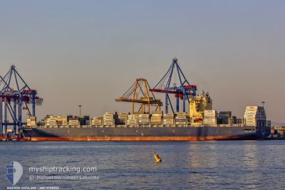
MAERSK SHIVLING
Cargo A
Current Trip
| Time Travelled | 7 days |
|---|---|
| Remaining Time | 3 days |
| Distance Travelled | 3647.47 nm |
| Remaining Distance | 1988.99 nm |
| AVG Speed | 18.8 Knots |
| MAX Speed | 20.6 Knots |
| AVG Wind | 17.3 knots |
| MAX Wind | 27 knots |
| MIN Temp | 4.2°C / 39.56°F |
| MAX Temp | 17.9°C / 64.22°F |
| Draught | 13.2 m |
| Position Received | 6 d ago |
Current Position
| Longitude | 142.03674° |
|---|---|
| Latitude | 41.65266° |
| Status | Under way using engine |
| Speed | 18.4 Knots |
| Course | 91.2° |
| Area | North Pacific Ocean |
| Station | T-AIS |
| Position Received | 6 d ago |
Info
Information
The current position of MAERSK SHIVLING is in North Pacific Ocean with coordinates 41.65266° / 142.03674° as reported on 2024-05-11 01:04 by AIS to our vessel tracker app. The vessel's current speed is 18.4 Knots and is heading at the port of LOS ANGELES. The estimated time of arrival as calculated by vessel tracking app is 2024-05-21 01:30 LT
The vessel MAERSK SHIVLING (IMO: 9728253, MMSI: 636017104) is a Cargo A It's sailing under the flag of [LR] Liberia.
In this page you can find informations about the vessels current position, last detected port calls, and current voyage information. If the vessels is not in coverage by AIS you will find the latest position.
The current position of MAERSK SHIVLING is detected by our AIS receivers and we are not responsible for the reliability of the data. The last position was recorded while the vessel was in Coverage by the Ais receivers of our vessel tracking app.
The current draught of MAERSK SHIVLING as reported by AIS is 13.2 meters
Weather
| Temperature | 9.3°C / 48.74°F |
|---|---|
| Wind Speed | 4 knots |
| Direction | 335° NNW |
| Pressure | 1029.8 hPa |
| Humidity | 88.8 % |
| Cloud Coverage | 96 % |
Featured Company
Last Port Calls
| Port | Arrival | Departure | Time In Port |
|---|---|---|---|
| 2024-05-08 00:38 | 2024-05-09 07:06 | 1 d | |
| 2024-05-01 16:51 | 2024-05-02 15:20 | 22 h | |
| 2024-04-25 02:08 | 2024-04-26 02:04 | 23 h | |
| 2024-04-09 14:14 | 2024-04-10 13:45 | 23 h | |
| 2024-04-04 14:38 | 2024-04-07 12:52 | 2 d | |
| 2024-03-31 00:45 | 2024-04-03 12:52 | 3 d | |
| 2024-03-10 14:34 | 2024-03-11 09:07 | 18 h | |
| 2024-03-08 02:23 | 2024-03-08 16:24 | 14 h |
Most Visited Ports (Last year)
| Port | Arrivals | |
|---|---|---|
| 7 | ||
| 6 | ||
| 6 | ||
| 5 | ||
| 5 | ||
| 1 |
Last Trips
| Origin | Departure | Destination | Arrival | Distance | |
|---|---|---|---|---|---|
| 2024-05-02 23:20 | 2024-05-08 09:38 | 677.16 nm | |||
| 2024-04-26 10:04 | 2024-05-02 00:51 | 510.46 nm | |||
| 2024-04-10 06:45 | 2024-04-25 10:08 | 5209.07 nm | |||
| 2024-04-07 05:52 | 2024-04-09 07:14 | 863.32 nm | |||
| 2024-04-03 05:52 | 2024-04-04 07:38 | 392.68 nm | |||
| 2024-03-11 17:07 | 2024-03-30 17:45 | 6348.95 nm | |||
| 2024-03-09 00:24 | 2024-03-10 22:34 | 430.25 nm | |||
| 2024-02-21 01:21 | 2024-03-08 10:23 | 6149.53 nm |
Events
| Time | Event | Details | Position / Dest | Info |
|---|---|---|---|---|
| 2024-05-11 01:08 | Status Changed | Default Under way using engine |
41.65242 / 142.07086
USLGB
|
Speed: 18.4 kn Course: 91.2° |
| 2024-05-11 01:04 | OUT of Coverage |
41.65266 / 142.03674
North Pacific Ocean
USLGB
|
Speed: 18.4 kn Course: 91.2° |
|
| 2024-05-11 00:59 | Status Changed | Under way using engine Default |
41.65301 / 142.00525
USLGB
|
Speed: 18.4 kn Course: 91° |
| 2024-05-11 00:44 | Status Changed | Default Under way using engine |
41.65389 / 141.90555
USLGB
|
Speed: 18.4 kn Course: 90.2° |
| 2024-05-10 23:17 | Change Sea Area | Japanese part of the North Pacific Ocean Japanese part of the Japan Sea |
41.63202 / 141.29441
North Pacific Ocean
USLGB
|
Speed: 17.5 kn Course: 85.9° |
| 2024-05-10 22:25 | Status Changed | Under way using engine Default |
41.62841 / 140.94604
USLGB
|
Speed: 18.3 kn Course: 89° |
| 2024-05-10 22:20 | Status Changed | Default Under way using engine |
41.62824 / 140.91363
USLGB
|
Speed: 18.3 kn Course: 74.3° |
| 2024-05-10 22:08 | Status Changed | Under way using engine Default |
41.60800 / 140.84094
USLGB
|
Speed: 18.4 kn Course: 47° |
| 2024-05-10 22:04 | Status Changed | Default Under way using engine |
41.59529 / 140.82071
USLGB
|
Speed: 18.5 kn Course: 50.5° |
| 2024-05-10 20:49 | Status Changed | Under way using engine Default |
41.36896 / 140.37587
USLGB
|
Speed: 18.1 kn Course: 57° |