
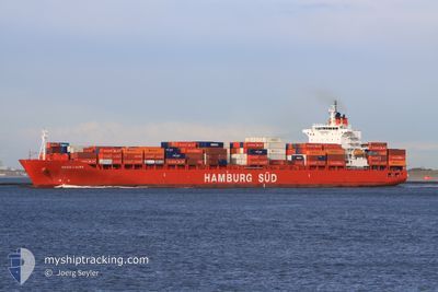
MAERSK WELLINGTON
Container Ship
Current Trip
NZPOE
| Time Travelled | 1 day |
|---|---|
| Remaining Time | --- |
| Distance Travelled | 558.53 nm |
| Remaining Distance | --- |
| AVG Speed | 18.7 Knots |
| MAX Speed | 20.1 Knots |
| AVG Wind | 18 knots |
| MAX Wind | 24 knots |
| MIN Temp | 9°C / 48.2°F |
| MAX Temp | 13.2°C / 55.76°F |
| Draught | 8.2 m |
| Position Received | 12 h, 27 m ago |
Current Position
| Longitude | 175.67152° |
|---|---|
| Latitude | -41.94979° |
| Status | Under way using engine |
| Speed | 19.4 Knots |
| Course | 40.7° |
| Area | South Pacific Ocean |
| Station | T-AIS |
| Position Received | 12 h, 27 m ago |
Info
Information
The current position of MAERSK WELLINGTON is in South Pacific Ocean with coordinates -41.94979° / 175.67152° as reported on 2024-06-20 02:33 by AIS to our vessel tracker app. The vessel's current speed is 19.4 Knots
The vessel MAERSK WELLINGTON (IMO: 9391660, MMSI: 563148300) is a Container Ship that was built in 2007 ( 17 years old ). It's sailing under the flag of [SG] Singapore.
In this page you can find informations about the vessels current position, last detected port calls, and current voyage information. If the vessels is not in coverage by AIS you will find the latest position.
The current position of MAERSK WELLINGTON is detected by our AIS receivers and we are not responsible for the reliability of the data. The last position was recorded while the vessel was in Coverage by the Ais receivers of our vessel tracking app.
The current draught of MAERSK WELLINGTON as reported by AIS is 8.2 meters
Weather
| Temperature | 13.2°C / 55.76°F |
|---|---|
| Wind Speed | 10 knots |
| Direction | 130° SE |
| Pressure | 1022.6 hPa |
| Humidity | 65.3 % |
| Cloud Coverage | 98 % |
Featured Company
Last Port Calls
| Port | Arrival | Departure | Time In Port |
|---|---|---|---|
| 2024-06-17 09:11 | 2024-06-19 09:12 | 2 d | |
| 2024-06-06 15:40 | 2024-06-08 06:54 | 1 d | |
| 2024-06-04 02:37 | 2024-06-05 08:19 | 1 d | |
| 2024-05-30 05:29 | 2024-05-30 20:40 | 15 h | |
| 2024-05-11 02:18 | 2024-05-13 14:18 | 2 d | |
| 2024-04-23 20:58 | 2024-04-24 21:50 | 1 d | |
| 2024-04-19 17:43 | 2024-04-21 19:27 | 2 d | |
| 2024-04-14 11:35 | 2024-04-15 21:58 | 1 d | |
| 2024-04-11 04:26 | 2024-04-12 03:11 | 22 h | |
| 2024-04-03 22:52 | 2024-04-04 14:57 | 16 h |
Most Visited Ports (Last year)
| Port | Arrivals | |
|---|---|---|
| 11 | ||
| 6 | ||
| 6 | ||
| 5 | ||
| 4 | ||
| 4 |
Last Trips
| Origin | Departure | Destination | Arrival | Distance | |
|---|---|---|---|---|---|
| 2024-06-08 16:54 | 2024-06-17 21:11 | 2007.66 nm | |||
| 2024-06-05 18:19 | 2024-06-07 01:40 | 574.86 nm | |||
| 2024-05-31 08:40 | 2024-06-04 12:37 | 1367.86 nm | |||
| 2024-05-13 09:18 | 2024-05-30 17:29 | 6729.77 nm | |||
| 2024-04-25 09:50 | 2024-05-10 21:18 | 6496.52 nm | |||
| 2024-04-22 07:27 | 2024-04-24 08:58 | 759.44 nm | |||
| 2024-04-16 07:58 | 2024-04-20 05:43 | 1362.65 nm | |||
| 2024-04-12 13:11 | 2024-04-14 21:35 | 600.42 nm | |||
| 2024-04-05 03:57 | 2024-04-11 14:26 | 1596.49 nm | |||
| 2024-03-19 19:49 | 2024-04-04 11:52 | 6606.80 nm |
Events
| Time | Event | Details | Position / Dest | Info |
|---|---|---|---|---|
| 2024-06-20 02:39 | Status Changed | Default Under way using engine |
-41.92471 / 175.70123
NZPOE
|
Speed: 19.4 kn Course: 40.7° |
| 2024-06-20 02:33 | OUT of Coverage |
-41.94979 / 175.67152
South Pacific Ocean
|
Speed: 19.4 kn Course: 40.7° |
|
| 2024-06-20 02:31 | Status Changed | Under way using engine Default |
-41.95879 / 175.66114
NZPOE
|
Speed: 19.4 kn Course: 41° |
| 2024-06-20 02:31 | IN Coverage |
-41.95879 / 175.66114
South Pacific Ocean
|
Speed: 19.4 kn Course: 41.1° |
|
| 2024-06-19 16:39 | Status Changed | Default Under way using engine |
-44.31768 / 172.89230
NZPOE
|
Speed: 19 kn Course: 47.2° |
| 2024-06-19 16:33 | OUT of Coverage |
-44.33911 / 172.86059
South Pacific Ocean
|
Speed: 19 kn Course: 47.2° |
|
| 2024-06-19 16:31 | Status Changed | Under way using engine Default |
-44.34483 / 172.85189
NZPOE
|
Speed: 19.1 kn Course: 47° |
| 2024-06-19 16:12 | IN Coverage |
-44.34483 / 172.85189
South Pacific Ocean
|
Speed: 19 kn Course: 47° |
|
| 2024-06-19 09:12 | START Moving | 0.56 nm, North of PORT CHALMERS |
-45.80382 / 170.63269
NZPOE
|
Speed: 5.8 kn Course: 40° |
| 2024-06-19 09:12 | PORT DEPARTURE |
|
-45.80382 / 170.63269
NZPOE
|
Speed: 2.8 kn Course: 20° |