
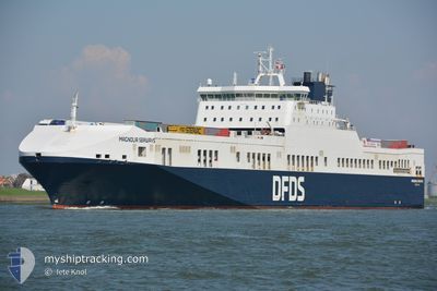
MAGNOLIA SEAWAYS
Ro-Ro Cargo
Current Trip
DECUX GBIMM
| Time Travelled | 16 h, 12 mins |
|---|---|
| Remaining Time | --- |
| Distance Travelled | 223.04 nm |
| Remaining Distance | --- |
| AVG Speed | 13.8 Knots |
| MAX Speed | 15.5 Knots |
| AVG Wind | 14.5 knots |
| MAX Wind | 25 knots |
| MIN Temp | 12.4°C / 54.32°F |
| MAX Temp | 19°C / 66.2°F |
| Draught | 7.4 m |
| Position Received | 32 m ago |
Current Position
| Longitude | 2.71240° |
|---|---|
| Latitude | 53.54983° |
| Status | Under way using engine |
| Speed | 13.8 Knots |
| Course | 283.3° |
| Area | North Sea |
| Station | T-AIS |
| Position Received | 32 m ago |
Info
Information
The current position of MAGNOLIA SEAWAYS is in North Sea with coordinates 53.54983° / 2.71240° as reported on 2024-06-01 06:17 by AIS to our vessel tracker app. The vessel's current speed is 13.8 Knots
The vessel MAGNOLIA SEAWAYS (IMO: 9259496, MMSI: 219455000) is a Ro-Ro Cargo that was built in 2003 ( 21 years old ). It's sailing under the flag of [DK] Denmark.
In this page you can find informations about the vessels current position, last detected port calls, and current voyage information. If the vessels is not in coverage by AIS you will find the latest position.
The current position of MAGNOLIA SEAWAYS is detected by our AIS receivers and we are not responsible for the reliability of the data. The last position was recorded while the vessel was in Coverage by the Ais receivers of our vessel tracking app.
The current draught of MAGNOLIA SEAWAYS as reported by AIS is 7.4 meters
Weather
| Temperature | 12.2°C / 53.96°F |
|---|---|
| Wind Speed | 22 knots |
| Direction | 358° N |
| Pressure | 1020.8 hPa |
| Humidity | 87 % |
| Cloud Coverage | 98 % |
Featured Company
Last Port Calls
| Port | Arrival | Departure | Time In Port |
|---|---|---|---|
| 2024-05-31 05:35 | 2024-05-31 14:38 | 9 h | |
| 2024-05-29 19:43 | 2024-05-30 08:43 | 12 h | |
| 2024-05-28 13:17 | 2024-05-28 22:12 | 8 h | |
| 2024-05-26 21:58 | 2024-05-27 16:06 | 18 h | |
| 2024-05-25 12:16 | 2024-05-25 21:23 | 9 h | |
| 2024-05-24 00:32 | 2024-05-24 13:01 | 12 h | |
| 2024-05-22 18:41 | 2024-05-23 03:20 | 8 h | |
| 2024-05-19 19:44 | 2024-05-21 22:26 | 2 d | |
| 2024-05-18 12:50 | 2024-05-18 21:19 | 8 h | |
| 2024-05-17 00:26 | 2024-05-17 13:09 | 12 h |
Most Visited Ports (Last year)
| Port | Arrivals | |
|---|---|---|
| 162 | ||
| 158 | ||
| 28 | ||
| 25 | ||
| 8 | ||
| 4 |
Last Trips
| Origin | Departure | Destination | Arrival | Distance | |
|---|---|---|---|---|---|
| 2024-05-30 09:43 | 2024-05-31 07:35 | 330.13 nm | |||
| 2024-05-29 00:12 | 2024-05-29 20:43 | 329.90 nm | |||
| 2024-05-27 17:06 | 2024-05-28 15:17 | 329.39 nm | |||
| 2024-05-25 23:23 | 2024-05-26 22:58 | 328.81 nm | |||
| 2024-05-24 14:01 | 2024-05-25 14:16 | 330.29 nm | |||
| 2024-05-23 05:20 | 2024-05-24 01:32 | 329.12 nm | |||
| 2024-05-21 23:26 | 2024-05-22 20:41 | 329.86 nm | |||
| 2024-05-18 23:19 | 2024-05-19 20:44 | 329.08 nm | |||
| 2024-05-17 14:09 | 2024-05-18 14:50 | 329.14 nm | |||
| 2024-05-16 05:46 | 2024-05-17 01:26 | 329.53 nm |
Events
| Time | Event | Details | Position / Dest | Info |
|---|---|---|---|---|
| 2024-06-01 06:22 | Status Changed | Default Under way using engine |
53.55374 / 2.68243
DECUX GBIMM
|
Speed: 13.8 kn Course: 283.3° |
| 2024-06-01 06:17 | Change Sea Area | United Kingdom part of the North Sea Dutch part of the North Sea |
53.54983 / 2.71240
North Sea
DECUX GBIMM
|
Speed: 13.8 kn Course: 283.3° |
| 2024-06-01 06:17 | Status Changed | Under way using engine Default |
53.54983 / 2.71240
DECUX GBIMM
|
Speed: 13.8 kn Course: 282° |
| 2024-06-01 06:17 | IN Coverage |
53.54983 / 2.71240
North Sea
DECUX GBIMM
|
Speed: 13.8 kn Course: 283.3° |
|
| 2024-06-01 01:42 | Status Changed | Default Under way using engine |
53.50167 / 4.49833
DECUX GBIMM
|
Speed: 14.3 kn Course: 269.2° |
| 2024-06-01 01:38 | OUT of Coverage |
53.50153 / 4.52033
North Sea
DECUX GBIMM
|
Speed: 14.3 kn Course: 269.2° |
|
| 2024-05-31 22:32 | Draught Changed | 7.4 6.5 |
53.71628 / 5.72168
DECUX GBIMM
|
Speed: 14.9 kn Course: 253° |
| 2024-05-31 21:55 | Change Sea Area | Dutch part of the North Sea German part of the North Sea |
53.76092 / 5.96690
North Sea
DECUX GBIMM
|
Speed: 15.4 kn Course: 251.7° |
| 2024-05-31 21:55 | Status Changed | Under way using engine Default |
53.76192 / 5.97229
DECUX GBIMM
|
Speed: 14.5 kn Course: 254° |
| 2024-05-31 21:42 | IN Coverage |
53.76092 / 5.96690
North Sea
DECUX GBIMM
|
Speed: 15.4 kn Course: 251.7° |