
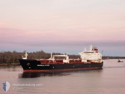
MAGNOLIA STATE
Tanker
Current Trip
| Time Travelled | 5 days |
|---|---|
| Remaining Time | 1 day |
| Distance Travelled | 1010.16 nm |
| Remaining Distance | 437.53 nm |
| AVG Speed | 9.5 Knots |
| MAX Speed | 14.9 Knots |
| AVG Wind | 11.5 knots |
| MAX Wind | 17.1 knots |
| MIN Temp | 23.3°C / 73.94°F |
| MAX Temp | 29.3°C / 84.74°F |
| Draught | 11.1 m |
| Position Received | 12 h, 25 m ago |
Current Position
| Longitude | -91.93810° |
|---|---|
| Latitude | 27.89030° |
| Status | Under way using engine |
| Speed | 11.2 Knots |
| Course | 85.4° |
| Area | Gulf of Mexico |
| Station | T-AIS |
| Position Received | 12 h, 25 m ago |
Info
Information
The current position of MAGNOLIA STATE is in Gulf of Mexico with coordinates 27.89030° / -91.93810° as reported on 2024-05-26 00:23 by AIS to our vessel tracker app. The vessel's current speed is 11.2 Knots and is heading at the port of TAMPA. The estimated time of arrival as calculated by vessel tracking app is 2024-05-27 21:41 LT
The vessel MAGNOLIA STATE (IMO: 9697997, MMSI: 338302000) is a Tanker It's sailing under the flag of [US] USA.
In this page you can find informations about the vessels current position, last detected port calls, and current voyage information. If the vessels is not in coverage by AIS you will find the latest position.
The current position of MAGNOLIA STATE is detected by our AIS receivers and we are not responsible for the reliability of the data. The last position was recorded while the vessel was in Coverage by the Ais receivers of our vessel tracking app.
The current draught of MAGNOLIA STATE as reported by AIS is 11.1 meters
Weather
| Temperature | 26.6°C / 79.88°F |
|---|---|
| Wind Speed | 15 knots |
| Direction | 155° SSE |
| Pressure | 1012 hPa |
| Humidity | 87.4 % |
| Cloud Coverage | --- |
Featured Company
Last Port Calls
| Port | Arrival | Departure | Time In Port |
|---|---|---|---|
| 2024-05-18 17:04 | 2024-05-20 20:24 | 2 d | |
| 2024-05-08 00:47 | 2024-05-10 19:18 | 2 d | |
| 2024-04-27 21:42 | 2024-04-29 14:32 | 1 d | |
| 2024-04-18 10:23 | 2024-04-20 00:17 | 1 d | |
| 2024-04-09 20:58 | 2024-04-11 18:42 | 1 d | |
| 2024-03-30 16:19 | 2024-04-01 14:19 | 1 d | |
| 2024-03-19 05:21 | 2024-03-21 03:00 | 1 d | |
| 2024-03-07 18:54 | 2024-03-09 23:34 | 2 d |
Most Visited Ports (Last year)
| Port | Arrivals | |
|---|---|---|
| 21 | ||
| 12 |
Last Trips
| Origin | Departure | Destination | Arrival | Distance | |
|---|---|---|---|---|---|
| 2024-05-10 15:18 | 2024-05-18 13:04 | 1411.51 nm | |||
| 2024-04-29 10:32 | 2024-05-07 20:47 | 1407.37 nm | |||
| 2024-04-19 20:17 | 2024-04-27 17:42 | 1420.14 nm | |||
| 2024-04-11 14:42 | 2024-04-18 06:23 | 1398.91 nm | |||
| 2024-04-01 10:19 | 2024-04-09 16:58 | 1405.18 nm | |||
| 2024-03-20 23:00 | 2024-03-30 12:19 | 1400.97 nm | |||
| 2024-03-09 18:34 | 2024-03-19 01:21 | 1359.67 nm | |||
| 2024-02-28 13:37 | 2024-03-07 13:54 | 1375.84 nm |
Events
| Time | Event | Details | Position / Dest | Info |
|---|---|---|---|---|
| 2024-05-26 00:30 | Status Changed | Default Under way using engine |
27.89208 / -91.91509
TAMPA
|
Speed: 11.2 kn Course: 85.4° |
| 2024-05-26 00:23 | OUT of Coverage |
27.89030 / -91.93810
Gulf of Mexico
TAMPA
|
Speed: 11.2 kn Course: 85.4° |
|
| 2024-05-26 00:12 | Status Changed | Under way using engine Default |
27.88728 / -91.97658
TAMPA
|
Speed: 11.2 kn Course: 85° |
| 2024-05-25 23:39 | Status Changed | Default Under way using engine |
27.87802 / -92.09338
TAMPA
|
Speed: 11.2 kn Course: 84.3° |
| 2024-05-25 22:30 | Status Changed | Under way using engine Default |
27.86073 / -92.33002
TAMPA
|
Speed: 10.8 kn Course: 86° |
| 2024-05-25 22:27 | Status Changed | Default Under way using engine |
27.85999 / -92.34131
TAMPA
|
Speed: 10.8 kn Course: 85.1° |
| 2024-05-25 22:12 | Status Changed | Under way using engine Default |
27.85664 / -92.39032
TAMPA
|
Speed: 10.7 kn Course: 86° |
| 2024-05-25 22:10 | Status Changed | Default Under way using engine |
27.85626 / -92.39625
TAMPA
|
Speed: 10.7 kn Course: 85.7° |
| 2024-05-25 21:59 | Status Changed | Under way using engine Default |
27.85376 / -92.43218
TAMPA
|
Speed: 10.6 kn Course: 86° |
| 2024-05-25 21:50 | IN Coverage |
27.85431 / -92.42505
Gulf of Mexico
TAMPA
|
Speed: 10.6 kn Course: 86.2° |