
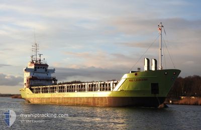
MAI LEHMANN
General Cargo
Current Trip
| Trip Time | 2 days |
|---|---|
| Trip Distance | 477.93 nm |
| AVG Speed | 11 Knots |
| MAX Speed | 12.2 Knots |
| Draught | 4.4 m |
| AVG Wind | 8.1 knots |
| MAX Wind | 17 knots |
| MIN Temp | 7.1°C / 44.78°F |
| MAX Temp | 18.1°C / 64.58°F |
| Position Received | 1 d ago |
Current Position
| Longitude | 19.05300° |
|---|---|
| Latitude | 60.46533° |
| Status | Under way using engine |
| Speed | 10.8 Knots |
| Course | 8° |
| Area | Gulf of Bothnia |
| Station | T-AIS |
| Position Received | 1 d ago |
Info
Information
The current position of MAI LEHMANN is in Gulf of Bothnia with coordinates 60.46533° / 19.05300° as reported on 2024-05-19 08:18 by AIS to our vessel tracker app. The vessel's current speed is 10.8 Knots and is currently inside the port of MANTYLUOTO.
The vessel MAI LEHMANN (IMO: 9196175, MMSI: 305804000) is a General Cargo that was built in 1999 ( 25 years old ). It's sailing under the flag of [AG] Antigua Barbuda.
In this page you can find informations about the vessels current position, last detected port calls, and current voyage information. If the vessels is not in coverage by AIS you will find the latest position.
The current position of MAI LEHMANN is detected by our AIS receivers and we are not responsible for the reliability of the data. The last position was recorded while the vessel was in Coverage by the Ais receivers of our vessel tracking app.
The current draught of MAI LEHMANN as reported by AIS is 4.4 meters
Weather
| Temperature | 5.9°C / 42.62°F |
|---|---|
| Wind Speed | 12 knots |
| Direction | 324° NW |
| Pressure | 1021.1 hPa |
| Humidity | 76.3 % |
| Cloud Coverage | 67 % |
Featured Company
Last Port Calls
| Port | Arrival | Departure | Time In Port |
|---|---|---|---|
| 2024-05-19 17:48 | |||
| 2024-05-16 15:48 | 2024-05-17 16:26 | 1 d | |
| 2024-05-04 05:32 | 2024-05-10 10:57 | 6 d | |
| 2024-04-28 05:30 | 2024-04-29 12:36 | 1 d | |
| 2024-04-26 04:40 | 2024-04-26 21:57 | 17 h | |
| 2024-04-24 23:47 | 2024-04-25 00:28 | 41 m | |
| 2024-04-23 14:16 | 2024-04-24 17:04 | 1 d | |
| 2024-04-22 23:05 | 2024-04-23 07:45 | 8 h | |
| 2024-04-14 08:48 | 2024-04-17 07:06 | 2 d | |
| 2024-04-07 23:54 | 2024-04-10 07:28 | 2 d |
Most Visited Ports (Last year)
| Port | Arrivals | |
|---|---|---|
| 11 | ||
| 10 | ||
| 7 | ||
| 7 | ||
| 4 | ||
| 3 |
Last Trips
| Origin | Departure | Destination | Arrival | Distance | |
|---|---|---|---|---|---|
| 2024-05-17 19:26 | 2024-05-19 20:48 | 477.93 nm | |||
| 2024-05-10 12:57 | 2024-05-16 18:48 | 1543.79 nm | |||
| 2024-04-29 14:36 | 2024-05-04 07:32 | 1128.04 nm | |||
| 2024-04-27 00:57 | 2024-04-28 07:30 | 324.32 nm | |||
| 2024-04-25 02:28 | 2024-04-26 07:40 | 248.99 nm | |||
| 2024-04-24 19:04 | 2024-04-25 01:47 | 65.00 nm | |||
| 2024-04-23 09:45 | 2024-04-23 16:16 | 65.45 nm | |||
| 2024-04-17 09:06 | 2024-04-23 01:05 | 1314.27 nm | |||
| 2024-04-10 09:28 | 2024-04-14 10:48 | 855.38 nm | |||
| 2024-04-06 11:25 | 2024-04-08 01:54 | 458.19 nm |
Events
| Time | Event | Details | Position / Dest | Info |
|---|---|---|---|---|
| 2024-05-19 18:09 | STOP Moving |
61.59600 / 21.49417
[FI] MANTYLUOTO
|
Speed: 0.1 kn Course: 271° |
|
| 2024-05-19 17:48 | PORT ARRIVAL |
|
61.59940 / 21.47767
[FI] MANTYLUOTO
|
Speed: 4 kn Course: 113° |
| 2024-05-19 08:24 | Status Changed | Default Under way using engine |
60.48150 / 19.06433
MANTYLUOTO
|
Speed: 10.8 kn Course: 8° |
| 2024-05-19 08:18 | OUT of Coverage |
60.46533 / 19.05300
Gulf of Bothnia
MANTYLUOTO
|
Speed: 10.8 kn Course: 8° |
|
| 2024-05-19 06:50 | Change Sea Area | Swedish part of the Gulf of Bothnia Finnish part of the Gulf of Bothnia |
60.21300 / 19.09100
Gulf of Bothnia
MANTYLUOTO
|
Speed: 10.6 kn Course: 332.3° |
| 2024-05-19 02:11 | Change Sea Area | Finnish part of the Gulf of Bothnia Finnish part of the Baltic Sea |
59.74083 / 20.42333
Gulf of Bothnia
MANTYLUOTO
|
Speed: 11.9 kn Course: 301.8° |
| 2024-05-19 02:00 | Status Changed | Under way using engine Default |
59.72264 / 20.47931
MANTYLUOTO
|
Speed: 11.9 kn Course: 315° |
| 2024-05-19 01:56 | Status Changed | Default Under way using engine |
59.71300 / 20.49833
MANTYLUOTO
|
Speed: 11.5 kn Course: 302.5° |
| 2024-05-19 01:49 | Status Changed | Under way using engine Default |
59.69561 / 20.53450
MANTYLUOTO
|
Speed: 11.8 kn Course: 288° |
| 2024-05-19 01:29 | Status Changed | Default Under way using engine |
59.67500 / 20.65667
MANTYLUOTO
|
Speed: 11.7 kn Course: 288.6° |