
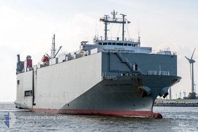
MALACCA HIGHWAY
Vehicles Carrier
Current Trip
| Time Travelled | 2 days |
|---|---|
| Remaining Time | 21 h, 56 mins |
| Distance Travelled | 760.15 nm |
| Remaining Distance | 319.19 nm |
| AVG Speed | 15.2 Knots |
| MAX Speed | 18.4 Knots |
| AVG Wind | 14.3 knots |
| MAX Wind | 22.6 knots |
| MIN Temp | 13.5°C / 56.3°F |
| MAX Temp | 21°C / 69.8°F |
| Draught | 6.6 m |
| Position Received | Now |
Current Position
| Longitude | 2.84563° |
|---|---|
| Latitude | 51.94874° |
| Status | Under way using engine |
| Speed | 14.8 Knots |
| Course | 43.4° |
| Area | North Sea |
| Station | T-AIS |
| Position Received | Now |
Info
Information
The current position of MALACCA HIGHWAY is in North Sea with coordinates 51.94874° / 2.84563° as reported on 2024-06-19 19:40 by AIS to our vessel tracker app. The vessel's current speed is 14.8 Knots and is heading at the port of HAMBURG. The estimated time of arrival as calculated by vessel tracking app is 2024-06-20 17:36 LT
The vessel MALACCA HIGHWAY (IMO: 9235414, MMSI: 355351000) is a Vehicles Carrier that was built in 2001 ( 23 years old ). It's sailing under the flag of [PA] Panama.
In this page you can find informations about the vessels current position, last detected port calls, and current voyage information. If the vessels is not in coverage by AIS you will find the latest position.
The current position of MALACCA HIGHWAY is detected by our AIS receivers and we are not responsible for the reliability of the data. The last position was recorded while the vessel was in Coverage by the Ais receivers of our vessel tracking app.
The current draught of MALACCA HIGHWAY as reported by AIS is 6.6 meters
Weather
| Temperature | 13.5°C / 56.3°F |
|---|---|
| Wind Speed | 14 knots |
| Direction | 28° NNE |
| Pressure | 1023 hPa |
| Humidity | 80 % |
| Cloud Coverage | 14 % |
Featured Company
Last Port Calls
| Port | Arrival | Departure | Time In Port |
|---|---|---|---|
| 2024-06-17 04:44 | 2024-06-17 18:52 | 14 h | |
| 2024-06-14 07:26 | 2024-06-14 15:01 | 7 h | |
| 2024-06-12 20:45 | 2024-06-14 00:21 | 1 d | |
| 2024-06-09 18:16 | 2024-06-10 10:43 | 16 h | |
| 2024-06-06 15:11 | 2024-06-06 21:34 | 6 h | |
| 2024-06-04 10:11 | 2024-06-04 18:11 | 8 h | |
| 2024-06-02 16:35 | 2024-06-03 12:21 | 19 h | |
| 2024-06-01 08:40 | 2024-06-01 18:22 | 9 h | |
| 2024-05-27 17:50 | 2024-05-28 13:36 | 19 h | |
| 2024-05-07 11:28 | 2024-05-27 14:13 | 20 d |
Last Trips
| Origin | Departure | Destination | Arrival | Distance | |
|---|---|---|---|---|---|
| 2024-06-14 16:01 | 2024-06-17 06:44 | 780.85 nm | |||
| 2024-06-14 02:21 | 2024-06-14 08:26 | 97.08 nm | |||
| 2024-06-10 12:43 | 2024-06-12 22:45 | 384.11 nm | |||
| 2024-06-06 23:34 | 2024-06-09 20:16 | 1080.28 nm | |||
| 2024-06-04 19:11 | 2024-06-06 17:11 | 745.67 nm | |||
| 2024-06-03 14:21 | 2024-06-04 11:11 | 303.99 nm | |||
| 2024-06-01 20:22 | 2024-06-02 18:35 | 266.16 nm | |||
| 2024-05-28 15:36 | 2024-06-01 10:40 | 1151.07 nm | |||
| 2024-05-27 16:13 | 2024-05-27 19:50 | 22.76 nm | |||
| 2024-05-06 16:14 | 2024-05-07 13:28 | 298.10 nm |
Events
| Time | Event | Details | Position / Dest | Info |
|---|---|---|---|---|
| 2024-06-19 18:56 | Change Sea Area | Dutch part of the North Sea Belgian part of the North Sea |
51.81421 / 2.65535
North Sea
DEHAM
|
Speed: 14.6 kn Course: 40.3° |
| 2024-06-19 17:19 | Change Sea Area | Belgian part of the North Sea French part of the North Sea |
51.52184 / 2.26400
North Sea
DEHAM
|
Speed: 14.1 kn Course: 38.5° |
| 2024-06-19 15:01 | Change Sea Area | French part of the North Sea United Kingdom part of the North Sea |
51.11627 / 1.75431
North Sea
DEHAM
|
Speed: 14 kn Course: 50.3° |
| 2024-06-19 14:56 | Change Sea Area | United Kingdom part of the North Sea French part of the North Sea |
51.10150 / 1.72581
North Sea
DEHAM
|
Speed: 14.2 kn Course: 50.4° |
| 2024-06-19 14:25 | Change Sea Area | French part of the North Sea French part of the English Channel |
51.02009 / 1.58979
North Sea
DEHAM
|
Speed: 14.1 kn Course: 46° |
| 2024-06-19 12:27 | Change Sea Area | French part of the English Channel United Kingdom part of the English Channel |
50.62488 / 1.20562
English Channel
DEHAM
|
Speed: 14.7 kn Course: 43.4° |
| 2024-06-19 12:27 | Status Changed | Under way using engine Default |
50.62488 / 1.20562
DEHAM
|
Speed: 14.7 kn Course: 44° |
| 2024-06-19 12:21 | IN Coverage |
50.62488 / 1.20562
English Channel
DEHAM
|
Speed: 14.7 kn Course: 43.4° |
|
| 2024-06-19 10:37 | Status Changed | Default Under way using engine |
50.45737 / .56756
DEHAM
|
Speed: 14.6 kn Course: 75.1° |
| 2024-06-19 10:32 | OUT of Coverage |
50.45211 / .53668
English Channel
DEHAM
|
Speed: 14.6 kn Course: 75.1° |