
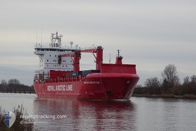
MALIK ARCTICA
Cargo
Current Trip
GLTAS
| Time Travelled | 10 days |
|---|---|
| Remaining Time | --- |
| Distance Travelled | 2236.82 nm |
| Remaining Distance | --- |
| AVG Speed | 10.4 Knots |
| MAX Speed | 16.9 Knots |
| AVG Wind | 14.7 knots |
| MAX Wind | 35 knots |
| MIN Temp | -5.9°C / 21.38°F |
| MAX Temp | 20.5°C / 68.9°F |
| Draught | 7.1 m |
| Position Received | 8 d ago |
Current Position
| Longitude | -2.22335° |
|---|---|
| Latitude | 59.83077° |
| Status | Under way using engine |
| Speed | 14.8 Knots |
| Course | 289.5° |
| Area | North Atlantic Ocean |
| Station | T-AIS |
| Position Received | 8 d ago |
Info
Information
The current position of MALIK ARCTICA is in North Atlantic Ocean with coordinates 59.83077° / -2.22335° as reported on 2024-05-23 05:11 by AIS to our vessel tracker app. The vessel's current speed is 14.8 Knots
The vessel MALIK ARCTICA (IMO: 9618135, MMSI: 219668000) is a Cargo It's sailing under the flag of [DK] Denmark.
In this page you can find informations about the vessels current position, last detected port calls, and current voyage information. If the vessels is not in coverage by AIS you will find the latest position.
The current position of MALIK ARCTICA is detected by our AIS receivers and we are not responsible for the reliability of the data. The last position was recorded while the vessel was in Coverage by the Ais receivers of our vessel tracking app.
The current draught of MALIK ARCTICA as reported by AIS is 7.1 meters
Weather
| Temperature | -6.3°C / 20.66°F |
|---|---|
| Wind Speed | 9 knots |
| Direction | 311° NW |
| Pressure | 1003.1 hPa |
| Humidity | 63.3 % |
| Cloud Coverage | 9 % |
Featured Company
Last Port Calls
| Port | Arrival | Departure | Time In Port |
|---|---|---|---|
| 2024-05-20 18:16 | 2024-05-21 14:21 | 20 h | |
| 2024-04-29 07:52 | 2024-04-29 18:54 | 11 h | |
| 2024-04-24 16:11 | 2024-04-25 16:38 | 1 d | |
| 2024-04-23 07:41 | 2024-04-23 20:33 | 12 h | |
| 2024-04-22 09:41 | 2024-04-23 06:20 | 20 h | |
| 2024-04-18 15:51 | 2024-04-19 07:26 | 15 h | |
| 2024-04-16 12:14 | 2024-04-17 17:03 | 1 d |
Last Trips
| Origin | Departure | Destination | Arrival | Distance | |
|---|---|---|---|---|---|
| 2024-04-29 20:54 | 2024-05-20 20:16 | 670.38 nm | |||
| 2024-04-25 16:38 | 2024-04-29 09:52 | 1243.50 nm | |||
| 2024-04-23 20:33 | 2024-04-24 16:11 | 14.99 nm | |||
| 2024-04-23 06:20 | 2024-04-23 07:41 | 15.29 nm | |||
| 2024-04-19 08:26 | 2024-04-22 09:41 | 998.09 nm | |||
| 2024-04-17 19:03 | 2024-04-18 16:51 | 278.80 nm | |||
| 2024-02-23 19:24 | 2024-04-16 14:14 | 579.42 nm |
Events
| Time | Event | Details | Position / Dest | Info |
|---|---|---|---|---|
| 2024-05-31 15:57 | STOP Moving |
65.61334 / -37.62667
GLTAS
|
Speed: Course: -1° |
|
| 2024-05-28 19:15 | START Moving |
65.03677 / -36.97423
GLTAS
|
Speed: 8.9 kn Course: 10° |
|
| 2024-05-28 13:54 | STOP Moving |
65.02500 / -37.06333
GLTAS
|
Speed: Course: -1° |
|
| 2024-05-28 12:36 | START Moving |
65.10500 / -37.06333
GLTAS
|
Speed: 4 kn Course: -1° |
|
| 2024-05-28 11:39 | STOP Moving |
65.11667 / -37.05333
GLTAS
|
Speed: Course: -1° |
|
| 2024-05-23 05:19 | Status Changed | Default Under way using engine |
59.84127 / -2.28315
GLTAS
|
Speed: 14.8 kn Course: 289.5° |
| 2024-05-23 05:11 | OUT of Coverage |
59.83077 / -2.22335
North Atlantic Ocean
GLTAS
|
Speed: 14.8 kn Course: 289.5° |
|
| 2024-05-23 05:03 | Status Changed | Under way using engine Default |
59.82047 / -2.16648
GLTAS
|
Speed: 14.9 kn Course: 289° |
| 2024-05-23 04:47 | Status Changed | Default Under way using engine |
59.79748 / -2.03748
GLTAS
|
Speed: 15 kn Course: 288.7° |
| 2024-05-23 04:38 | Status Changed | Under way using engine Default |
59.78602 / -1.97447
GLTAS
|
Speed: 14.9 kn Course: 289° |