
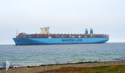
MANILA MAERSK
Cargo
Current Trip
MA PTM >> SG PWGBA
| Time Travelled | 11 days |
|---|---|
| Remaining Time | --- |
| Distance Travelled | 4372.62 nm |
| Remaining Distance | --- |
| AVG Speed | 16.4 Knots |
| MAX Speed | 19 Knots |
| AVG Wind | 14.1 knots |
| MAX Wind | 26 knots |
| MIN Temp | 18.2°C / 64.76°F |
| MAX Temp | 27.7°C / 81.86°F |
| Draught | 15.9 m |
| Position Received | 9 d ago |
Current Position
| Longitude | -13.91270° |
|---|---|
| Latitude | 27.58570° |
| Status | Under way using engine |
| Speed | 17.7 Knots |
| Course | 220° |
| Area | North Atlantic Ocean |
| Station | T-AIS |
| Position Received | 9 d ago |
Info
Information
The current position of MANILA MAERSK is in North Atlantic Ocean with coordinates 27.58570° / -13.91270° as reported on 2024-05-30 05:47 by AIS to our vessel tracker app. The vessel's current speed is 17.7 Knots
The vessel MANILA MAERSK (IMO: 9780469, MMSI: 219038000) is a Cargo It's sailing under the flag of [DK] Denmark.
In this page you can find informations about the vessels current position, last detected port calls, and current voyage information. If the vessels is not in coverage by AIS you will find the latest position.
The current position of MANILA MAERSK is detected by our AIS receivers and we are not responsible for the reliability of the data. The last position was recorded while the vessel was in Coverage by the Ais receivers of our vessel tracking app.
The current draught of MANILA MAERSK as reported by AIS is 15.9 meters
Weather
| Temperature | 18.2°C / 64.76°F |
|---|---|
| Wind Speed | 24 knots |
| Direction | 131° SE |
| Pressure | 1022 hPa |
| Humidity | 80.2 % |
| Cloud Coverage | 4 % |
Featured Company
Last Port Calls
| Port | Arrival | Departure | Time In Port |
|---|---|---|---|
| 2024-05-27 10:45 | 2024-05-28 14:45 | 1 d | |
| 2024-05-23 01:43 | 2024-05-23 14:28 | 12 h | |
| 2024-05-20 18:04 | 2024-05-22 21:39 | 2 d | |
| 2024-05-15 03:48 | 2024-05-17 16:26 | 2 d | |
| 2024-05-12 10:57 | 2024-05-14 17:33 | 2 d | |
| 2024-05-07 21:04 | 2024-05-11 10:23 | 3 d | |
| 2024-05-04 20:10 | 2024-05-06 12:45 | 1 d | |
| 2024-04-04 06:42 | 2024-04-05 19:34 | 1 d |
Most Visited Ports (Last year)
| Port | Arrivals | |
|---|---|---|
| 7 | ||
| 5 | ||
| 4 | ||
| 4 | ||
| 4 | ||
| 2 |
Last Trips
| Origin | Departure | Destination | Arrival | Distance | |
|---|---|---|---|---|---|
| 2024-05-23 16:28 | 2024-05-27 11:45 | 1670.30 nm | |||
| 2024-05-22 23:39 | 2024-05-23 03:43 | 48.73 nm | |||
| 2024-05-17 18:26 | 2024-05-20 20:04 | 519.58 nm | |||
| 2024-05-14 19:33 | 2024-05-15 05:48 | 136.79 nm | |||
| 2024-05-11 12:23 | 2024-05-12 12:57 | 394.20 nm | |||
| 2024-05-06 14:45 | 2024-05-07 23:04 | 297.74 nm | |||
| 2024-04-06 03:34 | 2024-05-04 22:10 | 11813.57 nm | |||
| 2024-03-23 01:05 | 2024-04-04 14:42 | 2997.14 nm |
Events
| Time | Event | Details | Position / Dest | Info |
|---|---|---|---|---|
| 2024-05-30 05:49 | Status Changed | Default Under way using engine |
27.57667 / -13.92167
MA PTM >> SG PWGBA
|
Speed: 17.7 kn Course: 220° |
| 2024-05-30 05:47 | OUT of Coverage |
27.58570 / -13.91270
North Atlantic Ocean
MA PTM >> SG PWGBA
|
Speed: 17.7 kn Course: 220° |
|
| 2024-05-30 05:46 | Change Sea Area | Spanish (Canary Islands) part of the North Atlantic Ocean Western Saharan part of the North Atlantic Ocean |
27.58765 / -13.91085
North Atlantic Ocean
MA PTM >> SG PWGBA
|
Speed: 17.7 kn Course: 220.2° |
| 2024-05-30 05:46 | Status Changed | Under way using engine Default |
27.58765 / -13.91085
MA PTM >> SG PWGBA
|
Speed: 18 kn Course: 220° |
| 2024-05-30 05:40 | Status Changed | Default Under way using engine |
27.61167 / -13.88833
MA PTM >> SG PWGBA
|
Speed: 17.6 kn Course: 220.1° |
| 2024-05-30 05:39 | Status Changed | Under way using engine Default |
27.61725 / -13.88285
MA PTM >> SG PWGBA
|
Speed: 18 kn Course: 220° |
| 2024-05-30 05:34 | Status Changed | Default Under way using engine |
27.63333 / -13.86833
MA PTM >> SG PWGBA
|
Speed: 17.6 kn Course: 219.8° |
| 2024-05-30 05:27 | Change Sea Area | Western Saharan part of the North Atlantic Ocean Moroccan part of the North Atlantic Ocean |
27.65890 / -13.84367
North Atlantic Ocean
MA PTM >> SG PWGBA
|
Speed: 17.5 kn Course: 220.4° |
| 2024-05-30 05:16 | Change Sea Area | Moroccan part of the North Atlantic Ocean Spanish (Canary Islands) part of the North Atlantic Ocean |
27.70227 / -13.80282
North Atlantic Ocean
MA PTM >> SG PWGBA
|
Speed: 17.2 kn Course: 219.9° |
| 2024-05-30 04:18 | Status Changed | Under way using engine Default |
27.91888 / -13.60900
MA PTM >> SG PWGBA
|
Speed: 17 kn Course: 213° |