
MANISA EMY
General Cargo
Current Trip
| Trip Time | 10 days |
|---|---|
| Trip Distance | 1999.34 nm |
| AVG Speed | 8.9 Knots |
| MAX Speed | 12.4 Knots |
| Draught | 7.1 m |
| AVG Wind | 11.3 knots |
| MAX Wind | 24.8 knots |
| MIN Temp | 15.6°C / 60.08°F |
| MAX Temp | 25.3°C / 77.54°F |
| Position Received | 1 d ago |
Current Position
| Longitude | 11.00586° |
|---|---|
| Latitude | 37.96502° |
| Status | Under way using engine |
| Speed | 9.2 Knots |
| Course | 293.4° |
| Area | Mediterranean Sea - Western Basin |
| Station | T-AIS |
| Position Received | 1 d ago |
Info
Information
The current position of MANISA EMY is in Mediterranean Sea - Western Basin with coordinates 37.96502° / 11.00586° as reported on 2024-05-18 20:07 by AIS to our vessel tracker app. The vessel's current speed is 9.2 Knots and is currently inside the port of ORISTANO.
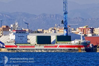
The vessel MANISA EMY (IMO: 9421063, MMSI: 244790314) is a General Cargo that was built in 2008 ( 16 years old ). It's sailing under the flag of [NL] Netherlands.
In this page you can find informations about the vessels current position, last detected port calls, and current voyage information. If the vessels is not in coverage by AIS you will find the latest position.
The current position of MANISA EMY is detected by our AIS receivers and we are not responsible for the reliability of the data. The last position was recorded while the vessel was in Coverage by the Ais receivers of our vessel tracking app.
The current draught of MANISA EMY as reported by AIS is 7.1 meters
Weather
| Temperature | 19.1°C / 66.38°F |
|---|---|
| Wind Speed | 6 knots |
| Direction | 47° NE |
| Pressure | 1008.9 hPa |
| Humidity | 83 % |
| Cloud Coverage | 100 % |
Featured Company
Last Port Calls
| Port | Arrival | Departure | Time In Port |
|---|---|---|---|
| 2024-05-20 05:42 | |||
| 2024-05-10 23:00 | 2024-05-12 21:00 | 1 d | |
| 2024-05-05 19:11 | 2024-05-09 10:29 | 3 d | |
| 2024-04-24 10:34 | 2024-04-27 14:40 | 3 d | |
| 2024-04-20 13:32 | 2024-04-24 09:48 | 3 d | |
| 2024-04-16 11:00 | 2024-04-19 18:18 | 3 d | |
| 2024-04-10 10:34 | 2024-04-11 14:56 | 1 d | |
| 2024-04-09 13:05 | 2024-04-09 22:24 | 9 h | |
| 2024-04-06 21:30 | 2024-04-08 12:27 | 1 d | |
| 2024-04-03 15:06 | 2024-04-05 10:08 | 1 d |
Last Trips
| Origin | Departure | Destination | Arrival | Distance | |
|---|---|---|---|---|---|
| 2024-05-09 13:29 | 2024-05-20 07:42 | 1999.34 nm | |||
| 2024-05-09 13:29 | 2024-05-11 01:00 | 569.25 nm | |||
| 2024-04-27 16:40 | 2024-05-05 22:11 | 1668.33 nm | |||
| 2024-04-24 11:48 | 2024-04-24 12:34 | 3.20 nm | |||
| 2024-04-19 20:18 | 2024-04-20 15:32 | 204.87 nm | |||
| 2024-04-11 17:56 | 2024-04-16 13:00 | 1063.79 nm | |||
| 2024-04-10 01:24 | 2024-04-10 13:34 | 1.61 nm | |||
| 2024-04-08 15:27 | 2024-04-09 16:05 | 287.57 nm | |||
| 2024-04-05 13:08 | 2024-04-07 00:30 | 347.91 nm | |||
| 2024-03-26 13:57 | 2024-04-03 18:06 | 1598.64 nm |
Events
| Time | Event | Details | Position / Dest | Info |
|---|---|---|---|---|
| 2024-05-20 05:42 | PORT ARRIVAL |
|
39.86333 / 8.54333
[IT] ORISTANO
|
Speed: 4 kn Course: -1° |
| 2024-05-18 20:13 | Status Changed | Default Under way using engine |
37.97078 / 10.98842
ORISTANO
|
Speed: 9.2 kn Course: 293.4° |
| 2024-05-18 20:07 | OUT of Coverage |
37.96502 / 11.00586
Mediterranean Sea - Western Basin
ORISTANO
|
Speed: 9.2 kn Course: 293.4° |
|
| 2024-05-18 19:46 | Status Changed | Under way using engine Default |
37.94354 / 11.06775
ORISTANO
|
Speed: 9 kn Course: 292° |
| 2024-05-18 19:00 | Status Changed | Default Under way using engine |
37.89834 / 11.20500
ORISTANO
|
Speed: 9.6 kn Course: 292.8° |
| 2024-05-18 18:45 | Status Changed | Under way using engine Default |
37.88432 / 11.25050
ORISTANO
|
Speed: 9 kn Course: 292° |
| 2024-05-18 18:21 | Status Changed | Default Under way using engine |
37.85833 / 11.32667
ORISTANO
|
Speed: 9.9 kn Course: 292.3° |
| 2024-05-18 18:20 | Status Changed | Under way using engine Default |
37.85775 / 11.33126
ORISTANO
|
Speed: 9 kn Course: 307° |
| 2024-05-18 18:15 | Status Changed | Default Under way using engine |
37.85166 / 11.34500
ORISTANO
|
Speed: 10.1 kn Course: 307.5° |
| 2024-05-18 14:46 | Change Sea Area | Italian part of the Mediterranean Sea - Western Basin Italian part of the Mediterranean Sea - Eastern Basin |
37.58855 / 12.01234
Mediterranean Sea - Western Basin
ORISTANO
|
Speed: 10.3 kn Course: 295.1° |