
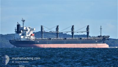
MANTA NILGUN
Bulk Carrier
Current Trip
| Time Travelled | 4 days |
|---|---|
| Remaining Time | --- |
| Distance Travelled | 1134.26 nm |
| Remaining Distance | --- |
| AVG Speed | 11 Knots |
| MAX Speed | 15.3 Knots |
| AVG Wind | 7.2 knots |
| MAX Wind | 17 knots |
| MIN Temp | 23.1°C / 73.58°F |
| MAX Temp | 30°C / 86°F |
| Draught | 9.6 m |
| Position Received | 3 d ago |
Current Position
| Longitude | -50.89410° |
|---|---|
| Latitude | 0.16249° |
| Status | Under way using engine |
| Speed | 9.1 Knots |
| Course | 76.8° |
| Area | North Atlantic Ocean |
| Station | T-AIS |
| Position Received | 3 d ago |
Info
Information
The current position of MANTA NILGUN is in North Atlantic Ocean with coordinates 0.16249° / -50.89410° as reported on 2024-05-19 02:35 by AIS to our vessel tracker app. The vessel's current speed is 9.1 Knots and is heading at the port of KALININGRAD. The estimated time of arrival as calculated by vessel tracking app is 2024-06-07 00:01 LT
The vessel MANTA NILGUN (IMO: 9553024, MMSI: 538009477) is a Bulk Carrier that was built in 2011 ( 13 years old ). It's sailing under the flag of [MH] Marshall Is.
In this page you can find informations about the vessels current position, last detected port calls, and current voyage information. If the vessels is not in coverage by AIS you will find the latest position.
The current position of MANTA NILGUN is detected by our AIS receivers and we are not responsible for the reliability of the data. The last position was recorded while the vessel was in Coverage by the Ais receivers of our vessel tracking app.
The current draught of MANTA NILGUN as reported by AIS is 9.6 meters
Weather
| Temperature | 27°C / 80.6°F |
|---|---|
| Wind Speed | 15 knots |
| Direction | 61° ENE |
| Pressure | 1014.5 hPa |
| Humidity | 86.1 % |
| Cloud Coverage | 84 % |
Featured Company
Last Port Calls
| Port | Arrival | Departure | Time In Port |
|---|---|---|---|
| 2024-05-09 21:41 | 2024-05-18 01:47 | 8 d | |
| 2024-03-07 13:41 | 2024-03-13 18:54 | 6 d |
Most Visited Ports (Last year)
| Port | Arrivals | |
|---|---|---|
| 1 | ||
| 1 | ||
| 1 | ||
| 1 | ||
| 1 | ||
| 1 |
Last Trips
| Origin | Departure | Destination | Arrival | Distance | |
|---|---|---|---|---|---|
| 2024-03-13 15:54 | 2024-05-09 18:41 | 3783.63 nm | |||
| 2024-02-03 08:30 | 2024-03-07 10:41 | 1715.46 nm |
Events
| Time | Event | Details | Position / Dest | Info |
|---|---|---|---|---|
| 2024-05-19 13:14 | START Moving |
.91041 / -49.80897
RUKGD
|
Speed: 10.5 kn Course: 57° |
|
| 2024-05-19 12:26 | STOP Moving |
.89130 / -49.83817
RUKGD
|
Speed: 0.3 kn Course: 65° |
|
| 2024-05-19 02:41 | Status Changed | Default Under way using engine |
.16617 / -50.87810
RUKGD
|
Speed: 9.1 kn Course: 76.8° |
| 2024-05-19 02:35 | OUT of Coverage |
.16249 / -50.89410
North Atlantic Ocean
RUKGD
|
Speed: 9.1 kn Course: 76.8° |
|
| 2024-05-19 02:26 | Status Changed | Under way using engine Default |
.15533 / -50.91643
RUKGD
|
Speed: 9.1 kn Course: 52° |
| 2024-05-19 02:21 | Status Changed | Default Under way using engine |
.14897 / -50.92522
RUKGD
|
Speed: 9.2 kn Course: 50.9° |
| 2024-05-19 01:08 | Change Sea Area | Brazilian part of the North Atlantic Ocean Brazilian part of the South Atlantic Ocean |
.00429 / -51.01190
North Atlantic Ocean
RUKGD
|
Speed: 8.7 kn Course: 10.8° |
| 2024-05-18 22:51 | Status Changed | Under way using engine Default |
-.42169 / -51.20313
RUKGD
|
Speed: 14 kn Course: 75° |
| 2024-05-18 22:35 | Status Changed | Default Under way using engine |
-.43900 / -51.26601
RUKGD
|
Speed: 13.6 kn Course: 75.9° |
| 2024-05-18 22:23 | Status Changed | Under way using engine Default |
-.45006 / -51.30812
RUKGD
|
Speed: 13.4 kn Course: 75° |