
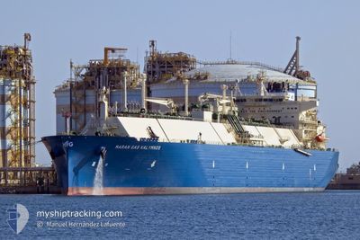
MARAN GAS KALYMNOS
Tanker
Current Trip
FOR ORDERS
| Time Travelled | 17 days |
|---|---|
| Remaining Time | --- |
| Distance Travelled | 5725.43 nm |
| Remaining Distance | --- |
| AVG Speed | 17.1 Knots |
| MAX Speed | 19.2 Knots |
| AVG Wind | 10.5 knots |
| MAX Wind | 21 knots |
| MIN Temp | 17.4°C / 63.32°F |
| MAX Temp | 30°C / 86°F |
| Draught | 9.8 m |
| Position Received | 1 d ago |
Current Position
| Longitude | -79.82887° |
|---|---|
| Latitude | 24.59602° |
| Status | Under way using engine |
| Speed | 16.4 Knots |
| Course | 209.5° |
| Area | North Atlantic Ocean |
| Station | T-AIS |
| Position Received | 1 d ago |
Info
Information
The current position of MARAN GAS KALYMNOS is in North Atlantic Ocean with coordinates 24.59602° / -79.82887° as reported on 2024-06-07 16:56 by AIS to our vessel tracker app. The vessel's current speed is 16.4 Knots
The vessel MARAN GAS KALYMNOS (IMO: 9883742, MMSI: 241748000) is a Tanker It's sailing under the flag of [GR] Greece.
In this page you can find informations about the vessels current position, last detected port calls, and current voyage information. If the vessels is not in coverage by AIS you will find the latest position.
The current position of MARAN GAS KALYMNOS is detected by our AIS receivers and we are not responsible for the reliability of the data. The last position was recorded while the vessel was in Coverage by the Ais receivers of our vessel tracking app.
The current draught of MARAN GAS KALYMNOS as reported by AIS is 9.8 meters
Weather
| Temperature | 28.5°C / 83.3°F |
|---|---|
| Wind Speed | 9 knots |
| Direction | 161° SSE |
| Pressure | 1012.6 hPa |
| Humidity | 76.9 % |
| Cloud Coverage | 37 % |
Featured Company
Last Port Calls
| Port | Arrival | Departure | Time In Port |
|---|---|---|---|
| 2024-05-22 21:16 | 2024-05-22 21:36 | 20 m | |
| 2024-05-01 06:54 | 2024-05-02 09:48 | 1 d | |
| 2024-04-17 01:23 | 2024-04-18 01:35 | 1 d |
Most Visited Ports (Last year)
| Port | Arrivals | |
|---|---|---|
| 2 | ||
| 2 | ||
| 2 | ||
| 1 | ||
| 1 | ||
| 1 |
Last Trips
| Origin | Departure | Destination | Arrival | Distance | |
|---|---|---|---|---|---|
| 2024-05-02 04:48 | 2024-05-22 23:16 | 6967.54 nm | |||
| 2024-04-18 03:35 | 2024-05-01 01:54 | 5158.27 nm | |||
| 2024-02-25 23:39 | 2024-04-17 03:23 | 12410.04 nm |
Events
| Time | Event | Details | Position / Dest | Info |
|---|---|---|---|---|
| 2024-06-07 17:01 | Status Changed | Default Under way using engine |
24.57776 / -79.84372
FOR ORDERS
|
Speed: 16.4 kn Course: 209.5° |
| 2024-06-07 16:56 | Status Changed | Under way using engine Default |
24.59602 / -79.82887
FOR ORDERS
|
Speed: 16.5 kn Course: 209° |
| 2024-06-07 16:56 | OUT of Coverage |
24.59602 / -79.82887
North Atlantic Ocean
FOR ORDERS
|
Speed: 16.4 kn Course: 209.5° |
|
| 2024-06-07 16:06 | Status Changed | Default Under way using engine |
24.79498 / -79.70544
FOR ORDERS
|
Speed: 16.4 kn Course: 210° |
| 2024-06-07 15:31 | Status Changed | Under way using engine Default |
24.93994 / -79.63098
FOR ORDERS
|
Speed: 16.2 kn Course: 202° |
| 2024-06-07 15:20 | Status Changed | Default Under way using engine |
24.98725 / -79.60800
FOR ORDERS
|
Speed: 16.3 kn Course: 201.8° |
| 2024-06-07 15:15 | Status Changed | Under way using engine Default |
25.00573 / -79.59991
FOR ORDERS
|
Speed: 16.3 kn Course: 199° |
| 2024-06-07 14:46 | Status Changed | Default Under way using engine |
25.13500 / -79.55534
FOR ORDERS
|
Speed: 16.7 kn Course: 195° |
| 2024-06-07 14:27 | Status Changed | Under way using engine Default |
25.21521 / -79.53270
FOR ORDERS
|
Speed: 16.6 kn Course: 183° |
| 2024-06-07 13:33 | Status Changed | Default Under way using engine |
25.46282 / -79.50108
FOR ORDERS
|
Speed: 16.3 kn Course: 186° |