
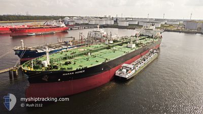
MARAN HOMER
Tanker A
Current Trip
| Time Travelled | 30 days |
|---|---|
| Remaining Time | --- |
| Distance Travelled | 6338.52 nm |
| Remaining Distance | --- |
| AVG Speed | 11.6 Knots |
| MAX Speed | 15.4 Knots |
| AVG Wind | 9.8 knots |
| MAX Wind | 21 knots |
| MIN Temp | 12.8°C / 55.04°F |
| MAX Temp | 28.9°C / 84.02°F |
| Draught | 12 m |
| Position Received | 1 m ago |
Current Position
| Longitude | 0.96714° |
|---|---|
| Latitude | 50.80882° |
| Status | Under way using engine |
| Speed | 11.4 Knots |
| Course | 226.6° |
| Area | English Channel |
| Station | T-AIS |
| Position Received | 1 m ago |
Info
Information
The current position of MARAN HOMER is in English Channel with coordinates 50.80882° / 0.96714° as reported on 2024-06-26 03:31 by AIS to our vessel tracker app. The vessel's current speed is 11.4 Knots and is heading at the port of SOUTHWOLD. The estimated time of arrival as calculated by vessel tracking app is 2024-06-26 11:00 LT
The vessel MARAN HOMER (IMO: 9761372, MMSI: 241518000) is a Tanker A It's sailing under the flag of [GR] Greece.
In this page you can find informations about the vessels current position, last detected port calls, and current voyage information. If the vessels is not in coverage by AIS you will find the latest position.
The current position of MARAN HOMER is detected by our AIS receivers and we are not responsible for the reliability of the data. The last position was recorded while the vessel was in Coverage by the Ais receivers of our vessel tracking app.
The current draught of MARAN HOMER as reported by AIS is 12 meters
Weather
| Temperature | 16°C / 60.8°F |
|---|---|
| Wind Speed | 9 knots |
| Direction | 20° NNE |
| Pressure | 1012.6 hPa |
| Humidity | 93 % |
| Cloud Coverage | --- |
Featured Company
Last Port Calls
| Port | Arrival | Departure | Time In Port |
|---|---|---|---|
| 2024-05-24 18:53 | 2024-05-26 06:25 | 1 d | |
| 2024-04-01 21:56 | 2024-04-08 02:23 | 6 d |
Most Visited Ports (Last year)
| Port | Arrivals | |
|---|---|---|
| 2 | ||
| 2 | ||
| 1 | ||
| 1 | ||
| 1 | ||
| 1 |
Last Trips
| Origin | Departure | Destination | Arrival | Distance | |
|---|---|---|---|---|---|
| 2024-04-08 03:23 | 2024-05-24 15:53 | 6516.82 nm | |||
| 2024-03-12 13:37 | 2024-04-01 22:56 | 3469.19 nm |
Events
| Time | Event | Details | Position / Dest | Info |
|---|---|---|---|---|
| 2024-06-26 01:07 | Change Sea Area | United Kingdom part of the English Channel United Kingdom part of the North Sea |
51.07845 / 1.45478
English Channel
SOUTHWOLD
|
Speed: 11.3 kn Course: 233.4° |
| 2024-06-25 20:05 | ETA Changed | 2024/06/26 11:00 2024/06/26 10:00 |
51.93397 / 2.39153
SOUTHWOLD
|
Speed: 11.7 kn Course: 135.7° |
| 2024-06-25 18:01 | ETA Changed | 2024/06/26 10:00 2024/06/26 11:00 |
52.27155 / 2.12304
SOUTHWOLD
|
Speed: 9.5 kn Course: 138° |
| 2024-06-25 17:56 | ETA Changed | 2024/06/26 11:00 2024/06/26 14:00 |
52.28032 / 2.10993
SOUTHWOLD
|
Speed: 8.9 kn Course: 137.9° |
| 2024-06-25 17:37 | Draught Changed | 12 11.8 |
52.30571 / 2.06601
SOUTHWOLD
|
Speed: 4.5 kn Course: 141° |
| 2024-06-25 17:37 | ETA Changed | 2024/06/26 14:00 2024/06/26 09:00 |
52.30571 / 2.06601
SOUTHWOLD
|
Speed: 4.5 kn Course: 141° |
| 2024-06-25 17:34 | START Moving | 13.91 nm, East of SOUTHWOLD |
52.30738 / 2.06059
SOUTHWOLD
|
Speed: 3.1 kn Course: 137° |
| 2024-06-25 17:32 | Status Changed | Under way using engine At anchor |
52.30776 / 2.05863
SOUTHWOLD
|
Speed: 2.3 kn Course: 140° |
| 2024-06-25 16:19 | Draught Changed | 11.8 15.7 |
52.31021 / 2.05138
SOUTHWOLD
|
Speed: Course: 190° |
| 2024-06-25 16:19 | ETA Changed | 2024/06/26 09:00 2024/06/26 07:30 |
52.31021 / 2.05138
SOUTHWOLD
|
Speed: Course: 190° |