
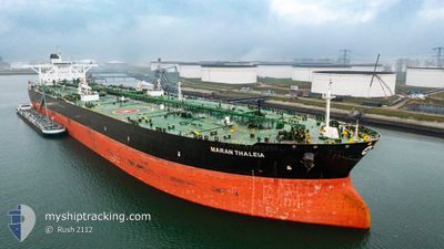
MARAN THALEIA
Crude Oil Tanker
Current Trip
| Time Travelled | --- |
|---|---|
| Remaining Time | --- |
| Distance Travelled | 6646.44 nm |
| Remaining Distance | --- |
| AVG Speed | 12.4 Knots |
| MAX Speed | 17.5 Knots |
| AVG Wind | 8.9 knots |
| MAX Wind | 20.3 knots |
| MIN Temp | 13°C / 55.4°F |
| MAX Temp | 33.4°C / 92.12°F |
| Draught | 21 m |
| Position Received | 8 d ago |
Current Position
| Longitude | 57.29924° |
|---|---|
| Latitude | 24.91126° |
| Status | Under way using engine |
| Speed | 13 Knots |
| Course | 123.2° |
| Area | Gulf of Oman |
| Station | T-AIS |
| Position Received | 8 d ago |
Info
Information
The current position of MARAN THALEIA is in Gulf of Oman with coordinates 24.91126° / 57.29924° as reported on 2024-06-03 04:20 by AIS to our vessel tracker app. The vessel's current speed is 13 Knots and is heading at the port of LE HAVRE. The estimated time of arrival as calculated by vessel tracking app is 2024-07-08 21:00 LT
The vessel MARAN THALEIA (IMO: 9527295, MMSI: 241390000) is a Crude Oil Tanker that was built in 2011 ( 13 years old ). It's sailing under the flag of [GR] Greece.
In this page you can find informations about the vessels current position, last detected port calls, and current voyage information. If the vessels is not in coverage by AIS you will find the latest position.
The current position of MARAN THALEIA is detected by our AIS receivers and we are not responsible for the reliability of the data. The last position was recorded while the vessel was in Coverage by the Ais receivers of our vessel tracking app.
The current draught of MARAN THALEIA as reported by AIS is 21 meters
Weather
| Temperature | 26.6°C / 79.88°F |
|---|---|
| Wind Speed | 15 knots |
| Direction | 188° S |
| Pressure | 1016.6 hPa |
| Humidity | 69.5 % |
| Cloud Coverage | 43 % |
Featured Company
Last Port Calls
Most Visited Ports (Last year)
| Port | Arrivals | |
|---|---|---|
| 1 | ||
| 1 | ||
| 1 |
Last Trips
| Origin | Departure | Destination | Arrival | Distance |
|---|
Events
| Time | Event | Details | Position / Dest | Info |
|---|---|---|---|---|
| 2024-06-03 04:27 | Status Changed | Default Under way using engine |
24.89867 / 57.32071
FR LEH
|
Speed: 13 kn Course: 123.2° |
| 2024-06-03 04:20 | OUT of Coverage |
24.91126 / 57.29924
Gulf of Oman
|
Speed: 13 kn Course: 123.2° |
|
| 2024-06-03 02:56 | Change Sea Area | Omani part of the Gulf of Oman United Arab Emirates part of the Gulf of Oman |
25.08348 / 57.03598
Gulf of Oman
|
Speed: 11.8 kn Course: 124.3° |
| 2024-06-03 00:44 | Detected in Sea | United Arab Emirates part of the Gulf of Oman |
25.51344 / 56.88657
Gulf of Oman
|
Speed: 12.7 kn Course: 167.5° |
| 2024-06-02 23:59 | Change Sea Area | Iranian part of the Gulf of Oman Omani part of the Gulf of Oman |
25.66928 / 56.84322
Gulf of Oman
|
Speed: 12.7 kn Course: 163.7° |
| 2024-06-02 22:23 | Change Sea Area | Omani part of the Gulf of Oman Omani part of the Persian Gulf |
26.00573 / 56.78294
Gulf of Oman
|
Speed: 13 kn Course: 164.6° |
| 2024-06-02 21:56 | Status Changed | Under way using engine Default |
26.09724 / 56.74528
FR LEH
|
Speed: 13.5 kn Course: 160° |
| 2024-06-02 21:42 | IN Coverage |
26.09356 / 56.74664
Persian Gulf
|
Speed: 13.4 kn Course: 161.7° |
|
| 2024-06-02 19:31 | Status Changed | Default Under way using engine |
26.56429 / 56.51393
FR LEH
|
Speed: 12.2 kn Course: 86.6° |
| 2024-06-02 19:26 | OUT of Coverage |
26.56645 / 56.49460
Persian Gulf
|
Speed: 12.2 kn Course: 86.6° |