
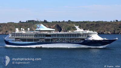
MARELLA DISCOVERY
Passengers Ship
Current Trip
| Trip Time | 23 h, 11 mins |
|---|---|
| Trip Distance | 318.93 nm |
| AVG Speed | 13.7 Knots |
| MAX Speed | 20 Knots |
| Draught | 8 m |
| AVG Wind | 10.8 knots |
| MAX Wind | 21 knots |
| MIN Temp | 18.1°C / 64.58°F |
| MAX Temp | 22°C / 71.6°F |
| Position Received | 1 m ago |
Current Position
| Longitude | 23.63686° |
|---|---|
| Latitude | 37.93964° |
| Status | Moored |
| Speed | |
| Course | 7° |
| Area | Aegean Sea |
| Station | T-AIS |
| Position Received | 1 m ago |
Info
Information
The current position of MARELLA DISCOVERY is in Aegean Sea with coordinates 37.93964° / 23.63686° as reported on 2024-05-29 09:34 by AIS to our vessel tracker app. The vessel's current speed is 0 Knots and is currently inside the port of PIRAEUS.
The vessel MARELLA DISCOVERY (IMO: 9070632, MMSI: 249639000) is a Passengers Ship that was built in 1996 ( 28 years old ). It's sailing under the flag of [MT] Malta.
In this page you can find informations about the vessels current position, last detected port calls, and current voyage information. If the vessels is not in coverage by AIS you will find the latest position.
The current position of MARELLA DISCOVERY is detected by our AIS receivers and we are not responsible for the reliability of the data. The last position was recorded while the vessel was in Coverage by the Ais receivers of our vessel tracking app.
The current draught of MARELLA DISCOVERY as reported by AIS is 8 meters
Weather
| Temperature | 24.9°C / 76.82°F |
|---|---|
| Wind Speed | 7 knots |
| Direction | 193° SSW |
| Pressure | 1012.4 hPa |
| Humidity | 32.5 % |
| Cloud Coverage | 6 % |
Featured Company
Last Port Calls
| Port | Arrival | Departure | Time In Port |
|---|---|---|---|
| 2024-05-28 21:14 | |||
| 2024-05-27 03:35 | 2024-05-27 22:03 | 18 h | |
| 2024-05-26 04:12 | 2024-05-26 16:05 | 11 h | |
| 2024-05-25 04:14 | 2024-05-25 15:13 | 10 h | |
| 2024-05-24 07:23 | 2024-05-24 17:13 | 9 h | |
| 2024-05-22 04:06 | 2024-05-22 15:20 | 11 h | |
| 2024-05-20 03:30 | 2024-05-20 21:49 | 18 h | |
| 2024-05-19 04:07 | 2024-05-19 14:32 | 10 h | |
| 2024-05-18 04:21 | 2024-05-18 16:01 | 11 h | |
| 2024-05-17 04:12 | 2024-05-17 14:54 | 10 h |
Most Visited Ports (Last year)
| Port | Arrivals | |
|---|---|---|
| 23 | ||
| 21 | ||
| 11 | ||
| 11 | ||
| 11 | ||
| 10 |
Last Trips
| Origin | Departure | Destination | Arrival | Distance | |
|---|---|---|---|---|---|
| 2024-05-28 01:03 | 2024-05-29 00:14 | 318.93 nm | |||
| 2024-05-26 19:05 | 2024-05-27 06:35 | 100.71 nm | |||
| 2024-05-25 18:13 | 2024-05-26 07:12 | 170.18 nm | |||
| 2024-05-24 20:13 | 2024-05-25 07:14 | 139.10 nm | |||
| 2024-05-22 18:20 | 2024-05-24 10:23 | 420.70 nm | |||
| 2024-05-21 00:49 | 2024-05-22 07:06 | 477.31 nm | |||
| 2024-05-19 17:32 | 2024-05-20 06:30 | 184.56 nm | |||
| 2024-05-18 19:01 | 2024-05-19 07:07 | 161.63 nm | |||
| 2024-05-17 17:54 | 2024-05-18 07:21 | 106.69 nm | |||
| 2024-05-16 18:34 | 2024-05-17 07:12 | 139.88 nm |
Events
| Time | Event | Details | Position / Dest | Info |
|---|---|---|---|---|
| 2024-05-28 21:44 | Status Changed | Moored Under way using engine |
37.93966 / 23.63690
[GR] PIRAEUS
|
Speed: Course: 7° |
| 2024-05-28 21:27 | STOP Moving |
37.94259 / 23.63745
[GR] PIRAEUS
|
Speed: 0.3 kn Course: 23° |
|
| 2024-05-28 21:14 | PORT ARRIVAL |
|
37.93742 / 23.62084
[GR] PIRAEUS
|
Speed: 7 kn Course: 75.5° |
| 2024-05-28 16:40 | ETA Changed | 2024/05/28 21:00 2024/05/29 02:45 |
36.83090 / 24.08779
GRPIR
|
Speed: 17 kn Course: 340.5° |
| 2024-05-28 05:13 | Status Changed | Under way using engine Default |
36.19478 / 27.08795
GRPIR
|
Speed: 11.4 kn Course: 248° |
| 2024-05-28 05:06 | Status Changed | Default Under way using engine |
36.20322 / 27.11429
GRPIR
|
Speed: 11.3 kn Course: 248.3° |
| 2024-05-28 01:14 | Change Sea Area | Greek part of the Aegean Sea Turkish part of the Aegean Sea |
36.48353 / 27.95397
Aegean Sea
GRPIR
|
Speed: 11.5 kn Course: 240.3° |
| 2024-05-28 01:10 | ETA Changed | 2024/05/29 02:45 2024/05/29 02:30 |
36.48999 / 27.96843
GRPIR
|
Speed: 11.5 kn Course: 240.3° |
| 2024-05-27 23:53 | Change Sea Area | Turkish part of the Aegean Sea Turkish part of the Mediterranean Sea - Eastern Basin |
36.58756 / 28.23928
Aegean Sea
GRPIR
|
Speed: 10.8 kn Course: 232.1° |
| 2024-05-27 22:47 | Destination Changed | GRPIR TRMRM |
36.74496 / 28.32771
GRPIR
|
Speed: 11.5 kn Course: 133.5° |