
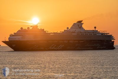
MARELLA VOYAGER
Passengers Ship
Current Trip
| Time Travelled | 1 day |
|---|---|
| Remaining Time | 5 h, 45 mins |
| Distance Travelled | 190.37 nm |
| Remaining Distance | 45.63 nm |
| AVG Speed | 8.1 Knots |
| MAX Speed | 12.9 Knots |
| AVG Wind | 4.3 knots |
| MAX Wind | 17.3 knots |
| MIN Temp | 17°C / 62.6°F |
| MAX Temp | 22.2°C / 71.96°F |
| Draught | 8.5 m |
| Position Received | Now |
Current Position
| Longitude | 6.93939° |
|---|---|
| Latitude | 42.97728° |
| Status | Under way using engine |
| Speed | 7.6 Knots |
| Course | 97.9° |
| Area | Mediterranean Sea - Western Basin |
| Station | T-AIS |
| Position Received | Now |
Info
Information
The current position of MARELLA VOYAGER is in Mediterranean Sea - Western Basin with coordinates 42.97728° / 6.93939° as reported on 2024-06-25 23:22 by AIS to our vessel tracker app. The vessel's current speed is 7.6 Knots and is heading at the port of TOULON. The estimated time of arrival as calculated by vessel tracking app is 2024-06-26 05:07 LT
The vessel MARELLA VOYAGER (IMO: 9106302, MMSI: 249053000) is a Passengers Ship that was built in 1997 ( 27 years old ). It's sailing under the flag of [MT] Malta.
In this page you can find informations about the vessels current position, last detected port calls, and current voyage information. If the vessels is not in coverage by AIS you will find the latest position.
The current position of MARELLA VOYAGER is detected by our AIS receivers and we are not responsible for the reliability of the data. The last position was recorded while the vessel was in Coverage by the Ais receivers of our vessel tracking app.
The current draught of MARELLA VOYAGER as reported by AIS is 8.5 meters
Weather
| Temperature | 20.4°C / 68.72°F |
|---|---|
| Wind Speed | 9 knots |
| Direction | 258° WSW |
| Pressure | 1012.8 hPa |
| Humidity | 83.4 % |
| Cloud Coverage | 56 % |
Featured Company
Last Port Calls
| Port | Arrival | Departure | Time In Port |
|---|---|---|---|
| 2024-06-24 05:16 | 2024-06-24 17:53 | 12 h | |
| 2024-06-22 03:14 | 2024-06-22 19:38 | 16 h | |
| 2024-06-21 04:17 | 2024-06-21 15:53 | 11 h | |
| 2024-06-20 06:45 | 2024-06-20 12:47 | 6 h | |
| 2024-06-19 04:01 | 2024-06-19 17:32 | 13 h | |
| 2024-06-18 04:09 | 2024-06-18 15:14 | 11 h | |
| 2024-06-17 07:40 | 2024-06-17 14:59 | 7 h | |
| 2024-06-15 03:20 | 2024-06-15 21:23 | 18 h | |
| 2024-06-14 06:11 | 2024-06-14 13:52 | 7 h | |
| 2024-06-13 03:59 | 2024-06-13 15:23 | 11 h |
Most Visited Ports (Last year)
| Port | Arrivals | |
|---|---|---|
| 27 | ||
| 22 | ||
| 15 | ||
| 14 | ||
| 12 | ||
| 12 |
Last Trips
| Origin | Departure | Destination | Arrival | Distance | |
|---|---|---|---|---|---|
| 2024-06-22 21:38 | 2024-06-24 07:16 | 459.17 nm | |||
| 2024-06-21 17:53 | 2024-06-22 05:14 | 172.14 nm | |||
| 2024-06-20 14:47 | 2024-06-21 06:17 | 256.99 nm | |||
| 2024-06-19 19:32 | 2024-06-20 08:45 | 189.32 nm | |||
| 2024-06-18 17:14 | 2024-06-19 06:01 | 177.29 nm | |||
| 2024-06-17 16:59 | 2024-06-18 06:09 | 169.87 nm | |||
| 2024-06-15 23:23 | 2024-06-17 09:40 | 534.73 nm | |||
| 2024-06-14 15:52 | 2024-06-15 05:20 | 172.59 nm | |||
| 2024-06-13 17:23 | 2024-06-14 08:11 | 196.29 nm | |||
| 2024-06-12 18:03 | 2024-06-13 05:59 | 114.66 nm |
Events
| Time | Event | Details | Position / Dest | Info |
|---|---|---|---|---|
| 2024-06-25 15:31 | START Moving | 0.88 nm, West of SAINTJEAN CAP FERRAT |
43.68820 / 7.31523
FRTLN
|
Speed: 3.1 kn Course: 189° |
| 2024-06-25 15:23 | Status Changed | Under way using engine At anchor |
43.69079 / 7.31530
FRTLN
|
Speed: 0.9 kn Course: 342° |
| 2024-06-25 12:56 | Destination Changed | FRTLN FR VFM |
43.68962 / 7.31624
FRTLN
|
Speed: Course: 340° |
| 2024-06-25 12:56 | ETA Changed | 2024/06/26 06:00 2024/06/25 05:00 |
43.68962 / 7.31624
FRTLN
|
Speed: Course: 340° |
| 2024-06-25 05:18 | Status Changed | At anchor Under way using engine |
43.69000 / 7.31508
FR VFM
|
Speed: 0.7 kn Course: 3° |
| 2024-06-25 05:18 | Status Changed | Under way using engine At anchor |
43.69011 / 7.31510
FR VFM
|
Speed: 0.8 kn Course: 4° |
| 2024-06-25 05:18 | Status Changed | At anchor Under way using engine |
43.69007 / 7.31509
FR VFM
|
Speed: 0.7 kn Course: 3° |
| 2024-06-25 05:15 | STOP Moving | 0.87 nm, West of SAINTJEAN CAP FERRAT |
43.69039 / 7.31513
FR VFM
|
Speed: 0.3 kn Course: 2° |
| 2024-06-25 04:16 | Detected in Sea | French part of the Mediterranean Sea - Western Basin |
43.65523 / 7.44308
Mediterranean Sea - Western Basin
FR VFM
|
Speed: 11.2 kn Course: 273.2° |
| 2024-06-25 04:07 | Change Sea Area | Mon�gasque part of the Mediterranean Sea - Western Basin French part of the Mediterranean Sea - Western Basin |
43.65355 / 7.48147
Mediterranean Sea - Western Basin
FR VFM
|
Speed: 11.5 kn Course: 273.1° |