
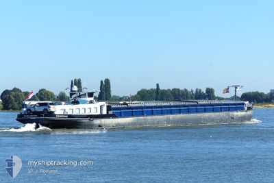
MARGARETHE
Cargo
Current Trip
| Time Travelled | 2 days |
|---|---|
| Remaining Time | --- |
| Distance Travelled | 102.37 nm |
| Remaining Distance | --- |
| AVG Speed | 5.7 Knots |
| MAX Speed | 7.2 Knots |
| AVG Wind | 5.3 knots |
| MAX Wind | 6.8 knots |
| MIN Temp | 12.1°C / 53.78°F |
| MAX Temp | 19.5°C / 67.1°F |
| Draught | 2.2 m |
| Position Received | 9 h, 51 m ago |
Current Position
| Longitude | 9.50649° |
|---|---|
| Latitude | 52.40779° |
| Status | Under way using engine |
| Speed | 7.1 Knots |
| Course | 102° |
| Area | North Sea |
| Station | T-AIS |
| Position Received | 9 h, 51 m ago |
Info
Information
The current position of MARGARETHE is in North Sea with coordinates 52.40779° / 9.50649° as reported on 2024-06-20 19:18 by AIS to our vessel tracker app. The vessel's current speed is 7.1 Knots
The vessel MARGARETHE (MMSI: 244700645) is a Cargo It's sailing under the flag of [NL] Netherlands.
In this page you can find informations about the vessels current position, last detected port calls, and current voyage information. If the vessels is not in coverage by AIS you will find the latest position.
The current position of MARGARETHE is detected by our AIS receivers and we are not responsible for the reliability of the data. The last position was recorded while the vessel was in Coverage by the Ais receivers of our vessel tracking app.
The current draught of MARGARETHE as reported by AIS is 2.2 meters
Weather
| Temperature | 16.3°C / 61.34°F |
|---|---|
| Wind Speed | 5 knots |
| Direction | 56° NE |
| Pressure | 1017.3 hPa |
| Humidity | 85.6 % |
| Cloud Coverage | 100 % |
Featured Company
Last Port Calls
| Port | Arrival | Departure | Time In Port |
|---|---|---|---|
| 2024-06-18 13:35 | 2024-06-18 13:54 | 19 m | |
| 2024-06-14 13:37 | 2024-06-17 05:23 | 2 d | |
| 2024-06-14 05:14 | 2024-06-14 06:00 | 45 m | |
| 2024-06-12 21:04 | 2024-06-14 03:08 | 1 d | |
| 2024-06-12 19:23 | 2024-06-12 19:34 | 11 m | |
| 2024-06-11 08:01 | 2024-06-11 08:35 | 33 m | |
| 2024-06-07 09:05 | 2024-06-10 23:52 | 3 d | |
| 2024-05-30 20:43 | 2024-05-30 21:00 | 16 m | |
| 2024-05-30 04:23 | 2024-05-30 05:05 | 42 m | |
| 2024-05-29 19:49 | 2024-05-30 03:02 | 7 h |
Last Trips
| Origin | Departure | Destination | Arrival | Distance | |
|---|---|---|---|---|---|
| 2024-06-17 07:23 | 2024-06-18 15:35 | 119.50 nm | |||
| 2024-06-14 08:00 | 2024-06-14 15:37 | 48.53 nm | |||
| 2024-06-14 05:08 | 2024-06-14 07:14 | 17.93 nm | |||
| 2024-06-12 21:34 | 2024-06-12 23:04 | 17.13 nm | |||
| 2024-06-11 10:35 | 2024-06-12 21:23 | 100.68 nm | |||
| 2024-06-11 01:52 | 2024-06-11 10:01 | 34.58 nm | |||
| 2024-05-30 23:00 | 2024-06-07 11:05 | 193.81 nm | |||
| 2024-05-30 07:05 | 2024-05-30 22:43 | 62.54 nm | |||
| 2024-05-30 05:02 | 2024-05-30 06:23 | 9.15 nm | |||
| 2024-05-30 05:02 | 2024-05-29 21:49 | 9.15 nm |
Events
| Time | Event | Details | Position / Dest | Info |
|---|---|---|---|---|
| 2024-06-20 19:18 | OUT of Coverage |
52.40779 / 9.50649
North Sea
HILDESHEIM
|
Speed: 7.1 kn Course: 102° |
|
| 2024-06-20 18:27 | IN Coverage |
52.38947 / 9.35438
North Sea
HILDESHEIM
|
Speed: 6.9 kn Course: 85.4° |
|
| 2024-06-20 16:43 | OUT of Coverage |
52.31536 / 9.06369
North Sea
HILDESHEIM
|
Speed: 6.9 kn Course: 56.4° |
|
| 2024-06-20 15:49 | Destination Changed | HILDESHEIM OSNABRUCK |
52.30190 / 8.91845
HILDESHEIM
|
Speed: 6.1 kn Course: 80.4° |
| 2024-06-20 15:49 | ETA Changed | 2024/06/21 10:00 2024/06/19 12:00 |
52.30190 / 8.91845
HILDESHEIM
|
Speed: 6.1 kn Course: 80.4° |
| 2024-06-20 15:25 | IN Coverage |
52.29874 / 8.85252
North Sea
|
Speed: 6.7 kn Course: 109.1° |
|
| 2024-06-20 11:36 | OUT of Coverage |
52.38108 / 8.21181
North Sea
|
Speed: 6.8 kn Course: 129.2° |
|
| 2024-06-20 08:35 | START Moving | 5.77 nm, South of BRAMSCHE |
52.30407 / 8.01935
OSNABRUCK
|
Speed: 5.2 kn Course: 334.5° |
| 2024-06-20 07:40 | IN Coverage |
52.29691 / 8.02505
North Sea
|
Speed: 0.1 kn Course: 147.9° |
|
| 2024-06-20 03:59 | OUT of Coverage |
52.29562 / 8.02570
North Sea
|
Speed: Course: 247.9° |