
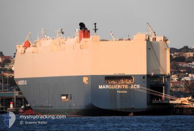
MARGUERITE ACE
Vehicles Carrier
Current Trip
| Time Travelled | 14 h, 24 mins |
|---|---|
| Remaining Time | 10 days |
| Distance Travelled | 235.86 nm |
| Remaining Distance | 4686.99 nm |
| AVG Speed | 18.2 Knoten |
| MAX Speed | 19.8 Knoten |
| AVG Wind | 10.6 knots |
| MAX Wind | 18 knots |
| MIN Temp | 14.7°C / 58.46°F |
| MAX Temp | 21.7°C / 71.06°F |
| Tiefgang | 8.7 m |
| Position erhalten | 12 h, 3 m alt |
Current Position
| Länge | 31.80571° |
|---|---|
| Breite | -29.69983° |
| Zustand | Under way using engine |
| Geschwindigkeit | 17.9 Knoten |
| Kurs | 78.7° |
| Gebiet | Indian Ocean |
| Station | T-AIS |
| Position erhalten | 12 h, 3 m alt |
Info
Information
Die aktuelle Position von MARGUERITE ACE befindet sich in Indian Ocean mit den Koordinaten -29.69983° / 31.80571°, wie von AIS am 2024-07-27 00:25 an unsere Schiffsverfolgungs-App. Die aktuelle Geschwindigkeit des Schiffes betragt 17.9 Knoten und fahrt in den Hafen von SINGAPORE. Die geschatzte Ankunftszeit, berechnet von der -App zur Schiffsverfolgung, ist 2024-08-07 04:43 LT
Das Schiff MARGUERITE ACE (IMO: 9426386, MMSI: 372158000) ist Vehicles Carrier das wurde im Jahr 2009 ( 15 Jahre alt ) gebaut. Es segelt unter der Flagge [PA] Panama.
Auf dieser Seite finden Sie Informationen zur aktuellen Position des Schiffes, zu den zuletzt erkannten Hafenanlaufen und zu aktuellen Reiseinformationen. Wenn die Schiffe nicht von AIS abgedeckt werden, finden Sie die neueste Position.
Die aktuelle Position von MARGUERITE ACE wird von unseren AIS-Empfangern erkannt und wir sind nicht fur die Zuverlassigkeit der Daten verantwortlich. Die letzte Position wurde von den Ais-Empfangern unserer Schiffsverfolgungs-App aufgezeichnet, wahrend sich das Schiff in Deckung befand.
Der aktuelle Entwurf von MARGUERITE ACE, wie von AIS gemeldet, betragt 8.7 meter
Weather
| Temperature | 21.2°C / 70.16°F |
|---|---|
| Wind Speed | 18 knots |
| Direction | 3° N |
| Pressure | 1017.1 hPa |
| Humidity | 74.6 % |
| Cloud Coverage | --- |
Featured Company
Last Port Calls
| Port | Arrival | Departure | Time In Port |
|---|---|---|---|
| 2024-07-26 10:50 | 2024-07-26 22:04 | 11 h | |
| 2024-07-25 05:04 | 2024-07-25 16:46 | 11 h | |
| 2024-07-14 20:05 | 2024-07-15 10:26 | 14 h | |
| 2024-06-29 23:11 | 2024-06-30 22:27 | 23 h | |
| 2024-06-28 12:48 | 2024-06-29 04:14 | 15 h | |
| 2024-06-26 00:10 | 2024-06-26 20:14 | 20 h | |
| 2024-06-24 09:27 | 2024-06-25 23:42 | 1 d | |
| 2024-06-09 19:31 | 2024-06-10 09:03 | 13 h | |
| 2024-05-22 21:36 | 2024-05-24 08:40 | 1 d | |
| 2024-05-21 20:48 | 2024-05-22 14:52 | 18 h |
Last Trips
| Origin | Departure | Destination | Arrival | Distance | |
|---|---|---|---|---|---|
| 2024-07-25 18:46 | 2024-07-26 12:50 | 277.88 nm | |||
| 2024-07-15 07:26 | 2024-07-25 07:04 | 4022.22 nm | |||
| 2024-06-30 18:27 | 2024-07-14 17:05 | 5125.24 nm | |||
| 2024-06-29 00:14 | 2024-06-29 19:11 | 170.43 nm | |||
| 2024-06-26 16:14 | 2024-06-28 08:48 | 568.80 nm | |||
| 2024-06-25 19:42 | 2024-06-25 20:10 | 1.00 nm | |||
| 2024-06-10 04:03 | 2024-06-24 05:27 | 3964.72 nm | |||
| 2024-05-24 17:40 | 2024-06-09 14:31 | 6655.85 nm | |||
| 2024-05-22 23:52 | 2024-05-23 06:36 | 94.51 nm | |||
| 2024-05-19 14:44 | 2024-05-22 05:48 | 765.52 nm |
Events
| Zeit | Ereignis | Details | Position / Ziel | Information |
|---|---|---|---|---|
| 2024-07-27 00:34 | geänderter Status | Default Under way using engine |
-29.69068 / 31.85304
SG SIN
|
Geschwindigkeit: 17.9 kn Kurs: 78.7° |
| 2024-07-27 00:25 | außerhalb Abdeckung |
-29.69983 / 31.80571
Indian Ocean
SG SIN
|
Geschwindigkeit: 17.9 kn Kurs: 78.7° |
|
| 2024-07-26 22:04 | ABFAHRTSHAFEN |
|
-29.86775 / 31.05862
SG SIN
|
Geschwindigkeit: 6.9 kn Kurs: 38° |
| 2024-07-26 21:49 | START Bewegung |
-29.87441 / 31.03945
[ZA] DURBAN
|
Geschwindigkeit: 3.1 kn Kurs: 118° |
|
| 2024-07-26 21:28 | geänderter Status | Under way using engine Moored |
-29.86901 / 31.03603
[ZA] DURBAN
|
Geschwindigkeit: Kurs: 316° |
| 2024-07-26 15:59 | geänderter Tiefgang | 8.7 8.6 |
-29.86904 / 31.03604
[ZA] DURBAN
|
Geschwindigkeit: Kurs: 316° |
| 2024-07-26 15:59 | geändertes Ziel | SG SIN ZA DUR |
-29.86904 / 31.03604
[ZA] DURBAN
|
Geschwindigkeit: Kurs: 316° |
| 2024-07-26 15:59 | geänderte voraussichtliche Ankunftszeit | 2024/08/07 22:00 2024/07/26 09:30 |
-29.86904 / 31.03604
[ZA] DURBAN
|
Geschwindigkeit: Kurs: 316° |
| 2024-07-26 15:58 | geänderter Status | Moored Default |
-29.86904 / 31.03604
[ZA] DURBAN
|
Geschwindigkeit: Kurs: 316° |
| 2024-07-26 15:46 | in Abdeckung |
-29.86904 / 31.03604
Indian Ocean
[ZA] DURBAN
|
Geschwindigkeit: Kurs: 316.4° |