
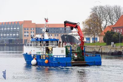
MARI
Cargo
Current Trip
MUSHOLM
| Time Travelled | 42 days |
|---|---|
| Remaining Time | --- |
| Distance Travelled | 71.70 nm |
| Remaining Distance | --- |
| AVG Speed | 6.5 Knots |
| MAX Speed | 8.4 Knots |
| AVG Wind | 12.9 knots |
| MAX Wind | 23 knots |
| MIN Temp | 9.5°C / 49.1°F |
| MAX Temp | 17.3°C / 63.14°F |
| Draught | 2.2 m |
| Position Received | 1 m ago |
Current Position
| Longitude | 11.11928° |
|---|---|
| Latitude | 55.51720° |
| Status | Under way using engine |
| Speed | 0.1 Knots |
| Course | 204° |
| Area | Kattegat |
| Station | T-AIS |
| Position Received | 1 m ago |
Info
Information
The current position of MARI is in Kattegat with coordinates 55.51720° / 11.11928° as reported on 2024-06-04 09:26 by AIS to our vessel tracker app. The vessel's current speed is 0.1 Knots
The vessel MARI (MMSI: 219019354) is a Cargo It's sailing under the flag of [DK] Denmark.
In this page you can find informations about the vessels current position, last detected port calls, and current voyage information. If the vessels is not in coverage by AIS you will find the latest position.
The current position of MARI is detected by our AIS receivers and we are not responsible for the reliability of the data. The last position was recorded while the vessel was in Coverage by the Ais receivers of our vessel tracking app.
The current draught of MARI as reported by AIS is 2.2 meters
Weather
| Temperature | 13.6°C / 56.48°F |
|---|---|
| Wind Speed | 8 knots |
| Direction | 189° S |
| Pressure | 1013 hPa |
| Humidity | 69.2 % |
| Cloud Coverage | 99 % |
Featured Company
Events
| Time | Event | Details | Position / Dest | Info |
|---|---|---|---|---|
| 2024-06-03 08:01 | STOP Moving | 9.29 nm, South of KALUNDBORG |
55.51703 / 11.11933
MUSHOLM
|
Speed: 0.3 kn Course: 222° |
| 2024-06-03 07:32 | START Moving | 9.44 nm, North of KORSOR |
55.48270 / 11.05827
MUSHOLM
|
Speed: 6 kn Course: 44° |
| 2024-06-03 07:26 | STOP Moving | 9.37 nm, North of KORSOR |
55.48113 / 11.05620
MUSHOLM
|
Speed: 0.3 kn Course: 87° |
| 2024-06-03 07:25 | START Moving | 9.47 nm, North of KORSOR |
55.48222 / 11.05298
MUSHOLM
|
Speed: 5.2 kn Course: 80° |
| 2024-06-03 06:15 | STOP Moving | 9.42 nm, North of KORSOR |
55.48097 / 11.05070
MUSHOLM
|
Speed: 0.3 kn Course: 162° |
| 2024-06-03 05:41 | Status Changed | Under way using engine Moored |
55.51433 / 11.12127
MUSHOLM
|
Speed: 6.9 kn Course: 205° |
| 2024-06-03 05:39 | START Moving | 9.25 nm, South of KALUNDBORG |
55.51777 / 11.12225
MUSHOLM
|
Speed: 3.9 kn Course: 97° |
| 2024-06-03 05:31 | Status Changed | Moored Default |
55.51698 / 11.11923
MUSHOLM
|
Speed: Course: 203° |
| 2024-06-03 05:25 | Status Changed | Default Moored |
55.51692 / 11.11898
MUSHOLM
|
Speed: 0.1 kn Course: 203° |
| 2024-06-03 04:33 | Status Changed | Moored Default |
55.51692 / 11.11898
MUSHOLM
|
Speed: Course: 206° |