
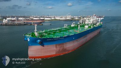
MARIA A. ANGELICOUSS
Tanker
Current Trip
| Time Travelled | 15 days |
|---|---|
| Remaining Time | --- |
| Distance Travelled | 3625.08 nm |
| Remaining Distance | --- |
| AVG Speed | 11.1 Knots |
| MAX Speed | 15.9 Knots |
| AVG Wind | 10.4 knots |
| MAX Wind | 25 knots |
| MIN Temp | 15.2°C / 59.36°F |
| MAX Temp | 28.2°C / 82.76°F |
| Draught | 11 m |
| Position Received | 21 h, 49 m ago |
Current Position
| Longitude | -78.79569° |
|---|---|
| Latitude | 26.51461° |
| Status | At anchor |
| Speed | |
| Course | 88° |
| Area | North Atlantic Ocean |
| Station | T-AIS |
| Position Received | 21 h, 49 m ago |
Info
Information
The current position of MARIA A. ANGELICOUSS is in North Atlantic Ocean with coordinates 26.51461° / -78.79569° as reported on 2024-06-01 11:04 by AIS to our vessel tracker app. The vessel's current speed is 0 Knots
The vessel MARIA A. ANGELICOUSS (MMSI: 241820000) is a Tanker It's sailing under the flag of [GR] Greece.
In this page you can find informations about the vessels current position, last detected port calls, and current voyage information. If the vessels is not in coverage by AIS you will find the latest position.
The current position of MARIA A. ANGELICOUSS is detected by our AIS receivers and we are not responsible for the reliability of the data. The last position was recorded while the vessel was in Coverage by the Ais receivers of our vessel tracking app.
The current draught of MARIA A. ANGELICOUSS as reported by AIS is 11 meters
Weather
| Temperature | 25.6°C / 78.08°F |
|---|---|
| Wind Speed | 16 knots |
| Direction | 80° E |
| Pressure | 1017 hPa |
| Humidity | 73.5 % |
| Cloud Coverage | 74 % |
Featured Company
Most Visited Ports (Last year)
| Port | Arrivals | |
|---|---|---|
| 2 | ||
| 1 | ||
| 1 |
Events
| Time | Event | Details | Position / Dest | Info |
|---|---|---|---|---|
| 2024-06-01 11:10 | Status Changed | Default At anchor |
26.51455 / -78.79564
BAHAMAS
|
Speed: Course: 88° |
| 2024-06-01 11:04 | OUT of Coverage |
26.51461 / -78.79569
North Atlantic Ocean
|
Speed: Course: 167° |
|
| 2024-06-01 11:01 | Status Changed | At anchor Default |
26.51463 / -78.79569
BAHAMAS
|
Speed: Course: 87° |
| 2024-06-01 10:49 | Status Changed | Default At anchor |
26.51463 / -78.79568
BAHAMAS
|
Speed: Course: 87° |
| 2024-06-01 10:46 | Status Changed | At anchor Default |
26.51461 / -78.79568
BAHAMAS
|
Speed: Course: 83° |
| 2024-06-01 10:40 | Status Changed | Default At anchor |
26.51447 / -78.79565
BAHAMAS
|
Speed: Course: 81° |
| 2024-06-01 10:22 | Status Changed | At anchor Default |
26.51411 / -78.79559
BAHAMAS
|
Speed: Course: 76° |
| 2024-06-01 10:19 | Status Changed | Default At anchor |
26.51411 / -78.79558
BAHAMAS
|
Speed: Course: 80° |
| 2024-06-01 10:13 | Status Changed | At anchor Default |
26.51423 / -78.79560
BAHAMAS
|
Speed: Course: 81° |
| 2024-06-01 09:58 | Status Changed | Default At anchor |
26.51437 / -78.79565
BAHAMAS
|
Speed: Course: 82° |