
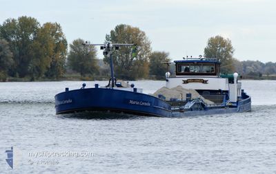
MARIA CORNELIA
Cargo
Current Trip
ROTT
| Time Travelled | 2 days |
|---|---|
| Remaining Time | --- |
| Distance Travelled | 143.92 nm |
| Remaining Distance | --- |
| AVG Speed | 6.8 Knots |
| MAX Speed | 8.9 Knots |
| AVG Wind | 12.9 knots |
| MAX Wind | 28 knots |
| MIN Temp | 9.3°C / 48.74°F |
| MAX Temp | 15°C / 59°F |
| Draught | 0 m |
| Position Received | 44 m ago |
Current Position
| Longitude | 5.38123° |
|---|---|
| Latitude | 51.79892° |
| Status | Moored |
| Speed | |
| Course | --- |
| Area | North Sea |
| Station | T-AIS |
| Position Received | 44 m ago |
Info
Information
The current position of MARIA CORNELIA is in North Sea with coordinates 51.79892° / 5.38123° as reported on 2024-06-13 03:29 by AIS to our vessel tracker app. The vessel's current speed is 0 Knots
The vessel MARIA CORNELIA (MMSI: 244730883) is a Cargo It's sailing under the flag of [NL] Netherlands.
In this page you can find informations about the vessels current position, last detected port calls, and current voyage information. If the vessels is not in coverage by AIS you will find the latest position.
The current position of MARIA CORNELIA is detected by our AIS receivers and we are not responsible for the reliability of the data. The last position was recorded while the vessel was in Coverage by the Ais receivers of our vessel tracking app.
Weather
| Temperature | 7.1°C / 44.78°F |
|---|---|
| Wind Speed | 4 knots |
| Direction | 210° SSW |
| Pressure | 1019.1 hPa |
| Humidity | 90.8 % |
| Cloud Coverage | 88 % |
Featured Company
Last Port Calls
| Port | Arrival | Departure | Time In Port |
|---|---|---|---|
| 2024-06-10 04:58 | 2024-06-10 05:16 | 18 m | |
| 2024-06-09 20:23 | 2024-06-10 04:17 | 7 h | |
| 2024-06-06 06:26 | |||
| 2024-06-05 16:33 | 2024-06-06 05:52 | 13 h | |
| 2024-06-04 20:17 | 2024-06-05 05:09 | 8 h | |
| 2024-06-03 17:28 | 2024-06-04 05:12 | 11 h | |
| 2024-05-16 21:48 | 2024-06-02 14:14 | 16 d | |
| 2024-05-16 15:54 | 2024-05-16 18:00 | 2 h | |
| 2024-04-24 15:09 | 2024-04-24 15:45 | 35 m | |
| 2024-04-23 19:18 | 2024-04-24 09:38 | 14 h |
Most Visited Ports (Last year)
| Port | Arrivals | |
|---|---|---|
| 40 | ||
| 15 | ||
| 8 | ||
| 6 | ||
| 6 | ||
| 5 |
Last Trips
| Origin | Departure | Destination | Arrival | Distance | |
|---|---|---|---|---|---|
| 2024-06-10 06:17 | 2024-06-10 06:58 | 2.43 nm | |||
| 2024-06-10 06:17 | 2024-06-09 22:23 | 2.43 nm | |||
| 2024-06-06 07:52 | 2024-06-06 08:26 | 2.17 nm | |||
| 2024-06-05 07:09 | 2024-06-05 18:33 | 51.70 nm | |||
| 2024-06-04 07:12 | 2024-06-04 22:17 | 52.07 nm | |||
| 2024-06-02 16:14 | 2024-06-03 19:28 | 59.97 nm | |||
| 2024-05-16 20:00 | 2024-05-16 23:48 | 36.75 nm | |||
| 2024-04-24 17:45 | 2024-05-16 17:54 | 81.31 nm | |||
| 2024-04-24 11:38 | 2024-04-24 17:09 | 31.14 nm | |||
| 2024-04-23 10:37 | 2024-04-23 21:18 | 52.23 nm |
Events
| Time | Event | Details | Position / Dest | Info |
|---|---|---|---|---|
| 2024-06-12 19:24 | IN Coverage |
51.79896 / 5.38122
North Sea
|
Speed: Course: 511° |
|
| 2024-06-12 17:50 | OUT of Coverage |
51.79895 / 5.38122
North Sea
|
Speed: Course: 511° |
|
| 2024-06-12 17:50 | STOP Moving | 1.04 nm, South West of HEEREWAARDEN |
51.79895 / 5.38122
ROTT
|
Speed: Course: 511° |
| 2024-06-12 17:50 | IN Coverage |
51.79895 / 5.38122
North Sea
|
Speed: Course: 511° |
|
| 2024-06-12 16:51 | OUT of Coverage |
51.79999 / 5.38283
North Sea
|
Speed: 2.4 kn Course: 220.8° |
|
| 2024-06-12 12:42 | Status Changed | Moored Default |
51.71888 / 4.89114
ROTT
|
Speed: 6.2 kn Course: 69° |
| 2024-06-12 12:22 | IN Coverage |
51.71888 / 4.89114
North Sea
|
Speed: 6.1 kn Course: 96° |
|
| 2024-06-12 09:17 | Status Changed | Default Moored |
51.68507 / 4.39710
ROTT
|
Speed: 6.1 kn Course: 38.5° |
| 2024-06-12 09:13 | OUT of Coverage |
51.68075 / 4.39168
North Sea
|
Speed: 6.1 kn Course: 38.5° |
|
| 2024-06-12 08:41 | IN Coverage |
51.64481 / 4.39246
North Sea
|
Speed: 4.2 kn Course: 290.7° |