
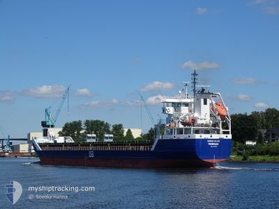
MARIA ELISE
General Cargo
Current Trip
NOSLV
| Time Travelled | 2 days |
|---|---|
| Remaining Time | --- |
| Distance Travelled | 501.35 nm |
| Remaining Distance | --- |
| AVG Speed | 10.2 Knots |
| MAX Speed | 17 Knots |
| AVG Wind | 14.2 knots |
| MAX Wind | 24.9 knots |
| MIN Temp | 10.4°C / 50.72°F |
| MAX Temp | 14.5°C / 58.1°F |
| Draught | 4 m |
| Position Received | 2 h, 45 m ago |
Current Position
| Longitude | 1.16573° |
|---|---|
| Latitude | 59.77278° |
| Status | Under way using engine |
| Speed | 7.2 Knots |
| Course | 60.2° |
| Area | North Sea |
| Station | T-AIS |
| Position Received | 2 h, 45 m ago |
Info
Information
The current position of MARIA ELISE is in North Sea with coordinates 59.77278° / 1.16573° as reported on 2024-05-31 20:33 by AIS to our vessel tracker app. The vessel's current speed is 7.2 Knots
The vessel MARIA ELISE (IMO: 9534250, MMSI: 636091859) is a General Cargo that was built in 2009 ( 15 years old ). It's sailing under the flag of [LR] Liberia.
In this page you can find informations about the vessels current position, last detected port calls, and current voyage information. If the vessels is not in coverage by AIS you will find the latest position.
The current position of MARIA ELISE is detected by our AIS receivers and we are not responsible for the reliability of the data. The last position was recorded while the vessel was in Coverage by the Ais receivers of our vessel tracking app.
The current draught of MARIA ELISE as reported by AIS is 4 meters
Weather
| Temperature | 12.4°C / 54.32°F |
|---|---|
| Wind Speed | 9 knots |
| Direction | 338° NNW |
| Pressure | 1023 hPa |
| Humidity | 76.6 % |
| Cloud Coverage | --- |
Featured Company
Last Port Calls
| Port | Arrival | Departure | Time In Port |
|---|---|---|---|
| 2024-05-27 15:43 | 2024-05-29 15:28 | 1 d | |
| 2024-05-16 19:05 | 2024-05-17 12:50 | 17 h | |
| 2024-05-06 15:40 | 2024-05-14 13:41 | 7 d | |
| 2024-04-22 21:48 | 2024-04-24 00:48 | 1 d | |
| 2024-04-17 08:20 | 2024-04-18 12:21 | 1 d | |
| 2024-04-13 16:19 | 2024-04-15 14:06 | 1 d | |
| 2024-04-10 21:40 | 2024-04-12 01:27 | 1 d | |
| 2024-04-08 09:57 | 2024-04-09 13:08 | 1 d | |
| 2024-04-05 19:23 | 2024-04-06 23:30 | 1 d | |
| 2024-04-03 07:01 | 2024-04-04 04:49 | 21 h |
Last Trips
| Origin | Departure | Destination | Arrival | Distance | |
|---|---|---|---|---|---|
| 2024-05-17 14:50 | 2024-05-27 16:43 | 1466.71 nm | |||
| 2024-05-14 15:41 | 2024-05-16 21:05 | 3.39 nm | |||
| 2024-04-24 03:48 | 2024-05-06 17:40 | 1395.58 nm | |||
| 2024-04-18 15:21 | 2024-04-23 00:48 | 742.58 nm | |||
| 2024-04-15 17:06 | 2024-04-17 11:20 | 409.85 nm | |||
| 2024-04-12 04:27 | 2024-04-13 19:19 | 397.58 nm | |||
| 2024-04-09 16:08 | 2024-04-11 00:40 | 368.93 nm | |||
| 2024-04-07 02:30 | 2024-04-08 12:57 | 370.01 nm | |||
| 2024-04-04 07:49 | 2024-04-05 22:23 | 361.69 nm | |||
| 2024-04-01 22:33 | 2024-04-03 10:01 | 366.29 nm |
Events
| Time | Event | Details | Position / Dest | Info |
|---|---|---|---|---|
| 2024-05-31 20:44 | Status Changed | Default Under way using engine |
59.78333 / 1.20333
NOSLV
|
Speed: 7.2 kn Course: 60.2° |
| 2024-05-31 20:33 | Status Changed | Under way using engine Default |
59.77278 / 1.16573
NOSLV
|
Speed: 7 kn Course: 63° |
| 2024-05-31 20:33 | OUT of Coverage |
59.77278 / 1.16573
North Sea
|
Speed: 7.2 kn Course: 60.2° |
|
| 2024-05-31 20:14 | IN Coverage |
59.77278 / 1.16573
North Sea
|
Speed: 7.2 kn Course: 60.2° |
|
| 2024-05-31 19:23 | Status Changed | Default Under way using engine |
59.70500 / .91667
NOSLV
|
Speed: 7.3 kn Course: 61.9° |
| 2024-05-31 19:20 | OUT of Coverage |
59.70356 / .90902
North Sea
|
Speed: 7.3 kn Course: 61.9° |
|
| 2024-05-31 19:16 | Status Changed | Under way using engine Default |
59.69987 / .89542
NOSLV
|
Speed: 7 kn Course: 60° |
| 2024-05-31 19:16 | IN Coverage |
59.69987 / .89542
North Sea
|
Speed: 7.2 kn Course: 62.3° |
|
| 2024-05-31 04:08 | Status Changed | Default Under way using engine |
58.70909 / -2.54749
NOSLV
|
Speed: 10.9 kn Course: 60.1° |
| 2024-05-31 04:00 | OUT of Coverage |
58.69678 / -2.58787
North Sea
|
Speed: 10.9 kn Course: 60.1° |