
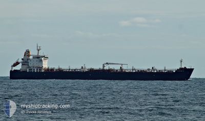
MARIA GLORY
Oil/Chemical Tanker
Current Trip
| Time Travelled | 19 days |
|---|---|
| Remaining Time | 4 days |
| Distance Travelled | 3934.19 nm |
| Remaining Distance | 1415.71 nm |
| AVG Speed | 12.1 Knots |
| MAX Speed | 15.9 Knots |
| AVG Wind | 14.4 knots |
| MAX Wind | 23 knots |
| MIN Temp | 24.4°C / 75.92°F |
| MAX Temp | 31.1°C / 87.98°F |
| Draught | 10.2 m |
| Position Received | 12 h, 10 m ago |
Current Position
| Longitude | 77.57626° |
|---|---|
| Latitude | 7.51263° |
| Status | Under way using engine |
| Speed | 13.2 Knots |
| Course | 126.3° |
| Area | Laccadive Sea |
| Station | T-AIS |
| Position Received | 12 h, 10 m ago |
Info
Information
The current position of MARIA GLORY is in Laccadive Sea with coordinates 7.51263° / 77.57626° as reported on 2024-06-03 05:44 by AIS to our vessel tracker app. The vessel's current speed is 13.2 Knots and is heading at the port of CHITTAGONG. The estimated time of arrival as calculated by vessel tracking app is 2024-06-07 21:08 LT
The vessel MARIA GLORY (IMO: 9314909, MMSI: 538003855) is a Oil/Chemical Tanker that was built in 2006 ( 18 years old ). It's sailing under the flag of [MH] Marshall Is.
In this page you can find informations about the vessels current position, last detected port calls, and current voyage information. If the vessels is not in coverage by AIS you will find the latest position.
The current position of MARIA GLORY is detected by our AIS receivers and we are not responsible for the reliability of the data. The last position was recorded while the vessel was in Coverage by the Ais receivers of our vessel tracking app.
The current draught of MARIA GLORY as reported by AIS is 10.2 meters
Weather
| Temperature | 27.5°C / 81.5°F |
|---|---|
| Wind Speed | 12 knots |
| Direction | 224° SW |
| Pressure | 1010.8 hPa |
| Humidity | 87.3 % |
| Cloud Coverage | 83 % |
Featured Company
Last Port Calls
| Port | Arrival | Departure | Time In Port |
|---|---|---|---|
| 2024-05-11 04:51 | 2024-05-15 11:11 | 4 d | |
| 2024-04-04 19:59 | 2024-04-08 15:39 | 3 d |
Most Visited Ports (Last year)
| Port | Arrivals | |
|---|---|---|
| 3 | ||
| 3 | ||
| 2 | ||
| 2 | ||
| 2 | ||
| 2 |
Last Trips
| Origin | Departure | Destination | Arrival | Distance | |
|---|---|---|---|---|---|
| 2024-04-08 19:39 | 2024-05-11 07:51 | 6445.87 nm | |||
| 2024-03-25 09:01 | 2024-04-04 23:59 | 2885.92 nm |
Events
| Time | Event | Details | Position / Dest | Info |
|---|---|---|---|---|
| 2024-06-03 05:47 | Status Changed | Default Under way using engine |
7.50807 / 77.58251
BD CGP
|
Speed: 13.2 kn Course: 126.3° |
| 2024-06-03 05:44 | OUT of Coverage |
7.51263 / 77.57626
Laccadive Sea
BD CGP
|
Speed: 13.2 kn Course: 126.3° |
|
| 2024-06-03 05:25 | Status Changed | Under way using engine Default |
7.55380 / 77.51957
BD CGP
|
Speed: 13.1 kn Course: 127° |
| 2024-06-03 05:13 | Status Changed | Default Under way using engine |
7.57946 / 77.48395
BD CGP
|
Speed: 13.1 kn Course: 127.4° |
| 2024-06-03 00:06 | Draught Changed | 10.2 8 |
8.20503 / 76.59215
BD CGP
|
Speed: 12.5 kn Course: 131.6° |
| 2024-06-03 00:06 | Destination Changed | BD CGP IN SIK |
8.20503 / 76.59215
BD CGP
|
Speed: 12.5 kn Course: 131.6° |
| 2024-06-03 00:06 | ETA Changed | 2024/06/08 14:00 2024/04/26 01:30 |
8.20503 / 76.59215
BD CGP
|
Speed: 12.5 kn Course: 131.6° |
| 2024-06-02 23:32 | Status Changed | Under way using engine Default |
8.27566 / 76.49827
IN SIK
|
Speed: 12.7 kn Course: 121° |
| 2024-06-02 23:06 | Status Changed | Default Under way using engine |
8.32403 / 76.42011
IN SIK
|
Speed: 13 kn Course: 122.9° |
| 2024-06-02 22:52 | Status Changed | Under way using engine Default |
8.35056 / 76.37955
IN SIK
|
Speed: 13.1 kn Course: 128° |