
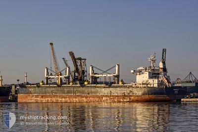
MARIGOULA
Bulk Carrier
Current Trip
| Trip Time | 13 days |
|---|---|
| Trip Distance | 2933.73 nm |
| AVG Speed | 11.2 Knots |
| MAX Speed | 13.6 Knots |
| Draught | 11.5 m |
| AVG Wind | 12.5 knots |
| MAX Wind | 29 knots |
| MIN Temp | 9.5°C / 49.1°F |
| MAX Temp | 31.2°C / 88.16°F |
| Position Received | 17 h, 40 m ago |
Current Position
| Longitude | 100.77676° |
|---|---|
| Latitude | 13.00266° |
| Status | Under way using engine |
| Speed | 12.5 Knots |
| Course | 23.4° |
| Area | Gulf of Thailand |
| Station | T-AIS |
| Position Received | 17 h, 40 m ago |
Info
Information
The current position of MARIGOULA is in Gulf of Thailand with coordinates 13.00266° / 100.77676° as reported on 2024-05-17 08:59 by AIS to our vessel tracker app. The vessel's current speed is 12.5 Knots and is currently inside the port of SIRACHA.
The vessel MARIGOULA (IMO: 9617662, MMSI: 538005001) is a Bulk Carrier that was built in 2013 ( 11 years old ). It's sailing under the flag of [MH] Marshall Is.
In this page you can find informations about the vessels current position, last detected port calls, and current voyage information. If the vessels is not in coverage by AIS you will find the latest position.
The current position of MARIGOULA is detected by our AIS receivers and we are not responsible for the reliability of the data. The last position was recorded while the vessel was in Coverage by the Ais receivers of our vessel tracking app.
The current draught of MARIGOULA as reported by AIS is 11.5 meters
Weather
| Temperature | 30.1°C / 86.18°F |
|---|---|
| Wind Speed | 5 knots |
| Direction | 161° SSE |
| Pressure | 1008.7 hPa |
| Humidity | 72.5 % |
| Cloud Coverage | 100 % |
Featured Company
Most Visited Ports (Last year)
| Port | Arrivals | |
|---|---|---|
| 3 | ||
| 2 | ||
| 2 | ||
| 1 | ||
| 1 | ||
| 1 |
Events
| Time | Event | Details | Position / Dest | Info |
|---|---|---|---|---|
| 2024-05-17 10:22 | STOP Moving |
13.15977 / 100.88285
[TH] SIRACHA
|
Speed: 0.3 kn Course: 21° |
|
| 2024-05-17 10:18 | PORT ARRIVAL |
|
13.15997 / 100.88248
[TH] SIRACHA
|
Speed: 1.8 kn Course: 26° |
| 2024-05-17 09:04 | Status Changed | Default Under way using engine |
13.01830 / 100.78610
LAEM CHABANG
|
Speed: 12.5 kn Course: 23.4° |
| 2024-05-17 08:59 | OUT of Coverage |
13.00266 / 100.77676
Gulf of Thailand
|
Speed: 12.5 kn Course: 23.4° |
|
| 2024-05-17 08:58 | Status Changed | Under way using engine Default |
12.99991 / 100.77562
LAEM CHABANG
|
Speed: 12.5 kn Course: 22° |
| 2024-05-17 08:32 | Status Changed | Default Under way using engine |
12.91340 / 100.74514
LAEM CHABANG
|
Speed: 12.4 kn Course: 0.9° |
| 2024-05-17 08:23 | Status Changed | Under way using engine Default |
12.88191 / 100.74338
LAEM CHABANG
|
Speed: 12.4 kn Course: 359° |
| 2024-05-17 08:14 | Status Changed | Default Under way using engine |
12.85073 / 100.74420
LAEM CHABANG
|
Speed: 12.5 kn Course: 355.7° |
| 2024-05-17 07:55 | Status Changed | Under way using engine Default |
12.78322 / 100.75054
LAEM CHABANG
|
Speed: 12.3 kn Course: 355° |
| 2024-05-17 07:31 | Status Changed | Default Under way using engine |
12.69984 / 100.74663
LAEM CHABANG
|
Speed: 12.4 kn Course: 335.7° |