
MARIN
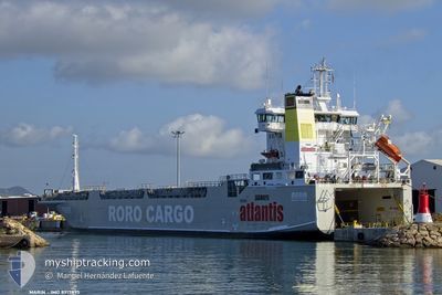
Ro-Ro Cargo
Current Trip
| Time Travelled | 8 days |
|---|---|
| Remaining Time | 6 h, 20 mins |
| Distance Travelled | 429.62 nm |
| Remaining Distance | 76.74 nm |
| AVG Speed | 9.8 Knots |
| MAX Speed | 9.8 Knots |
| AVG Wind | 6.6 knots |
| MAX Wind | 11.8 knots |
| MIN Temp | 20.2°C / 68.36°F |
| MAX Temp | 25.2°C / 77.36°F |
| Draught | 6.4 m |
| Position Received | 1 h, 25 m ago |
Current Position
| Longitude | 35.23035° |
|---|---|
| Latitude | 35.67780° |
| Status | Under way using engine |
| Speed | 10 Knots |
| Course | 24.2° |
| Area | Mediterranean Sea - Eastern Basin |
| Station | T-AIS |
| Position Received | 1 h, 25 m ago |
Info
Information
The current position of MARIN is in Mediterranean Sea - Eastern Basin with coordinates 35.67780° / 35.23035° as reported on 2024-05-22 22:28 by AIS to our vessel tracker app. The vessel's current speed is 10 Knots and is heading at the port of ISKENDERUN. The estimated time of arrival as calculated by vessel tracking app is 2024-05-23 06:14 LT
The vessel MARIN (IMO: 8917895, MMSI: 511100476) is a Ro-Ro Cargo that was built in 1990 ( 34 years old ). It's sailing under the flag of [PW] Palau.
In this page you can find informations about the vessels current position, last detected port calls, and current voyage information. If the vessels is not in coverage by AIS you will find the latest position.
The current position of MARIN is detected by our AIS receivers and we are not responsible for the reliability of the data. The last position was recorded while the vessel was in Coverage by the Ais receivers of our vessel tracking app.
The current draught of MARIN as reported by AIS is 6.4 meters
Weather
| Temperature | 22.6°C / 72.68°F |
|---|---|
| Wind Speed | 7 knots |
| Direction | 176° S |
| Pressure | 1009.5 hPa |
| Humidity | 87.3 % |
| Cloud Coverage | 82 % |
Featured Company
Last Port Calls
| Port | Arrival | Departure | Time In Port |
|---|---|---|---|
| 2024-05-08 14:57 | 2024-05-14 06:30 | 5 d | |
| 2024-05-08 09:06 | 2024-05-08 14:55 | 5 h | |
| 2024-04-30 21:52 | 2024-05-05 15:32 | 4 d | |
| 2024-04-29 07:55 | |||
| 2024-04-16 02:23 | 2024-04-16 13:04 | 10 h | |
| 2024-04-03 21:58 | 2024-04-07 13:45 | 3 d | |
| 2024-03-30 11:05 | |||
| 2024-03-01 12:56 | 2024-03-07 09:20 | 5 d |
Last Trips
| Origin | Departure | Destination | Arrival | Distance | |
|---|---|---|---|---|---|
| 2024-05-08 16:55 | 2024-05-08 16:57 | 1.62 nm | |||
| 2024-05-05 18:32 | 2024-05-08 11:06 | 439.84 nm | |||
| 2024-04-29 09:55 | 2024-05-01 00:52 | 355.09 nm | |||
| 2024-04-07 16:45 | 2024-04-16 05:23 | 11.74 nm | |||
| 2024-03-30 13:05 | 2024-04-04 00:58 | 449.70 nm | |||
| 2024-02-23 14:06 | 2024-03-01 15:56 | 281.06 nm |
Events
| Time | Event | Details | Position / Dest | Info |
|---|---|---|---|---|
| 2024-05-22 22:28 | OUT of Coverage |
35.67780 / 35.23035
Mediterranean Sea - Eastern Basin
TRISK
|
Speed: 10 kn Course: 24.2° |
|
| 2024-05-22 22:23 | IN Coverage |
35.66483 / 35.22344
Mediterranean Sea - Eastern Basin
TRISK
|
Speed: 10.4 kn Course: 24.1° |
|
| 2024-05-22 21:20 | OUT of Coverage |
35.49646 / 35.13991
Mediterranean Sea - Eastern Basin
TRISK
|
Speed: 4.8 kn Course: 37.9° |
|
| 2024-05-22 21:16 | Change Sea Area | Syrian part of the Mediterranean Sea - Eastern Basin Cypriote part of the Mediterranean Sea - Eastern Basin |
35.48705 / 35.13491
Mediterranean Sea - Eastern Basin
TRISK
|
Speed: 9.2 kn Course: 21.7° |
| 2024-05-22 21:03 | Status Changed | Under way using engine Default |
35.45243 / 35.11718
TRISK
|
Speed: 10.6 kn Course: 22° |
| 2024-05-22 20:53 | IN Coverage |
35.45670 / 35.11934
Mediterranean Sea - Eastern Basin
TRISK
|
Speed: 9.9 kn Course: 22.2° |
|
| 2024-05-22 19:57 | Status Changed | Default Under way using engine |
35.28376 / 35.03413
TRISK
|
Speed: 9.9 kn Course: 22.4° |
| 2024-05-22 19:51 | OUT of Coverage |
35.27055 / 35.02764
Mediterranean Sea - Eastern Basin
TRISK
|
Speed: 9.9 kn Course: 22.4° |
|
| 2024-05-22 19:47 | Status Changed | Under way using engine Default |
35.25951 / 35.02211
TRISK
|
Speed: 9.9 kn Course: 22° |
| 2024-05-22 19:44 | IN Coverage |
35.26506 / 35.02490
Mediterranean Sea - Eastern Basin
TRISK
|
Speed: 9.9 kn Course: 22° |